Detailed Route
Kang La Pass Expedition Itinerary — Day by Day Route & Camps
Begins in the lush Miyar valley, transitions to the massive Miyar Glacier, and descends into the stark Zanskar desert.
Standard RouteThis is the standard mountain pacing for this trek. Specific operators may add an acclimatization day or alter the starting point. Check individual operator schedules for their exact logistics.
Duration
8 Days
Total Distance
80 KM
Max Altitude
17,940 FT
Trek Type
linear
Permits Required Before You Go
Permit Cost
Where to Get
Keylong / Manali
Documents
Passport/Aadhar, Medical Fitness Certificate
Foreign Nationals
Foreigners may require PAP depending on the exact exit route through Zanskar/Ladakh.
Foreigner Process
Inner Line Permit (ILP) for Spiti — obtain from Shimla or Kaza DC office.
Nearest Embassy Hub
New Delhi
Day by Day Breakdown
Drive Manali to Shukto (Miyar Valley)
A long drive from Manali crossing the Atal Tunnel into Lahaul, turning into the beautiful and remote Miyar Valley.
Key Landmarks
Staying At
Trek: Shukto to Thanpattan
An easy walk through the incredibly flat and wide Miyar Valley, often compared to Yosemite for its towering granite walls.
Key Landmarks
Staying At
Trek: Thanpattan to Kesar Yon Chhap
The trail gets rockier as you approach the snout of the Miyar glacier. Seven sacred streams (Kesar Yon Chhap) mark the end of the meadows.
Key Landmarks
Staying At
Trek: Kesar Yon Chhap to Miyar Glacier Camp 1
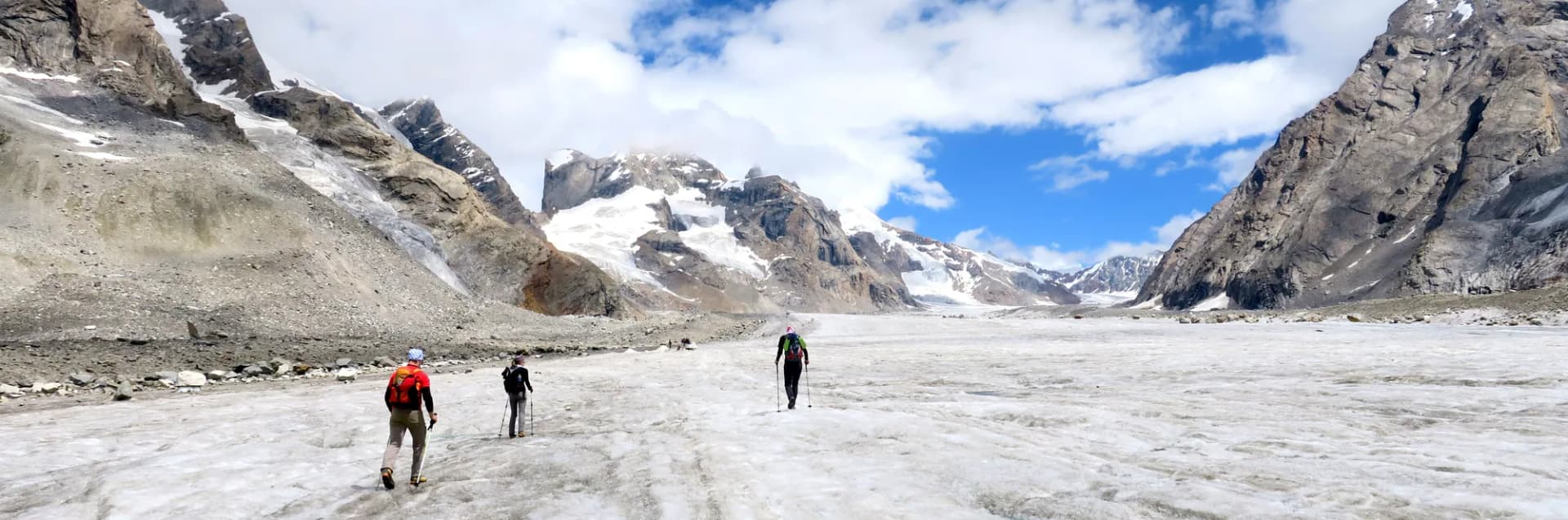
Step onto the Miyar Glacier, one of the longest in the Himalayas (28km). Navigation becomes tricky over hard ice and moraine.
Key Landmarks
Staying At
Trek: Glacier Camp 1 to High Camp (Kang La Base)
A long, exhausting day walking entirely on the glacier. Crevasses become more frequent as you approach the base of Kang La.
Key Landmarks
Staying At
Pass Day: High Camp to Kang La to Temasa Tok
Start at 3:00 AM. A steep climb over the vast snowfield to Kang La (17,940 ft). The descent drops dramatically into the Zanskar region.
Key Landmarks
Staying At
Descent: Temasa Tok to Bardan / Padum
Descend following the Temasa Nala. The landscape changes to the arid, colorful mountains of Zanskar. Reach the roadhead near Bardan monastery.
Key Landmarks
Staying At
Drive: Padum to Kargil / Leh
A long, spectacular drive out of Zanskar valley towards Leh or Kargil, marking the end of the expedition.
Key Landmarks
Staying At
Trek Extensions & Add-ons
Pin Valley Wildlife Extension
+3 DaysAdd 3 days before the pass crossing for a dedicated Snow Leopard observation camp at 16,500 ft with an experienced Spiti wildlife guide.
Also on this trek
Ready to book? Compare verified operators for Kang La Pass Expedition — transparent pricing, no paid rankings.
Still deciding?
Compare routes side-by-side to find the perfect match for your fitness, dates, and budget.
Day by day, camp by camp. Send this to your group so everyone's on the same page.
Love this itinerary?
Find operators who follow this exact route with verified acclimatization days.
Find matching operators