
Explore
Intelligence
Difficulty & Readiness Guide
Is Gupt Khal Expedition Difficult? — Fitness & Altitude Guide
An Extreme, elite-level mountaineering traverse. Requires prior technical training, crevasse rescue knowledge, and peak physical conditioning.
The Question
Can I do this trip?
Preparation Required
Advanced
Prior Experience
Required: At least 2-3 moderate Himalayan treks (above 13,000ft).
Expert Verdict
Highly technical peak requiring physical and mental preparation.
Gupt Khal Expedition
Himalayan Placement · Index 75Route Knowledge
Why is it difficult?
Exertion Index
Primary Challenge
Route Identity
Long-duration high-altitude approach through glacial valleys and moraine terrain.
Primary Drivers
- Maximum sleeping altitude of 17,000 ft
- Grueling summit push with 2,052 ft of elevation gain
- 4 consecutive high-output trekking days
- Peak daily distance of 12 km
View Full Route Analysis
Physiological Demand
Complex, dangerous terrain requiring technical skills, scrambling, and navigating high-consequence exposure zones.
Expect long, exhausting days of sustained climbing at high intensity. Your cardiovascular system will be pushed to its absolute limit.
Extreme high altitude exposure. Severe oxygen depletion requires careful acclimatization and peak cardiovascular health.
Rolling or gradual terrain with minimal harsh impact on joints.
Comfortable pacing with good recovery options.
Terrain Breakdown
You spend over 6 days entirely on ice and moraine, navigating a maze of crevasses. The psychological toll of continuous glacial travel is immense.
Summit Day Notes
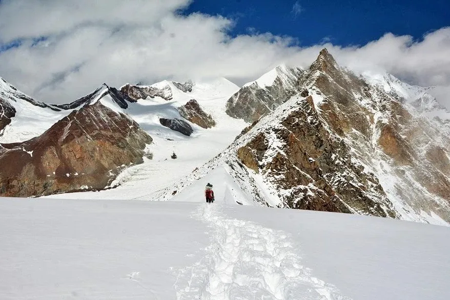
The most critical stage, climbing from Base Camp to the Secret Pass (~5,760m). The descent toward Nakthani Hanging Glacier is technically demanding over moraines and crevasses.
The Descent
The descent from Gupt Khal towards Bhyundar is notoriously steep and requires rappelling or highly skilled front-pointing down 60-degree ice.
Altitude Profile
The route keeps you above 15,000 ft for almost a week, placing extreme stress on the respiratory system.
Run AMS Risk Audit →Trail Performance Data
Max Gradient
70%
Hydration
1.5L per km recommended
Loose Surface Sections
- •Endless miles of shifting boulder moraine on the Ratanban and Bankund glaciers.
Personal Readiness
Am I ready?
What this route demands
People who feel comfortable on this expedition can usually:
Who Can Do This Trip?
Min Age
18+
Max Age
60
Western Toilets at Base
Yes
Solo Female Travelers
Group travel is mandatory. Safe within the context of a professional mountaineering team.
Hazard Profile
What goes wrong?
Common Mistakes on Gupt Khal Expedition
Most injuries and failures on this trail can be avoided by making smarter decisions early on.
Attempting with insufficient ice climbing experience.
Starting the pass crossing too late, resulting in collapsing snow bridges.
Underestimating the Bhyundar Khal crossing, which follows immediately after Gupt Khal.
Safety & Medical Risks
Key Risks
Crevasse fall on Bankund or Bhyundar glaciers
Severe Acute Mountain Sickness (HAPE/HACE)
Avalanche or icefall on the Gupt Khal headwall
Hypothermia/Frostbite during the 1:00 AM pass crossing
AMS (Altitude Sickness)
The sustained time spent above 15,000 ft makes AMS a constant threat. Daily O2 saturation monitoring is mandatory.
Evacuation Route
Evacuation is a logistical nightmare. From Bankund side, stretcher carry to Ghamsali. From Bhyundar side, stretcher carry to Ghangaria.
Solo Trekking
Attempting this trek solo is extremely dangerous. This is an 'expedition-level' route requiring a certified team, rope work, and crevasse crossing skills.
Common Trail Ailments
🏥 Nearest ICU: AIIMS Rishikesh (14+ hours by road from Joshimath)
Tactical Emergency Hub
> No dedicated emergency helipads exist on this highly remote route. Extreme altitude and technical terrain require reliance on immediate physical descent and self-rescue protocols before reaching lower altitudes where chopper rescue becomes viable.
Auditability
How is this calculated?
Understand This Route Further
Before attempting this route:
Still deciding?
Compare routes side-by-side to find the perfect match for your fitness, dates, and budget.
Still think it's doable? Share this with your trek mate and see if they agree.
Step 2: Seasonal Safety
You know how demanding this route is.
Now find the safest and most reliable season to attempt it.
Check Best Time to Go