Detailed Route
Chobia Pass Expedition Itinerary — Day by Day Route & Camps
Connects the Chamba valley with the remote Lahaul region over ancient Gaddi shepherd trails.
Standard RouteThis is the standard mountain pacing for this trek. Specific operators may add an acclimatization day or alter the starting point. Check individual operator schedules for their exact logistics.
Duration
6 Days
Total Distance
47 KM
Max Altitude
16,293 FT
Trek Type
linear
Permits Required Before You Go
Permit Cost
Where to Get
Bharmour Forest HQ
Documents
Medical Certificate, Rescue Insurance, Aadhar
Foreign Nationals
A passport check is required in Lahaul upon exit.
Foreigner Process
Must check in at local police stations.
Nearest Embassy Hub
New Delhi
Day by Day Breakdown
Drive Bharmour to Chobia Roadhead, Trek to Chobia Village
A short drive followed by a walk into the ancient, culturally rich Chobia village. Use this day to organize porters and finalize all technical gear.
Key Landmarks
Staying At
Trek Chobia Village to Baggi / Dalotu
A steep ascent leaving civilization entirely. The trail winds through incredibly thick and dark deodar and pine forests. You are deeply inside the wilderness now.
Key Landmarks
Staying At
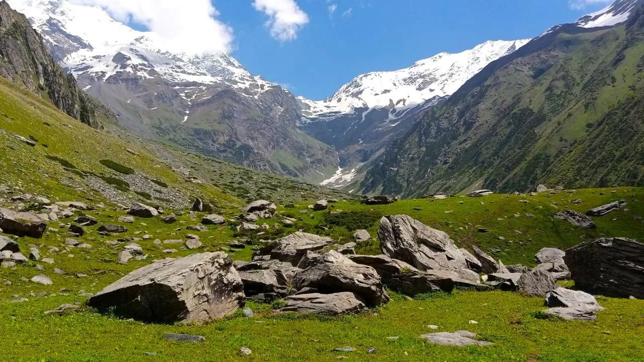
Trek Dalotu to Alyas (Chamba Basecamp)
Break the treeline and enter the brutal alpine zone. The trail is replaced by massive boulder-hopping alongside glacial streams. Establish base camp as close to the glacier snout as safety permits.
Key Landmarks
Staying At
Summit Chobia Pass (16,350 ft) and Descend to Lahaul Base
Start at 2 AM. Rope up to cross the fractured glacier. The final 1,000 feet require kicking steps into a terrifyingly steep snow wall. At the summit, the environment changes instantly to red, dry rock. Descend a dangerously loose scree slope into Lahaul.
Key Landmarks
Staying At
Trek Lahaul Base to Triloknath / Rapé
A massive, hot walk through the dust and stark beauty of Lahaul. Arrive at the famous Triloknath temple (revered by both Hindus and Buddhists), marking the end of the expedition.
Key Landmarks
Staying At
Drive Triloknath to Manali via Keylong
Drive through the Chenab valley toward Keylong before crossing beneath the Rohtang range via the Atal Tunnel into Kullu valley and Manali.
Key Landmarks
Staying At
Trek Extensions & Add-ons
Zanskar Highway
+3 DaysDon't stop in Manali. Turn north at Keylong and drive the grueling highway all the way into Zanskar and Ladakh.
Also on this trek
Ready to book? Compare verified operators for Chobia Pass Expedition — transparent pricing, no paid rankings.
Still deciding?
Compare routes side-by-side to find the perfect match for your fitness, dates, and budget.
Day by day, camp by camp. Send this to your group so everyone's on the same page.
Love this itinerary?
Find operators who follow this exact route with verified acclimatization days.
Find matching operators