
Explore
Intelligence
Detailed Route
Warwan Valley Trek Itinerary — Day by Day Route & Camps
Start in the barren deserts of Ladakh, trek up to 14,500 ft, cross a glacier, and descend into the hidden, hyper-lush Warwan Valley of Kashmir.
Standard RouteThis is the standard mountain pacing for this trek. Specific operators may add an acclimatization day or alter the starting point. Check individual operator schedules for their exact logistics.
Duration
9 Days
Total Distance
76.0 KM
Max Altitude
14,500 FT
Trek Type
circuit
Permits Required Before You Go
Permit Cost
Where to Get
Kargil DC Office & Srinagar
Documents
Original Aadhar Card / Passport, Passport Photos
Foreign Nationals
Foreigners face immense scrutiny due to the sensitive border region. The permit process can take weeks and may be denied randomly by military authorities.
Foreigner Process
Highly complex. Foreigners are heavily scrutinized in Kargil and Suru Valley. Process through a top-tier Delhi/Srinagar agency weeks in advance.
Nearest Embassy Hub
New Delhi
Day by Day Breakdown
Camp Alt
10,826 ft
Day Gain
+5,626 ft
Drive to Panikhar
A massive driving day. You leave the green Kashmir valley, crossing the infamous Zoji La pass, and enter the stark, arid landscapes of Ladakh. You pass through Kargil and drive deep into the Suru Valley to the remote village of Panikhar, surrounded by the towering Nun and Kun massifs.
Key Landmarks
Staying At
The motorable road navigates deeper into the Indus and Zanskar valleys, where the landscape transitions from lower foothills into the steep, high-altitude cold desert.
Camp Alt
10,826 ft
Day Gain
0 ft
Today's Objective
☕ Acclimatization & Recovery
Because you have driven from 5,200 ft to almost 11,000 ft in a single day, this rest day is strictly mandatory. Spend the day doing short acclimatization walks around the village and organizing your expedition gear with the mules.
Key Landmarks
Staying At
The team holds position within the alpine meadow basin, monitoring weather patterns and adapting to the thinning atmosphere.
Camp Alt
12,400 ft
Day Gain
+1,574 ft
Reach Denora
The trek begins. You walk along the Suru River on a wide, arid, and dusty trail characteristic of the Zanskar region. The gradient is gradual but unrelenting. You will set up your first wilderness camp at the desolate pasture of Denora.
Key Landmarks
Staying At
Tree line disappears as the valley broadens into a spectacular high-altitude alpine meadow basin, replacing the dense forests with expansive grazing pastures.
Field Notes
KEY ACTIONRiver Crossings
Plan to cross early in the day before snowmelt swells the water levels. Unclip backpack waist belts before crossing.
Use Trekking Poles
Trekking poles are highly recommended to save your knees on the descent.
INFOSlower Progress
Progress will be significantly slower and more taxing on your ankles than trail distance suggests.
Camp Alt
13,700 ft
Day Gain
+1,300 ft
Reach Kalapari
The landscape becomes harsher. The trail moves from dirt to rocky moraine as you approach the snout of the Kalapari glacier. You will have to ford several freezing glacial streams. The camp at Kalapari is extremely cold, situated on rocks near the base of the pass.
Key Landmarks
Staying At
The valley transitions into a glacial basin. The route follows the river valley. The path breaches the mountain barrier crossing the watershed.
Field Notes
KEY ACTIONRiver Crossings
Plan to cross early in the day before snowmelt swells the water levels. Unclip backpack waist belts before crossing.
Use Trekking Poles
Trekking poles are highly recommended to save your knees on the descent.
INFOSlower Progress
Progress will be significantly slower and more taxing on your ankles than trail distance suggests.
Camp Alt
11,500 ft
Day Gain
-2,200 ft
Today's Objective
🏔 Cross Trek Kalapari To Kaintal Via Lomvilad Pass
The crux of the expedition. You start before dawn, ascending a steep, icy moraine wall onto the massive Lomvilad Glacier. The glacier walk to the pass takes several hours. You must walk carefully behind the guide to avoid crevasses. At the pass (14,500 ft), the arid landscape abruptly ends, and you look down into the lush green Warwan Valley. The descent is incredibly steep and taxing on the knees, ending at the beautiful meadows of Kaintal.
Key Landmarks
Staying At
The environment transitions into open alpine meadows. The valley transitions into a glacial basin. The path breaches the mountain barrier crossing the watershed.
Field Notes
KEY ACTIONRoped Travel
Requires roped glacier travel.
KEY ACTIONStart Early
Start before sunrise to ensure snow bridges remain solid.
Use Trekking Poles
Trekking poles are highly recommended to save your knees on the descent.
INFOSlower Progress
Progress will be significantly slower and more taxing on your ankles than trail distance suggests.
Camp Alt
10,200 ft
Day Gain
-1,300 ft
Reach Humpet
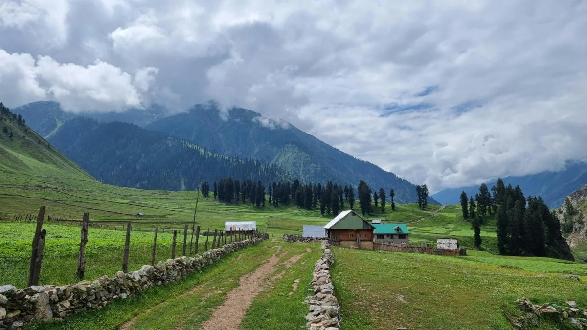
A stark visual contrast to the previous days. You are now deep in Kashmir. The trail is mostly flat, winding through endless meadows blooming with wildflowers, alongside crystal-clear braided rivers. The walking is long but visually spectacular and physically forgiving after the pass.
Key Landmarks
Staying At
The environment transitions into open alpine meadows. The route follows the river valley. The path breaches the mountain barrier crossing the watershed.
Field Notes
KEY ACTIONRiver Crossings
Plan to cross early in the day before snowmelt swells the water levels. Unclip backpack waist belts before crossing.
Camp Alt
8,700 ft
Day Gain
-1,500 ft
Reach Sukhnai
You continue your descent through the valley, passing through thick forests of silver birch and pine. By afternoon, you arrive at Sukhnai, one of the most isolated villages in the Himalayas, entirely constructed of traditional interlocking wooden logs without a single iron nail.
Key Landmarks
Staying At
The route moves through forested zones. The path breaches the mountain barrier crossing the watershed.
Camp Alt
8,200 ft
Day Gain
-500 ft
Reach Margi
The final trekking day. You walk through a series of small, picturesque Kashmiri villages along the Warwan river to reach Inshan, the main administrative hub of the valley. Here you will find the roadhead and military checkpoints.
Key Landmarks
Staying At
The trail follows the Sindh and Lidder valleys through a narrow, forested gorge, moving past traditional settlements into increasingly dense lush pine and fir forests.
Field Notes
KEY ACTIONRiver Crossings
Plan to cross early in the day before snowmelt swells the water levels. Unclip backpack waist belts before crossing.
Camp Alt
5,200 ft
Day Gain
-3,000 ft
Drive to Srinagar
Board your vehicles for the long, bumpy drive out of the Warwan Valley. You will cross the Margan Top pass (11,000 ft) before descending into the main Kashmir valley (Anantnag) and finally arriving in Srinagar by late afternoon, concluding the expedition.
Key Landmarks
The motorable road navigates deeper into the Sindh and Lidder valleys, where the landscape transitions from lower foothills into the steep, lush pine and fir forests.
Trek Extensions & Add-ons
Nun Kun Base Camp
+2 DaysBefore starting the trek, spend 2 days hiking towards the base camps of the 7,000m Nun and Kun peaks from Panikhar.
Plan Your Trek:
Ready to book? Compare verified operators for Warwan Valley Trek — transparent pricing, no paid rankings.
Still deciding?
Compare routes side-by-side to find the perfect match for your fitness, dates, and budget.
Day by day, camp by camp. Send this to your group so everyone's on the same page.
Step 4: Cost & Logistics
You understand the route.
Now see what services, permits, and logistics actually cost.
View Cost Breakdown