Warwan Valley Trek — compare operators and pricing

Compare operators for Warwan Valley Trek

KashmirModerate

Interested in this trek?

We are currently vetting local partners for Warwan Valley Trek to ensure the highest safety standards. Be the first to know when it's open for booking.

Are you a local operator?

Join our platform to list your verified packages for Warwan Valley Trek and reach thousands of trekkers directly.

Apply to join

Found the right operator? Share this list with whoever's coming with you.

About Warwan Valley Trek

9 Days
14,500 FT
Moderate

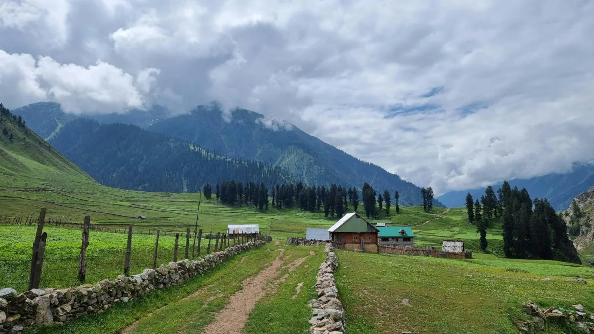
The Warwan Valley Trek is a classic trans-Himalayan crossover linking Ladakh's Suru Valley with Kashmir's remote Warwan Valley. Crossing high mountain passes, glaciers, alpine meadows, and isolated shepherd settlements, it is widely regarded as one of India's finest wilderness expeditions.

Trek Highlights

Lomvilad Pass Edge

Standing on a barren glacier, looking straight down into a hyper-green, forested valley.

Sukhnai Village

A medieval-looking cluster of pure wooden log houses completely disconnected from modern roads.

Suru Valley Arid Peaks

The stark, brown, Martian-like jagged peaks surrounding Panikhar and Denora.

View Complete Trek Guide

Common Questions

How difficult is the Warwan Valley trek?
It is rated as Difficult. It is a grueling 9-day expedition covering 80km of harsh terrain. You must cross a massive glacier at 14,500 ft, navigate icy river crossings, and endure absolute isolation. It is not for beginners.
Is the Lomvilad Pass dangerous?
The pass crossing involves a long glacier walk. While not highly technical (no ropes required), it is heavily crevassed in sections. You must walk in a single file behind your guide and use microspikes if the ice is hard.
Are there any villages along the route?
You will start in Panikhar (Suru Valley) and will not see a single village or road until Day 7 when you reach the remote wooden village of Sukhnai in the Warwan Valley.
What happens in a medical emergency?
Evacuation is extremely difficult. Once you cross the Lomvilad pass, there is no turning back. You must be carried by mules to the nearest roadhead (either Panikhar or Inshan). Satellite phones (if carried by the operator) are the only way to contact military helicopters.
Will my phone work?
You will have BSNL/Jio network in Kargil/Panikhar on Day 1. After that, expect a total blackout for 7 days until you drive back towards Srinagar on Day 9.
Do I need special permits?
Yes. The trek crosses sensitive border regions between Ladakh and Jammu & Kashmir. Inner Line Permits are required and must be arranged by a registered trekking operator.
How cold does it get?
Even in August, night temperatures at the high camps (Kalapari and Kaintal) can easily drop to -5°C to -10°C, especially on the glacial moraines.
Is water readily available?
Yes, water is abundant from glacial streams and the Warwan river. However, due to grazing livestock in the lower valleys, all water must be strictly purified.
How difficult is the Warwan Valley trek?
It is rated as Difficult. It is a grueling 9-day expedition covering 80km of harsh terrain. You must cross a massive glacier at 14,500 ft, navigate icy river crossings, and endure absolute isolation. It is not for beginners.
Is the Lomvilad Pass dangerous?
The pass crossing involves a long glacier walk. While not highly technical (no ropes required), it is heavily crevassed in sections. You must walk in a single file behind your guide and use microspikes if the ice is hard.
Are there any villages along the route?
You will start in Panikhar (Suru Valley) and will not see a single village or road until Day 7 when you reach the remote wooden village of Sukhnai in the Warwan Valley.
What happens in a medical emergency?
Evacuation is extremely difficult. Once you cross the Lomvilad pass, there is no turning back. You must be carried by mules to the nearest roadhead (either Panikhar or Inshan). Satellite phones (if carried by the operator) are the only way to contact military helicopters.
Will my phone work?
You will have BSNL/Jio network in Kargil/Panikhar on Day 1. After that, expect a total blackout for 7 days until you drive back towards Srinagar on Day 9.
Do I need special permits?
Yes. The trek crosses sensitive border regions between Ladakh and Jammu & Kashmir. Inner Line Permits are required and must be arranged by a registered trekking operator.
How cold does it get?
Even in August, night temperatures at the high camps (Kalapari and Kaintal) can easily drop to -5°C to -10°C, especially on the glacial moraines.
Is water readily available?
Yes, water is abundant from glacial streams and the Warwan river. However, due to grazing livestock in the lower valleys, all water must be strictly purified.

Are you a local operator?

Join our platform to list your verified packages for this trek.

Apply to join
MountRoutes Dispatch

Planning Warwan Valley Trek?

Get route conditions, operator updates, and season windows before booking.

Don't miss out! Follow us for route updates@mountroutes|LinkedIn

No spam. Only useful trek updates.

Explore Collections

Not sure where to go next?

View all