Detailed Route
Surajtal Lake Trek Itinerary — Day by Day Route & Camps
Standard RouteThis is the standard mountain pacing for this trek. Specific operators may add an acclimatization day or alter the starting point. Check individual operator schedules for their exact logistics.
Duration
4 Days
Total Distance
28 KM
Max Altitude
16,040 FT
Trek Type
linear
Day by Day Breakdown
Drive Keylong to Patseo and Acclimatization
Drive gradually higher through the Bhaga valley toward Patseo. Spend the remainder of the day acclimatizing at altitude before moving toward Baralacha La.
Key Landmarks
Staying At
Trek Patseo to Zingzingbar
Follow the gradual upstream valley toward Zingzingbar. Vegetation disappears almost completely as the landscape transitions into the cold desert terrain below Baralacha La.
Key Landmarks
Staying At
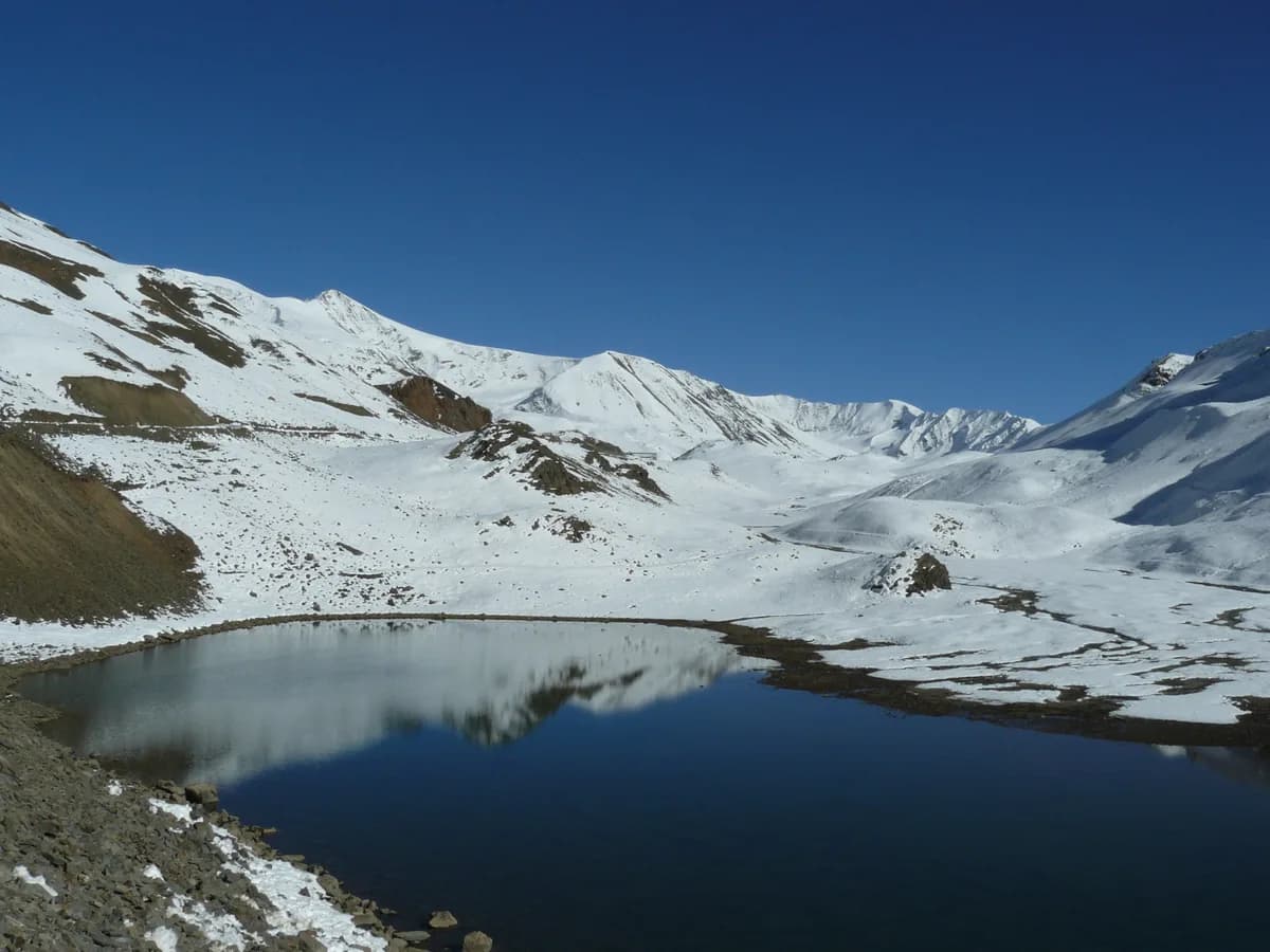
Trek Zingzingbar to Suraj Tal via Baralacha La and Return
Ascend gradually toward Baralacha La (~16,000 ft) before reaching the sacred high-altitude lake of Suraj Tal. Spend limited time at the lake because of the altitude and weather exposure before descending back to Zingzingbar.
Key Landmarks
Staying At
Drive Zingzingbar to Keylong
Drive back down the Leh-Manali highway through the Bhaga valley, descending steadily from the high-altitude cold desert toward Keylong.
Key Landmarks
Trek Extensions & Add-ons
Baralacha La Ridge Expedition
+1 DayShort climb to the higher ridges of the pass for an aerial view of the lake.
Also on this trek
Ready to book? Compare verified operators for Surajtal Lake Trek — transparent pricing, no paid rankings.
Still deciding?
Compare routes side-by-side to find the perfect match for your fitness, dates, and budget.
Day by day, camp by camp. Send this to your group so everyone's on the same page.
Love this itinerary?
Find operators who follow this exact route with verified acclimatization days.
Find matching operators