Difficulty & Readiness Guide
Is Surajtal Lake Trek Difficult? — Fitness & Altitude Guide
Preparation Required
Advanced
Prior Experience
Required: At least 2-3 moderate Himalayan treks (above 13,000ft).
Score Engine v3
Why This Score?
Stamina
42/100
Based on average nightly altitude gain, highest campsite, and daily distance. Reflects how hard the average day feels.
Spike Day
63/100
Based on max altitude reached, summit day elevation gain, and summit day distance. Reflects the hardest single day.
Why Surajtal Lake Trek Feels Difficult
A demanding expedition that balances altitude exposure and cardio demand.
Physiological Demand
Extreme high altitude exposure. Severe oxygen depletion requires careful acclimatization and peak cardiovascular health.
Challenging daily distances and steady climbs. Good cardiovascular fitness is required.
Notable elevation gains and losses requiring good leg strength and joint resilience.
Rough, uneven trails with occasional scrambling or minor exposure.
Comfortable pacing with good recovery options.
Crux Section
Day 3 — Oxygen Peak
Highest exposure point at 16,040ft.
Surajtal Lake Trek/ 65
Terrain Breakdown
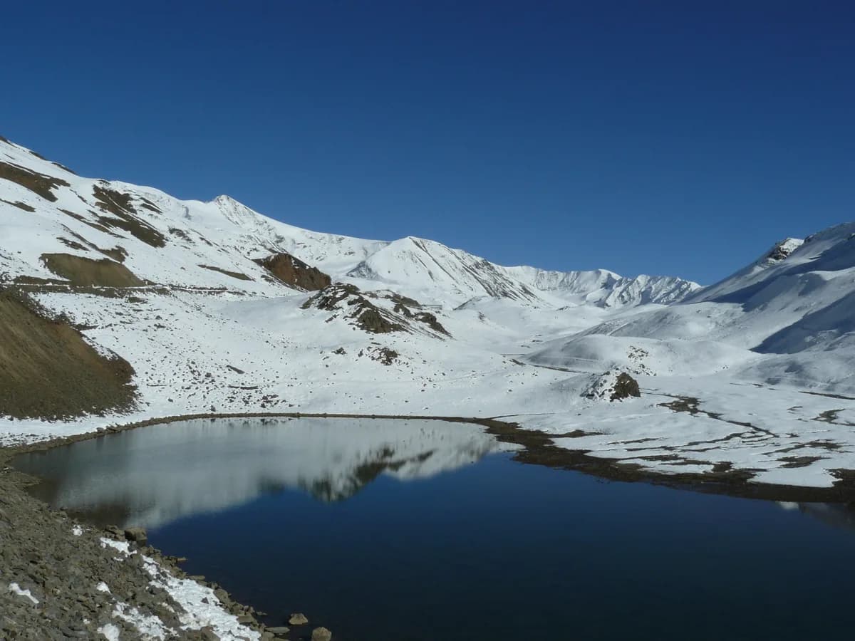
Mostly high-altitude desert terrain with loose gravel and sharp stones. The final approach to the lake involves some boulder hopping.
Summit Day Notes
Oxygen levels are roughly 50% of sea level. Every step requires mental effort.
Preparation
Requires previous 14k+ ft trek experience. Focus on breathing techniques and high-altitude endurance.
Altitude Profile
You will be ascending from an base altitude of 12500 ft to 16040 ft.
Run AMS Risk Audit →Route Stress Forecast
Highest exposure point at 16,040ft.
Deep 2,040ft descent will test joint stability.
Day 2 requires the highest sustained output.
*Forecast derived from route geometry and altitude profile. External variables (weather/group) remain the final authority.
Trail Performance Data
Max Gradient
25%
Hydration
0.6L per km recommended
Loose Surface Sections
- •Baralacha La approach moraine
Common Mistakes on Surajtal Lake Trek
Most injuries and failures on this trail can be avoided by making smarter decisions early on.
Underestimating the severe wind chill factor at Baralacha La pass.
Ascending too quickly from the starting point without properly acclimatizing to the already high base altitude.
Safety & Medical Risks
Key Risks
Severe AMS (HAPE/HACE risk)
Snow blindness without glasses
Sudden blizzards
AMS (Altitude Sickness)
At 15,800 ft, even minor symptoms should be treated seriously. Patseo Army camp has oxygen for emergencies.
Evacuation Route
The Manali-Leh highway is nearby; vehicle evacuation is the primary method.
Common Trail Ailments
🏥 Nearest ICU: Keylong District Hospital / Manali Regional Hospital
Tactical Emergency Hub
> Highway access is less than 1km from most points on the trek. National Emergency (112) or BRO assistance is primary.
Who Can Do This Trek?
Min Age
15+
Max Age
55
Western Toilets at Base
Yes
Solo Female Travelers
High safety due to heavy highway traffic and ITBP/BRO presence.
Expert Verdict
Highly technical trek requiring physical and mental preparation.
Ready to book? Compare verified operators for Surajtal Lake Trek — transparent pricing, no paid rankings.
Want to know which operators carry certified guides and medical support? See operator safety ratings for Surajtal Lake Trek
Also on this trek
Still deciding?
Compare routes side-by-side to find the perfect match for your fitness, dates, and budget.
Still think it's doable? Share this with your trek mate and see if they agree.
Fit for the challenge?
For challenging treks, safety is paramount. Find operators prioritizing medical support and guide expertise.
Compare operator safety scores