
Explore
Intelligence
Detailed Route
Stok Kangri Base Camp Trek Itinerary — Day by Day Route & Camps
A 5-day intense altitude challenge starting with acclimatization in Leh, ascending rapidly through the rocky Stok gorge to Base Camp, and concluding with a long descent.
Standard RouteThis is the standard mountain pacing for this trek. Specific operators may add an acclimatization day or alter the starting point. Check individual operator schedules for their exact logistics.
Duration
5 Days
Total Distance
26.0 KM
Max Altitude
16,300 FT
Trek Type
linear
Permits Required Before You Go
Permit Cost
Where to Get
Leh DC Office and ALTOA Office (Operators usually handle this)
Documents
Aadhar Card / Passport, Passport Photos, Medical Fitness Certificate
Foreign Nationals
Foreigners must apply for a Protected Area Permit (PAP) through a registered travel agent in Leh.
Foreigner Process
Protected Area Permit (PAP) must be obtained through a Leh travel agent. Minimum group of 2 required.
Nearest Embassy Hub
New Delhi
Day by Day Breakdown
Camp Alt
11,500 ft
Day Gain
0 ft
Today's Objective
☕ Acclimatization & Recovery
Fly into Leh. Due to the rapid altitude gain from sea level to 11,500 ft, complete rest on day one is absolutely mandatory to prevent AMS. Drink plenty of water and avoid physical exertion.
Key Landmarks
Staying At
The team holds position within the alpine meadow basin, monitoring weather patterns and adapting to the thinning atmosphere.
Camp Alt
13,080 ft
Day Gain
+1,580 ft
Drive to Stok Village & Trek to Chang Ma
After a short drive to Stok Village, the trek officially begins. The trail enters a barren gorge characterized by striking rock formations. You will gradually ascend alongside the Stok River to the first campsite at Chang Ma. This is a gentle introduction to the altitude.
Key Landmarks
Staying At
The drive leaves the city environment, transitioning into a barren gorge characterized by rock formations and steep valley walls.
Field Notes
KEY ACTIONRiver Crossings
Plan to cross early in the day before snowmelt swells the water levels. Unclip backpack waist belts before crossing.
Camp Alt
14,200 ft
Day Gain
+1,120 ft
Reach Mankorma
A relatively short trekking day designed specifically for acclimatization. The trail involves river crossings and traversing dry, dusty terrain. Mankorma is a wide, open valley serving as the advanced camp before Base Camp. Spend the afternoon resting.
Key Landmarks
Staying At
The narrow rock gorge opens up into a wide, barren high-altitude valley entirely devoid of vegetation.
Field Notes
KEY ACTIONRiver Crossings
Plan to cross early in the day before snowmelt swells the water levels. Unclip backpack waist belts before crossing.
Use Trekking Poles
Trekking poles are highly recommended to save your knees on the descent.
INFOSlower Progress
Progress will be significantly slower and more taxing on your ankles than trail distance suggests.
Camp Alt
16,300 ft
Day Gain
+2,100 ft
Today's Objective
🏕 Establish Stok Kangri Base Camp
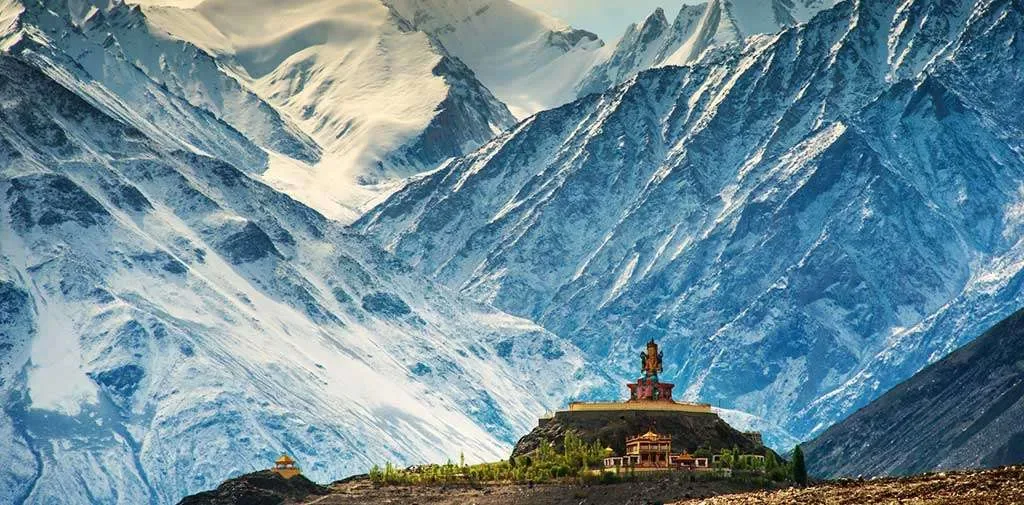
The most challenging day of the ascent. The air becomes noticeably thinner as you climb over 2,000 feet into the high alpine zone. The trail is a steady, grinding uphill over rocky terrain. Arriving at Base Camp (16,300 ft), you are rewarded with an amphitheater of towering 6000m peaks.
Key Landmarks
Staying At
The wide valley floor opens into a steep, rocky glacial basin situated directly beneath glaciated 6000m peaks.
Field Notes
Use Trekking Poles
Trekking poles are highly recommended to save your knees on the descent.
INFOSlower Progress
Progress will be significantly slower and more taxing on your ankles than trail distance suggests.
Camp Alt
11,500 ft
Day Gain
-4,800 ft
Trek to Stok Village & Drive to Leh
A long, steep descent day. You will retrace your steps all the way back down the gorge to Stok Village. The rapid loss of altitude brings immense relief to the lungs, but the continuous downhill over 13 km is tough on the knees. From Stok, drive back to Leh.
Key Landmarks
The glacial basin is left behind for the narrow rock gorge, eventually returning to the urban environment of Leh.
Field Notes
KEY ACTIONRiver Crossings
Plan to cross early in the day before snowmelt swells the water levels. Unclip backpack waist belts before crossing.
Use Trekking Poles
Trekking poles are highly recommended to save your knees on the descent.
INFOSlower Progress
Progress will be significantly slower and more taxing on your ankles than trail distance suggests.
Trek Extensions & Add-ons
Markha Valley Connection
+4 DaysMany trekkers combine the Stok Kangri Base Camp with the famous Markha Valley trek, entering via Chilling and exiting via Stok over the Stok La pass.
Plan Your Trek:
Ready to book? Compare verified operators for Stok Kangri Base Camp Trek — transparent pricing, no paid rankings.
Still deciding?
Compare routes side-by-side to find the perfect match for your fitness, dates, and budget.
Day by day, camp by camp. Send this to your group so everyone's on the same page.
Step 4: Cost & Logistics
You understand the route.
Now see what services, permits, and logistics actually cost.
View Cost Breakdown