
Explore
Intelligence
Essential Planning Guide
Saru Tal Trek — Complete Guide (2026)
Vibe & Scenery
The Experience
Introduction
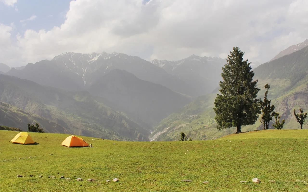
Hidden beyond the better-known trekking routes of Govind Pashu Vihar National Park, Saru Tal offers one of Garhwal's finest alpine lake expeditions. The trail winds through oak, pine, and rhododendron forests before emerging onto broad bugyals and exposed ridges that overlook the upper Supin Valley.
The highlight is the isolated glacial lake of Saru Tal, surrounded by impressive Himalayan peaks including Swargarohini, Black Peak (Kalanag), and Bandarpoonch. Compared with nearby trekking destinations, visitor numbers remain relatively low, creating a genuine wilderness experience.
Long walking days, sustained climbing, and remote camping make this trek best suited to trekkers with good endurance and previous multi-day Himalayan experience.
Quick Facts
Duration
Max Altitude
Difficulty
Best Time
Trek Distance
Trail Atmosphere
Stargazing
Class 1 Dark Sky
Scent Profile
Silence Level
~15 dB
Vertigo Factor
7 / 10
Iconic Spots
Kedarkantha Summit (Dawn)
Saru Tal Basin
Environment
Nature & Culture
Flora & Fauna
Flora
Fauna
The peaks you see, specifically Swargarohini, hold deep mythological significance. It is believed to be the stairway to heaven used by the Pandavas in the Mahabharata.
— Local folklore
Spiritual & Cultural Significance
The peaks surrounding the lake are deeply tied to the Mahabharata epics, and local shepherds consider the high lakes sacred.
🕐 Shrine Timings: N/A
Temple Protocols
- •Do not wash clothes or use soap in Saru Tal.
- •Maintain strict silence and reverence near the lake.
Technical Details
Challenge & Preparation
Primarily a cardio demand and joint & muscle impact challenge
A demanding expedition that balances cardio demand and joint & muscle impact.
Personal Readiness
Am I ready?
Planning
Logistics & Trail Intel
Getting There
Route to Base
Take an overnight train or bus to Dehradun
From Dehradun ISBT or Railway station, shared maxicabs or private tempos depart for the 9-hour drive to Sankri
Base Village
Sankri
6,400 ft
Last ATM
Purola (2 hours before Sankri). Withdraw cash in Dehradun to be safe.
Nearest Medical Facility
Primary Health Center (PHC) Purola / Max Hospital Dehradun.
Mobile Signal
Complete dead zone after Day 2.
Water Sources
Abundant streams until Dunda Thach. On the high ridges (Days 4-6), water sources are scarce and rely on glacial melt. You must carry 2L minimum from camp.
Charging
Zero charging points after Sankri. Carry multiple power banks.
For Drivers
Road Condition
The drive from Dehradun to Sankri is long and winding. The final 22 km from Netwar to Sankri is often unpaved, bumpy, and prone to landslides during rains.
Purola
Trail Culinary & Diet
Don't miss the High-altitude Khichdi for easy digestion at 12,000 ft.
Buy specialized diet items at Dehradun (Sankri has basic Maggi/Dal-Chawal stalls).
The Content & Remote Hub
No DronesDrones are generally banned within the Govind Pashu Vihar National Park without explicit written permission from the Chief Wildlife Warden.Top Vlog Spots
Video Calls
none
UPI Reliability
3/10
Permits and Regulations
The trek falls entirely within the Govind Pashu Vihar National Park and Wildlife Sanctuary. Trekkers require a forest entry permit, which is obtained at the forest check post in Netwar (en route to Sankri). A registered local guide is legally mandated to enter the core zones. Strict Leave No Trace policies must be followed, especially near the fragile ecosystem of the Saru Tal lake.
Learn more about how we vet operators and ensure transparency on our why MountRoutes page.
Packing List
High-Altitude Clothing
- Heavyweight down jacket (rated to -10°C)
- Waterproof and windproof hardshell jacket and pants (Gore-Tex)
- 3 pairs of merino wool thermal baselayers
- 2 heavy fleece mid-layers
- Waterproof alpine gloves with thermal liners
- Fleece balaclava and UV-protective neck gaiter
- 4 pairs of heavy woolen/synthetic trekking socks
Technical Footwear & Gear
- Sturdy, waterproof mountaineering boots with deep lugs
- Microspikes and gaiters (essential for early summer/late autumn snow)
- 2 anti-shock trekking poles with snow baskets
- 50L-60L expedition backpack with a waterproof rain cover
- Lightweight camp sandals/slip-ons
Survival & Health Equipment
- Four-season sleeping bag (if carrying personal gear)
- High-lumen headlamp with spare lithium batteries (cold drains batteries fast)
- Category 4 UV Polarized Glacier Glasses (essential at the lake)
- Comprehensive Personal First Aid Kit with Diamox
- High SPF Sunscreen (50+) and zinc oxide lip balm
- Insulated water thermos (1 Liter) and a 1L hydration bladder
Deep Dives
Explore Further
Editor's Notes
Explore In Detail
Day by Day Itinerary
8-day route reaching 13,615ft. Covers 62.0km of varied terrain.
→ See full itinerary with altitude profileDifficulty & Fitness
Rated challenging. The terrain shifts dramatically from well-trodden, muddy forest paths (Days 1-2) to steep, rocky, and potentially snow-covered ridges (Days 4-5).
→ See difficulty breakdown and fitness guideCost & Pricing
Packages range from ₹16,000 – ₹22,000. Inclusions and hidden costs vary by operator tier.
→ See full cost breakdownFrequently Asked Questions
How difficult is the Saru Tal Trek?
It is graded as Moderate-to-Difficult. While the initial days mimic the easy Kedarkantha route, the push beyond Dunda Thach toward Saru Tal involves steep, continuous ascents and exposed ridge walks at high altitudes.
Is this trek suitable for beginners?
No. Due to the total distance (over 50 km), the max altitude of 13,615 ft, and the remote nature of the final camps, prior Himalayan trekking experience (at least one high-altitude pass) is highly recommended.
How cold does it get at Saru Tal?
During the peak trekking months of May and October, nighttime temperatures at the higher camps (Taloti Thach, Saru Tal) routinely drop below freezing, often reaching -5°C to -10°C.
Will we encounter snow?
If trekking in late May, June, or October, expect substantial snow patches near the Kedarkantha summit and heavily banked snow around the Saru Tal basin.
What is the risk of AMS on this trek?
Moderate to High. The trek involves sleeping above 11,000 feet for multiple nights. Proper acclimatization, slow pacing, and hydration are crucial.
Is mobile network available?
You will have a patchy network (BSNL/Jio) at Sankri base camp. Beyond Juda Ka Talab (Day 2), expect a complete dead zone for the next 5 days.
Do we need specialized mountaineering gear like ropes and ice axes?
Usually, no. However, in heavy snow conditions (early May or late November), your guide may carry ropes for safety on the exposed ridges, and microspikes are mandatory.
Can I do this trek without a guide?
Absolutely not. Beyond Kedarkantha, the trail to Saru Tal is largely unmarked, heavily forested in sections, and crisscrossed by confusing shepherd trails. A certified local guide is mandatory.
Still deciding?
Compare routes side-by-side to find the perfect match for your fitness, dates, and budget.
Everything you need to know, in one place. Someone else in your group needs to see this.
Planning Saru Tal Trek?
Get route conditions, operator updates, and season windows before booking.
Don't miss out! Follow us for route updates@mountroutes|LinkedIn
No spam. Only useful trek updates.
Ready to walk this route?
You’ve read the guide, now find the perfect local team to take you there. Compare our verified list of operators.
Compare verified operators