
Explore
Intelligence
Detailed Route
Rupin Pass Trek Itinerary — Day by Day Route & Camps
A dramatic 8-day crossover journey starting from the forests of Uttarakhand, ascending past the three-stage Rupin waterfall, crossing the high pass, and descending into the cinematic Sangla Valley of Himachal Pradesh.
Standard RouteThis is the standard mountain pacing for this trek. Specific operators may add an acclimatization day or alter the starting point. Check individual operator schedules for their exact logistics.
Duration
8 Days
Total Distance
42.0 KM
Max Altitude
15,250 FT
Trek Type
linear
Permits Required Before You Go
Permit Cost
Where to Get
Forest checkpoint at Netwar/Dhaula
Documents
Aadhar Card / Passport, Passport Photos, Original Medical Fitness Certificate
Foreign Nationals
Foreigners require additional clearance at the Netwar checkpoint and pay higher park entry fees.
Foreigner Process
Foreign nationals must pay higher park entry fees and register at the Netwar checkpoint with passports and visas.
Nearest Embassy Hub
New Delhi
Day by Day Breakdown
Camp Alt
5,100 ft
Day Gain
+3,000 ft
Drive to Dhaula
A long, winding drive through the Garhwal Himalayas. The road follows the Tons river and then the Rupin river, passing through pine forests. Dhaula is the base camp, located at the edge of the national park.
Key Landmarks
Staying At
A long mountain drive along the Tons and Rupin river valleys to the trekking base camp.
Camp Alt
6,300 ft
Day Gain
+1,200 ft
Reach Sewa
An easy first day of trekking. The trail ascends gently through apple and apricot orchards, passing small Garhwali villages. You cross the border into Himachal Pradesh briefly. Sewa features a unique two-story temple displaying the region's distinct wooden architecture.
Key Landmarks
Staying At
The trail follows the mountain river corridor through a narrow, forested gorge, moving past traditional settlements into increasingly dense dense forested valleys.
Camp Alt
8,700 ft
Day Gain
+2,400 ft
Reach Jhaka
A day of steep ascents and cultural immersion. The trail drops down to the river bed before climbing sharply through dense forests. You pass through the village of Bawta before reaching Jhaka, the famous 'hanging village' that sits precariously on a cliff face.
Key Landmarks
Staying At
The trail follows the mountain river corridor through a narrow, forested gorge, moving past traditional settlements into increasingly dense dense forested valleys.
Camp Alt
11,150 ft
Day Gain
+2,450 ft
Reach Saruwas Thatch
The landscape transforms from civilization to wild alpine nature. The trail zigzags through magnificent fir forests. If trekking in summer, you will encounter the first massive snow bridges spanning the Rupin River. Saruwas Thatch is a beautiful meadow campsite.
Key Landmarks
Staying At
Transition into wild alpine terrain involving forest trails and river snow-bridge crossings.
Field Notes
KEY ACTIONRiver Crossings
Plan to cross early in the day before snowmelt swells the water levels. Unclip backpack waist belts before crossing.
Camp Alt
11,680 ft
Day Gain
+530 ft
Reach Dhanderas Thatch
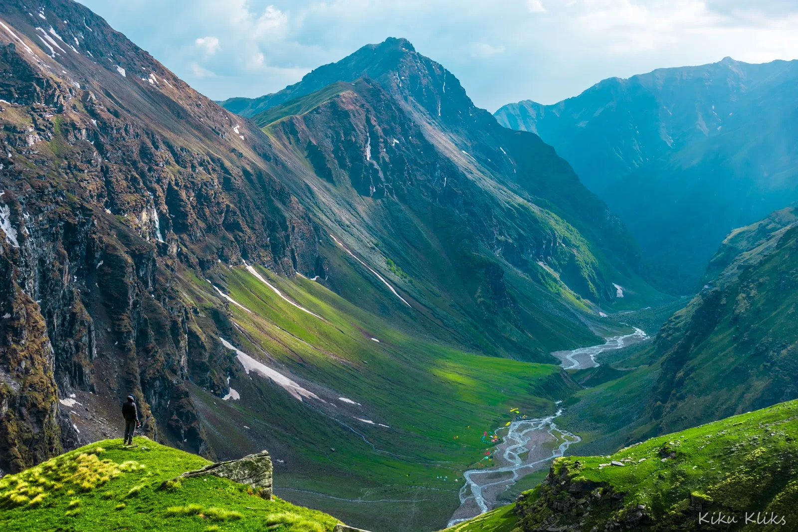
A spectacular day. The trail opens up into a massive U-shaped glacial valley. You walk through miles of green meadows (thatch) bursting with wildflowers. The highlight is the view of the majestic Rupin waterfall cascading down the mountain in three distinct stages.
Key Landmarks
Staying At
A scenic trek through expansive alpine meadows within a wide U-shaped glacial valley.
Camp Alt
13,120 ft
Day Gain
+1,440 ft
Reach Upper Waterfall Camp
A short but highly strenuous acclimatization day. You will climb directly up the side of the waterfall. It is a steep, rocky ascent (often covered in snow in early summer) that rapidly gains altitude. The Upper Waterfall camp is cold, windy, and surrounded by ice and rock.
Key Landmarks
Staying At
Tree line disappears as the valley broadens into a spectacular high-altitude alpine meadow basin, replacing the dense forests with expansive grazing pastures.
Field Notes
Stow Poles
Requires hands-on rock scrambling. Stow trekking poles to free up your hands.
INFOSlower Progress
Progress will be significantly slower and more taxing on your ankles than trail distance suggests.
Camp Alt
13,420 ft
Day Gain
+300 ft
Today's Objective
🏔 Cross Cross Rupin Pass
The summit day. You start before dawn to tackle the steep snow gully leading to the pass. The final 200 meters are a grueling 45-degree climb. At the pass (15,250 ft), you cross into the Sangla valley, greeted by views of the Kinnaur Kailash peaks. A steep, sliding descent follows to the camp at Ronti Gad.
Key Landmarks
Staying At
Crossing the high-altitude pass bridges two distinct watershed systems, shifting the expedition over the glaciated divide and down into a new river basin.
Field Notes
KEY ACTIONHelmet Mandatory
Helmet mandatory. Move quickly and quietly through the rockfall zone without stopping to rest.
Stow Poles
Requires hands-on rock scrambling. Stow trekking poles to free up your hands.
INFOSlower Progress
Progress will be significantly slower and more taxing on your ankles than trail distance suggests.
Camp Alt
8,800 ft
Day Gain
-4,620 ft
Trek to Sangla & Drive to Shimla
A long descent day. The barren landscape gives way to the lush, green meadows of Sangla Kanda and eventually dense pine forests. The sharp descent is tough on the knees. Arrive in the beautiful Sangla village, where the trek ends. Board vehicles for the overnight drive to Shimla.
Key Landmarks
Staying At
Crossing the high-altitude pass bridges two distinct watershed systems, shifting the expedition over the glaciated divide and down into a new river basin.
Trek Extensions & Add-ons
Chitkul Visit
+1 DayAfter reaching Sangla, take a taxi to Chitkul, the last inhabited village near the Indo-Tibet border, famous for its pristine beauty and wooden houses.
Plan Your Trek:
Ready to book? Compare verified operators for Rupin Pass Trek — transparent pricing, no paid rankings.
Still deciding?
Compare routes side-by-side to find the perfect match for your fitness, dates, and budget.
Day by day, camp by camp. Send this to your group so everyone's on the same page.
Step 4: Cost & Logistics
You understand the route.
Now see what services, permits, and logistics actually cost.
View Cost Breakdown