
Explore
Intelligence
Essential Planning Guide
Rupin Pass Trek — Complete Guide (2026)
Vibe & Scenery
The Experience
Introduction
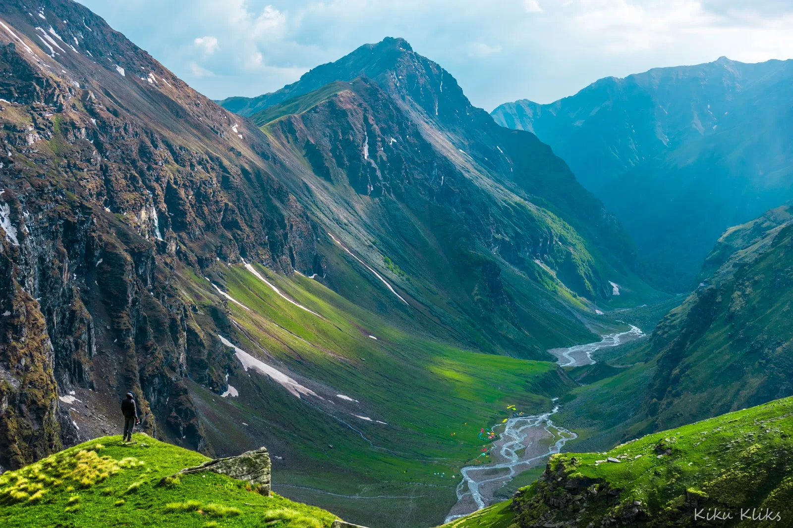
Few Himalayan treks change character as dramatically as Rupin Pass. Beginning in the forested valleys of Uttarakhand and finishing among the orchards and traditional villages of Kinnaur, the route passes through an extraordinary variety of landscapes over the course of a single expedition.
Highlights include hanging villages, dense conifer forests, the spectacular multi-stage Rupin Waterfall, expansive alpine meadows, and the final ascent to Rupin Pass, where snowfields often persist well into the trekking season. Beyond its scenery, the trek also offers a fascinating cultural transition as Garhwali villages gradually give way to Kinnauri settlements.
Long trekking days, significant elevation gain, and sustained high-altitude travel make Rupin Pass best suited to trekkers with good fitness and prior multi-day Himalayan trekking experience.
Quick Facts
Duration
Max Altitude
Difficulty
Best Time
Trek Distance
Trail Atmosphere
Stargazing
Class 1 Dark Sky
Scent Profile
Silence Level
~30 dB
Vertigo Factor
6 / 10
Iconic Spots
Rupin Waterfall
Jhaka Village
Environment
Nature & Culture
Flora & Fauna
Flora
Fauna
The two-story wooden temple in Sewa village contains trophies and horns of local wildlife. It is part of an ancient route connecting the people of Garhwal and Kinnaur for trade and matrimonial alliances.
— Local folklore
Spiritual & Cultural Significance
The trek bridges two distinct cultural zones: the Hindu traditions of the Garhwal Himalayas and the mixed Hindu-Buddhist culture of the Kinnaur valley.
🕐 Shrine Timings: The Sewa temple is open during the day, but entry into the inner sanctum is restricted.
Temple Protocols
- •Do not touch the main temple structures without permission.
- •Remove shoes before approaching village shrines.
Festivals & Dates
Technical Details
Challenge & Preparation
Primarily a joint & muscle impact and cardio demand challenge
A capable trekker's route that balances joint & muscle impact and cardio demand.
Personal Readiness
Am I ready?
Planning
Logistics & Trail Intel
Getting There
Route to Base
Arrive in Dehradun via flight or train
From Dehradun, take a shared taxi/bus for a 9-10 hour drive through Mussoorie and Mori to reach Dhaula
Base Village
Dhaula
5,100 ft
Nearest Railhead
Dehradun Railway Station
Nearest Airport
Jolly Grant Airport, Dehradun
Last ATM
Purola or Mori (En route to Dhaula)
Nearest Medical Facility
Primary Health Centre in Mori. Major hospitals in Dehradun (Start) and Shimla/Rampur (End).
Mobile Signal
None from Day 2 to Day 7.
Water Sources
Abundant streams and the Rupin river. Water must be purified, especially near sheep grazing meadows.
Charging
None after Dhaula. Carry high-capacity power banks.
For Drivers
Road Condition
The drive from Dehradun to Dhaula is long and winding on narrow mountain roads. The return from Sangla to Shimla is also a long journey on the Hindustan-Tibet highway.
Purola (Start) / Sangla (End)
Trail Culinary & Diet
Don't miss the Rajma Chawal in Garhwal; Thukpa in Kinnaur.
Buy specialized diet items at Dehradun
The Content & Remote Hub
No DronesDrones are prohibited within the Govind Pashu Vihar National Park without explicit forest department permission.Top Vlog Spots
Video Calls
none
Est. 0 Mbps
UPI Reliability
2/10
Permits and Regulations
Indian nationals must pay the Govind Pashu Vihar National Park fee and forest department trekking fees. A medical fitness certificate and valid ID are required at the Dhaula forest checkpoint. Strict Leave No Trace rules apply.
Learn more about how we vet operators and ensure transparency on our why MountRoutes page.
Packing List
Clothing & Outerwear
- Heavy down jacket (rated for -10°C to -15°C)
- Gore-Tex waterproof hardshell jacket and rain pants
- Durable, quick-dry trekking pants (2 pairs)
- Merino wool thermal baselayers (top and bottom, 2 sets)
- Fleece mid-layers (jacket or heavy pullover)
- Balaclava and UV-protective neck gaiter (Buff)
- Waterproof alpine gloves and fleece liner gloves
Footwear
- High-ankle waterproof trekking boots with rigid soles
- Camp shoes or sturdy sandals for river crossings
- Heavy woolen trekking socks (4 pairs)
- Moisture-wicking liner socks (3 pairs)
- Waterproof gaiters (mandatory for the snow gully and pass)
Gear & Accessories
- 50-60L trekking backpack with heavy-duty rain cover
- Sleeping bag rated for -10°C comfort
- Anti-shock trekking poles (mandatory for steep ascents and snow)
- High-lumen headlamp with spare lithium batteries
- Category 4 UV protection sunglasses (glacier glasses)
- Microspikes (provided by operator if summer snow conditions require)
Health & Hygiene
- Comprehensive High-Altitude First Aid Kit (Diamox, Dexamethasone)
- High SPF (50+) sunscreen and zinc oxide lip balm
- Water purification tablets or LifeStraw filter
- Biodegradable wet wipes and hand sanitizer
- Personal oximeter and blister care kit (Moleskin/Compeed)
Deep Dives
Explore Further
Editor's Notes
Explore In Detail
Day by Day Itinerary
8-day route reaching 15,250ft. Covers 42.0km of varied terrain.
→ See full itinerary with altitude profileDifficulty & Fitness
Rated moderate. The terrain changes drastically: dirt trails through forests, massive meadows, steep rock scrambling alongside a waterfall, and a highly technical snow/scree gully approach to the pass.
→ See difficulty breakdown and fitness guideCost & Pricing
Packages range from ₹25,000 - ₹35,000. Inclusions and hidden costs vary by operator tier.
→ See full cost breakdownFrequently Asked Questions
What permits are required for the Rupin Pass Trek?
You need a Govind Pashu Vihar National Park entry permit and a Forest Department Trekking Permit. Since the trek crosses from Uttarakhand to Himachal Pradesh, permits are checked at the Dhaula forest checkpoint. Ensure you have original government ID and a medical fitness certificate.
How difficult is the Rupin Pass Trek at 15,250 ft?
It is rated as Moderate to Difficult. While the first few days starting from Dhaula (5,100 ft) are moderate, the final push to the 15,250 ft pass involves a grueling near 45-degree ascent through a snow or scree gully.
Which is better: the pre-monsoon (Summer) or post-monsoon (Autumn) season?
Both offer distinct experiences. May/June is famous for massive snow bridges over the Rupin River and an exhilarating snow climb to the pass. September/October offers crystal clear views, golden meadows, and a rocky, scree-filled pass crossing with minimal snow.
Is acclimatization an issue on this trek?
Yes. The trek starts at 5,100 ft and climbs to 15,250 ft over several days. The itinerary naturally aids acclimatization by spreading the ascent over 6 days. You will sleep at high camps like Dhanderas Thatch (11,680 ft) and Upper Waterfall (13,120 ft) before the final push.
Are there river crossings on the Rupin Pass route?
Yes, you will walk alongside and cross the Rupin River multiple times. In summer, you cross over natural snow bridges. In autumn, when snow bridges melt, you may have to wade through freezing water or use improvised wooden bridges near Saruwas Thatch.
Is this a crossover trek?
Yes, it is a classic crossover. You start your trek from Dhaula in the Govind Pashu Vihar National Park (Uttarakhand) and end your trek in Sangla in the Kinnaur district (Himachal Pradesh).
Is there mobile connectivity on the trail?
Connectivity is very poor. You will have network at the base camps like Dhaula and Sewa (faint BSNL), but you will lose all signal for the next 5 days. You regain network (BSNL/Jio) once you descend to Sangla.
Do I need technical mountaineering gear?
Since the peak altitude is 15,250 ft (under 5000m), no technical ice axes, crampons, or ropes are usually required for the trekker. Microspikes and trekking poles are sufficient for the summer snow gully. The operator will carry safety ropes if needed.
Can a beginner do the Rupin Pass trek?
It is not recommended for absolute beginners. Due to the high altitude (15,250 ft) and the steep, continuous descent to Sangla (dropping 4,620 ft in one day), you should have prior experience with at least one high-altitude Himalayan trek.
What is the descent like to Sangla?
The descent from Rupin Pass into Sangla is extremely steep and continuous. Dropping from 15,250 ft down to 8,800 ft puts immense pressure on the knees and toes, requiring the mandatory use of trekking poles.
Still deciding?
Compare routes side-by-side to find the perfect match for your fitness, dates, and budget.
Everything you need to know, in one place. Someone else in your group needs to see this.
Planning Rupin Pass Trek?
Get route conditions, operator updates, and season windows before booking.
Don't miss out! Follow us for route updates@mountroutes|LinkedIn
No spam. Only useful trek updates.
Ready to walk this route?
You’ve read the guide, now find the perfect local team to take you there. Compare our verified list of operators.
Compare verified operators