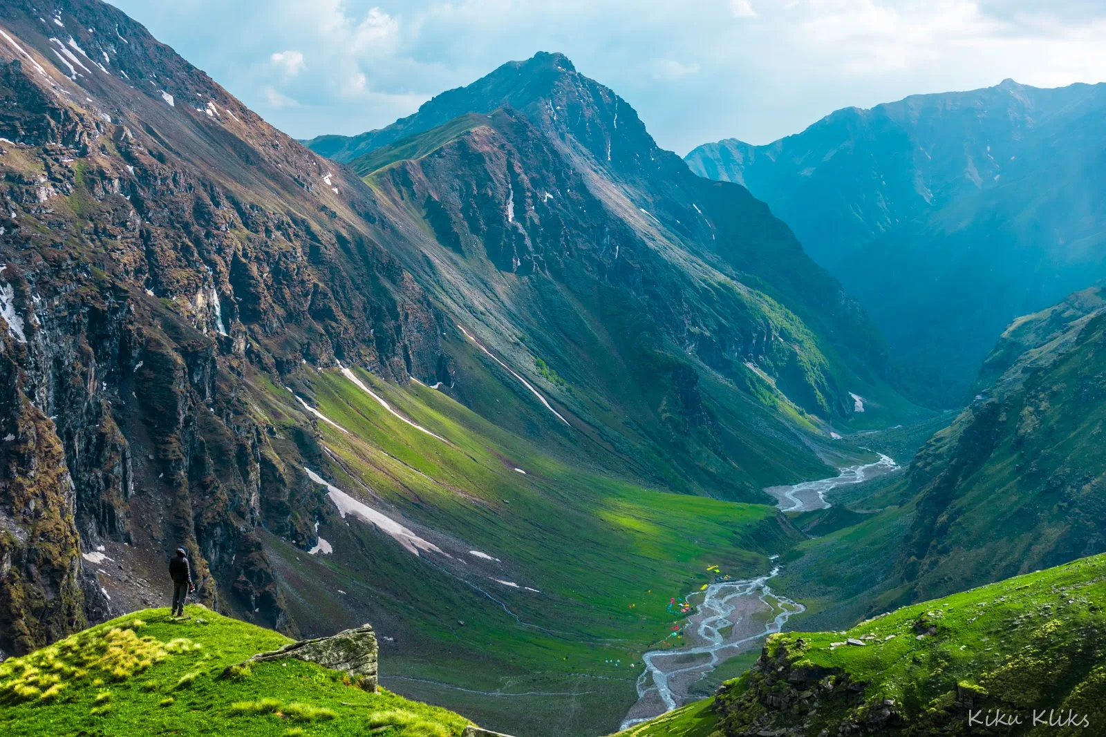
The Rupin Pass Trek is one of the Himalayas' classic crossover expeditions, linking Uttarakhand's Rupin Valley with Himachal Pradesh's Sangla Valley. Crossing Rupin Pass at approximately 15,250 ft, the trek is renowned for its dramatic changes in landscape, diverse mountain villages, waterfalls, alpine meadows, and high mountain terrain.
Trek Highlights
Rupin Waterfall
A magnificent three-stage waterfall tumbling down the mountain, visible from the Dhanderas Thatch meadows.
Jhaka Village
A remarkable village seemingly glued to a vertical cliff face, earning it the title of 'hanging village'.
What permits are required for the Rupin Pass Trek?
You need a Govind Pashu Vihar National Park entry permit and a Forest Department Trekking Permit. Since the trek crosses from Uttarakhand to Himachal Pradesh, permits are checked at the Dhaula forest checkpoint. Ensure you have original government ID and a medical fitness certificate.
How difficult is the Rupin Pass Trek at 15,250 ft?
It is rated as Moderate to Difficult. While the first few days starting from Dhaula (5,100 ft) are moderate, the final push to the 15,250 ft pass involves a grueling near 45-degree ascent through a snow or scree gully.
Which is better: the pre-monsoon (Summer) or post-monsoon (Autumn) season?
Both offer distinct experiences. May/June is famous for massive snow bridges over the Rupin River and an exhilarating snow climb to the pass. September/October offers crystal clear views, golden meadows, and a rocky, scree-filled pass crossing with minimal snow.
Is acclimatization an issue on this trek?
Yes. The trek starts at 5,100 ft and climbs to 15,250 ft over several days. The itinerary naturally aids acclimatization by spreading the ascent over 6 days. You will sleep at high camps like Dhanderas Thatch (11,680 ft) and Upper Waterfall (13,120 ft) before the final push.
Are there river crossings on the Rupin Pass route?
Yes, you will walk alongside and cross the Rupin River multiple times. In summer, you cross over natural snow bridges. In autumn, when snow bridges melt, you may have to wade through freezing water or use improvised wooden bridges near Saruwas Thatch.
Is this a crossover trek?
Yes, it is a classic crossover. You start your trek from Dhaula in the Govind Pashu Vihar National Park (Uttarakhand) and end your trek in Sangla in the Kinnaur district (Himachal Pradesh).
Is there mobile connectivity on the trail?
Connectivity is very poor. You will have network at the base camps like Dhaula and Sewa (faint BSNL), but you will lose all signal for the next 5 days. You regain network (BSNL/Jio) once you descend to Sangla.
Do I need technical mountaineering gear?
Since the peak altitude is 15,250 ft (under 5000m), no technical ice axes, crampons, or ropes are usually required for the trekker. Microspikes and trekking poles are sufficient for the summer snow gully. The operator will carry safety ropes if needed.
Can a beginner do the Rupin Pass trek?
It is not recommended for absolute beginners. Due to the high altitude (15,250 ft) and the steep, continuous descent to Sangla (dropping 4,620 ft in one day), you should have prior experience with at least one high-altitude Himalayan trek.
What is the descent like to Sangla?
The descent from Rupin Pass into Sangla is extremely steep and continuous. Dropping from 15,250 ft down to 8,800 ft puts immense pressure on the knees and toes, requiring the mandatory use of trekking poles.
What permits are required for the Rupin Pass Trek?
You need a Govind Pashu Vihar National Park entry permit and a Forest Department Trekking Permit. Since the trek crosses from Uttarakhand to Himachal Pradesh, permits are checked at the Dhaula forest checkpoint. Ensure you have original government ID and a medical fitness certificate.
How difficult is the Rupin Pass Trek at 15,250 ft?
It is rated as Moderate to Difficult. While the first few days starting from Dhaula (5,100 ft) are moderate, the final push to the 15,250 ft pass involves a grueling near 45-degree ascent through a snow or scree gully.
Which is better: the pre-monsoon (Summer) or post-monsoon (Autumn) season?
Both offer distinct experiences. May/June is famous for massive snow bridges over the Rupin River and an exhilarating snow climb to the pass. September/October offers crystal clear views, golden meadows, and a rocky, scree-filled pass crossing with minimal snow.
Is acclimatization an issue on this trek?
Yes. The trek starts at 5,100 ft and climbs to 15,250 ft over several days. The itinerary naturally aids acclimatization by spreading the ascent over 6 days. You will sleep at high camps like Dhanderas Thatch (11,680 ft) and Upper Waterfall (13,120 ft) before the final push.
Are there river crossings on the Rupin Pass route?
Yes, you will walk alongside and cross the Rupin River multiple times. In summer, you cross over natural snow bridges. In autumn, when snow bridges melt, you may have to wade through freezing water or use improvised wooden bridges near Saruwas Thatch.
Is this a crossover trek?
Yes, it is a classic crossover. You start your trek from Dhaula in the Govind Pashu Vihar National Park (Uttarakhand) and end your trek in Sangla in the Kinnaur district (Himachal Pradesh).
Is there mobile connectivity on the trail?
Connectivity is very poor. You will have network at the base camps like Dhaula and Sewa (faint BSNL), but you will lose all signal for the next 5 days. You regain network (BSNL/Jio) once you descend to Sangla.
Do I need technical mountaineering gear?
Since the peak altitude is 15,250 ft (under 5000m), no technical ice axes, crampons, or ropes are usually required for the trekker. Microspikes and trekking poles are sufficient for the summer snow gully. The operator will carry safety ropes if needed.
Can a beginner do the Rupin Pass trek?
It is not recommended for absolute beginners. Due to the high altitude (15,250 ft) and the steep, continuous descent to Sangla (dropping 4,620 ft in one day), you should have prior experience with at least one high-altitude Himalayan trek.
What is the descent like to Sangla?
The descent from Rupin Pass into Sangla is extremely steep and continuous. Dropping from 15,250 ft down to 8,800 ft puts immense pressure on the knees and toes, requiring the mandatory use of trekking poles.
Are you a local operator?
Join our platform to list your verified packages for this trek.