
Explore
Intelligence
Essential Planning Guide
Ruinsara Tal Trek — Complete Guide (2026)
Vibe & Scenery
The Experience
Introduction
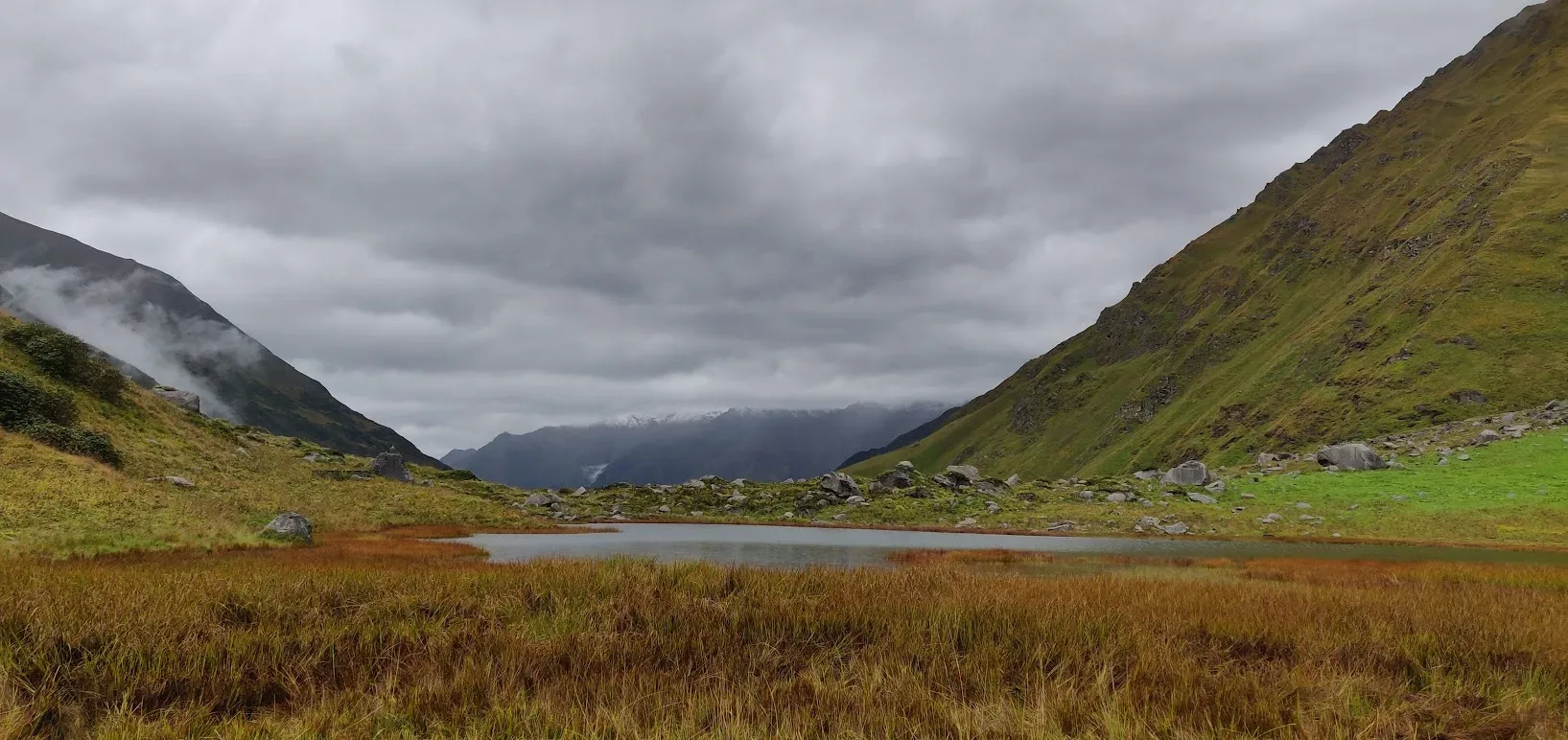
Ruinsara Tal offers everything that makes the Har Ki Dun region famous—but with far fewer trekkers beyond the initial approach. After passing through the traditional villages of Sankri, Osla, and Seema, the trail leaves the main Har Ki Dun route and enters a peaceful valley leading towards the sacred Ruinsara Lake.
Campsites at Devsu Bugyal and Ruinsara Tal are surrounded by towering Himalayan peaks including Swargarohini, Bandarpoonch, and Black Peak (Kalanag). Dense forests, wooden villages, glacial streams, and broad alpine meadows create one of the most varied landscapes in the Garhwal Himalayas.
The route carries both ecological and mythological significance, with local traditions linking the valley to stories from the Mahabharata. Suitable for trekkers with reasonable fitness, Ruinsara Tal combines rich cultural heritage with outstanding mountain scenery while avoiding the crowds found on more popular Himalayan trails.
Quick Facts
Duration
Max Altitude
Difficulty
Best Time
Trek Distance
Trail Atmosphere
Stargazing
Class 1 Dark Sky
Scent Profile
Silence Level
~25 dB
Vertigo Factor
3 / 10
Iconic Spots
Devsu Bugyal
Ruinsara Tal
Environment
Nature & Culture
Flora & Fauna
Flora
Fauna
The Ruinsara Lake is deeply tied to the Mahabharata. It is believed that Yudhishthira, the eldest Pandava, sought the path to heaven (Swargarohini) through this very valley. The lake is considered sacred by the villagers of Osla.
— Local folklore
Spiritual & Cultural Significance
Deeply tied to the Mahabharata legend of the Pandavas' ascent to heaven.
🕐 Shrine Timings: N/A
Temple Protocols
- •Strictly vegetarian zone. Alcohol and meat are banned.
- •Respect the sacred nature of the lake; do not wash clothes or utensils in it.
Technical Details
Challenge & Preparation
Primarily a cumulative fatigue and cardio demand challenge
A capable trekker's route that balances cumulative fatigue and cardio demand.
Personal Readiness
Am I ready?
Planning
Logistics & Trail Intel
Getting There
Route to Base
Drive 10 hours from Dehradun ISBT or Railway Station via Mussoorie, Purola, and Netwar
Base Village
Sankri
6,400 ft
Last ATM
Purola. Do not rely on any ATMs in Sankri.
Nearest Medical Facility
Primary Health Centre (PHC) Purola / District Hospital Uttarkashi
Mobile Signal
Complete dead zone after leaving Sankri.
Water Sources
Water is abundant from glacial streams and the Supin/Ruinsara rivers. Always use purification tablets as mule traffic can contaminate lower streams.
Charging
Zero charging points after Sankri. Carry a 20,000+ mAh power bank.
For Drivers
Road Condition
The highway to Sankri is notorious for sudden roadblocks and poor maintenance near Purola and Netwar.
Purola
Trail Culinary & Diet
Don't miss the Pahadi Rajma Chawal is a staple.
Buy specialized diet items at Dehradun / Mussoorie
The Content & Remote Hub
No DronesDrones are strictly banned in Govind Pashu Vihar National Park. Confiscation is guaranteed.Top Vlog Spots
Video Calls
none
UPI Reliability
3/10
Permits and Regulations
Entry into the Govind Pashu Vihar National Park requires a forest permit, which is obtained at the Netwar checkpoint. A registered local guide is mandatory. The Forest Department strictly enforces a 'Leave No Trace' policy; all plastic wrappers and non-biodegradable waste must be counted at entry and exit. Drones are strictly prohibited inside the National Park without special SDM clearance.
Learn more about how we vet operators and ensure transparency on our why MountRoutes page.
Packing List
Layering & Clothing
- Medium-weight down jacket (temperatures drop to -2°C at the lake)
- Waterproof and windproof hardshell jacket (for valley winds)
- 2 pairs of quick-dry trekking pants (no jeans)
- 2 thermal baselayers (merino wool or synthetic blend)
- Heavy fleece mid-layer
- 4 pairs of moisture-wicking trekking socks
- Waterproof gloves and woolen inner liners
Footwear & Gear
- Waterproof trekking boots with strong ankle support (mandatory for rocky riverbeds)
- Camp sandals or slip-on shoes for evening rest at campsites
- 2 anti-shock trekking poles (crucial for river crossings and descents)
- 30-40L daypack with integrated rain cover
- High-quality sleeping bag rated to -10°C (if camping independently)
Health & Survival
- Headlamp with spare lithium batteries
- UV400 Polarized Sunglasses
- High SPF Sunscreen (50+) and Lip Balm
- Personal First-Aid Kit with Diamox, ORS, and muscle relaxants
- Water purification tablets or Lifestraw (crucial near the lake)
- 2 reusable 1-liter water bottles
Deep Dives
Explore Further
Editor's Notes
Explore In Detail
Day by Day Itinerary
8-day route reaching 12,000ft. Covers 66.0km of varied terrain.
→ See full itinerary with altitude profileDifficulty & Fitness
Rated moderate. The trail is a mix of well-trodden mud paths, steep boulder ascents, and narrow ridges along the Ruinsara river. The section between Devsu Bugyal and Ruinsara Tal requires careful footing over loose rocks.
→ See difficulty breakdown and fitness guideCost & Pricing
Packages range from ₹12,000 – ₹16,000. Inclusions and hidden costs vary by operator tier.
→ See full cost breakdownFrequently Asked Questions
How does Ruinsara Tal compare to Har Ki Dun?
They share the same initial trail from Taluka to Seema. While Har Ki Dun turns left into a wider, highly commercialized valley, Ruinsara turns right into a narrower, steeper, and much more isolated valley leading to the alpine lake.
Is this trek safe for beginners?
It is graded as Moderate. A physically fit beginner can complete it, but the days are long (often 6-7 hours of walking) and the terrain includes boulder hopping and steep forest ascents. Pre-trek cardiovascular training is required.
Can we swim in Ruinsara Tal?
No. The lake is considered highly sacred by the locals of the Tons Valley. Furthermore, it is a glacial lake with freezing temperatures that can induce immediate hypothermia.
Will we see snow on the Ruinsara Tal trek?
If trekking in early May, you will encounter residual snow around the lake and Devsu Bugyal. In autumn (September/October), the trail is generally clear of snow until the very late season.
Do I need Diamox for this trek?
The maximum altitude is 11,480 ft. While severe Acute Mountain Sickness (AMS) is uncommon here, mild symptoms like headaches and nausea can occur. Carrying Diamox as a preventative measure is highly recommended.
Is there mobile network on the trail?
You will have limited BSNL network at Sankri. Once you leave Sankri for Taluka, there is absolutely zero mobile connectivity for the next 6 days.
Are there leeches or heavy mud?
During the monsoon and immediate post-monsoon weeks, the forest sections between Taluka and Seema can be muddy and contain leeches. Proper trekking boots and gaiters mitigate this.
Can we do the Bali Pass from Ruinsara Tal?
Yes. Ruinsara Tal is the final major camp before the aggressive ascent over the Bali Pass (16,200 ft). However, Bali Pass requires a completely different level of mountaineering gear, permits, and fitness.
Still deciding?
Compare routes side-by-side to find the perfect match for your fitness, dates, and budget.
Everything you need to know, in one place. Someone else in your group needs to see this.
Planning Ruinsara Tal Trek?
Get route conditions, operator updates, and season windows before booking.
Don't miss out! Follow us for route updates@mountroutes|LinkedIn
No spam. Only useful trek updates.
Ready to walk this route?
You’ve read the guide, now find the perfect local team to take you there. Compare our verified list of operators.
Compare verified operators