
Explore
Intelligence
Detailed Route
Parang La Trek Itinerary — Day by Day Route & Camps
An epic 8-9 day traverse from the Spiti Valley, over the towering Parang La pass, down through the barren Pare Chu gorge, and finally arriving at the shores of Tso Moriri.
Standard RouteThis is the standard mountain pacing for this trek. Specific operators may add an acclimatization day or alter the starting point. Check individual operator schedules for their exact logistics.
Duration
8 Days
Total Distance
95.0 KM
Max Altitude
18,300 FT
Trek Type
linear
Permits Required Before You Go
Permit Cost
Where to Get
Kaza SDM Office / Leh DC Office
Documents
Original Passport/Aadhar, Medical Fitness Certificate, High Altitude Insurance
Foreign Nationals
Foreigners require a Protected Area Permit (PAP) for both Spiti and the Tso Moriri region. This must be arranged through registered travel agents in advance.
Foreigner Process
Foreigners must apply for a Protected Area Permit (PAP) through a registered agency in Manali/Kaza. Group of minimum 2 foreigners required.
Nearest Embassy Hub
New Delhi
Day by Day Breakdown
Camp Alt
14,000 ft
Day Gain
+1,500 ft
Drive to Kibber & Trek to Dumla
After acclimatizing in Kaza, take a short drive to Kibber. The trek begins with a steep descent into the Parilungbi gorge and a subsequent ascent to the small, green pastures of Dumla.
Key Landmarks
Staying At
Crossing the high-altitude pass bridges two distinct watershed systems, shifting the expedition over the glaciated divide and down into a new river basin.
Field Notes
Use Trekking Poles
Trekking poles are highly recommended to save your knees on the descent.
INFOSlower Progress
Progress will be significantly slower and more taxing on your ankles than trail distance suggests.
Camp Alt
15,250 ft
Day Gain
+1,250 ft
Reach Thaltak
A continuous, demanding ascent out of the Dumla bowl up to the expansive Thaltak meadows. The air thins noticeably here, and pacing is critical.
Key Landmarks
Staying At
Vegetation gives way to barren glacial debris as the route enters the expansive moraine basin and ablation zone of the glaciated upper watershed.
Camp Alt
16,400 ft
Day Gain
+1,150 ft
Reach Bongrojen Base Camp
A long, arduous day navigating through rocky moraines and ascending further into the high mountains. Bongrojen serves as the base camp for Parang La, sitting in a stark, frozen amphitheater.
Key Landmarks
Staying At
Vegetation gives way to barren glacial debris as the route enters the expansive moraine basin and ablation zone of the glaciated upper watershed.
Field Notes
Use Trekking Poles
Trekking poles are highly recommended to save your knees on the descent.
INFOSlower Progress
Progress will be significantly slower and more taxing on your ankles than trail distance suggests.
Camp Alt
16,000 ft
Day Gain
-400 ft
Today's Objective
🏔 Cross Bongrojen To Dak Karzong Via Parang La Pass
The hardest day of the expedition. An alpine start (3:00 AM) is required. The climb is steep and breathless, crossing a heavily crevassed glacier to reach the 18,300 ft pass. The descent into Ladakh is equally harsh, dropping down to the source of the Pare Chu river.
Key Landmarks
Staying At
The valley transitions into a glacial basin. The route follows the river valley. The path breaches the mountain barrier crossing the watershed.
Field Notes
KEY ACTIONRoped Travel
Requires roped glacier travel.
KEY ACTIONStart Early
Start before sunrise to ensure snow bridges remain solid.
KEY ACTIONIce Gear
Crampons and ice axe proficiency required to safely navigate steep, icy inclines.
KEY ACTIONHidden Traps
Hidden rocks under deep snow create severe ankle-twisting traps. Proceed with extreme caution.
Use Trekking Poles
Trekking poles are highly recommended to save your knees on the descent.
Camp Alt
15,500 ft
Day Gain
-500 ft
Reach Datang Yongma
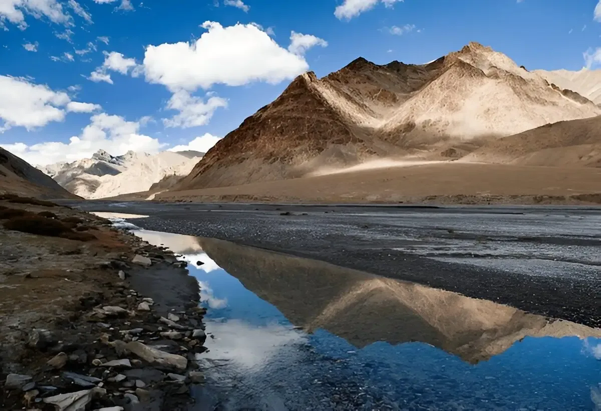
The route flattens out as you enter the vast, barren valleys of the Changthang plateau. The trek follows the meandering Pare Chu river, a bizarre river that flows into Tibet and back into India.
Key Landmarks
Staying At
Vegetation gives way to barren glacial debris as the route enters the expansive moraine basin and ablation zone of the glaciated upper watershed.
Field Notes
Use Trekking Poles
Trekking poles are highly recommended to save your knees on the descent.
INFOSlower Progress
Progress will be significantly slower and more taxing on your ankles than trail distance suggests.
Camp Alt
15,000 ft
Day Gain
-500 ft
Reach Chumik Shilde
A massive, wet day. The trail frequently crisscrosses the wide, freezing Pare Chu river. Trekkers must endure multiple sub-zero stream crossings. The camp at Chumik Shilde marks a return to green pastures.
Key Landmarks
Staying At
Vegetation gives way to barren glacial debris as the route enters the expansive moraine basin and ablation zone of the glaciated upper watershed.
Field Notes
Use Trekking Poles
Trekking poles are highly recommended to save your knees on the descent.
INFOSlower Progress
Progress will be significantly slower and more taxing on your ankles than trail distance suggests.
Camp Alt
14,800 ft
Day Gain
-200 ft
Reach Tso Moriri
A relatively easy, flat walk across the sweeping plains of Rupshu. Suddenly, the massive, sapphire-blue expanse of Tso Moriri reveals itself. Camp is set on the southern tip of the lake at Kiangdam.
Key Landmarks
Staying At
Vegetation gives way to barren glacial debris as the route enters the expansive moraine basin and ablation zone of the glaciated upper watershed.
Camp Alt
15,000 ft
Day Gain
+200 ft
Trek to Korzok
The final, epic day. You will walk 22 km along the entire western shore of Tso Moriri. The colors of the lake shift throughout the day. The trek concludes upon reaching the ancient village of Korzok.
Key Landmarks
Staying At
Vegetation gives way to barren glacial debris as the route enters the expansive moraine basin and ablation zone of the glaciated upper watershed.
Trek Extensions & Add-ons
Korzok to Leh via Tso Kar
+2 DaysInstead of driving straight to Leh, drive via the stunning, salt-crusted Tso Kar lake to complete the ultimate Changthang road trip.
Plan Your Trek:
Ready to book? Compare verified operators for Parang La Trek — transparent pricing, no paid rankings.
Still deciding?
Compare routes side-by-side to find the perfect match for your fitness, dates, and budget.
Day by day, camp by camp. Send this to your group so everyone's on the same page.
Step 4: Cost & Logistics
You understand the route.
Now see what services, permits, and logistics actually cost.
View Cost Breakdown