Parang La Trek — compare operators and pricing

Compare operators for Parang La Trek

LadakhChallenging

Interested in this trek?

We are currently vetting local partners for Parang La Trek to ensure the highest safety standards. Be the first to know when it's open for booking.

Are you a local operator?

Join our platform to list your verified packages for Parang La Trek and reach thousands of trekkers directly.

Apply to join

Found the right operator? Share this list with whoever's coming with you.

About Parang La Trek

8 Days
18,300 FT
Challenging

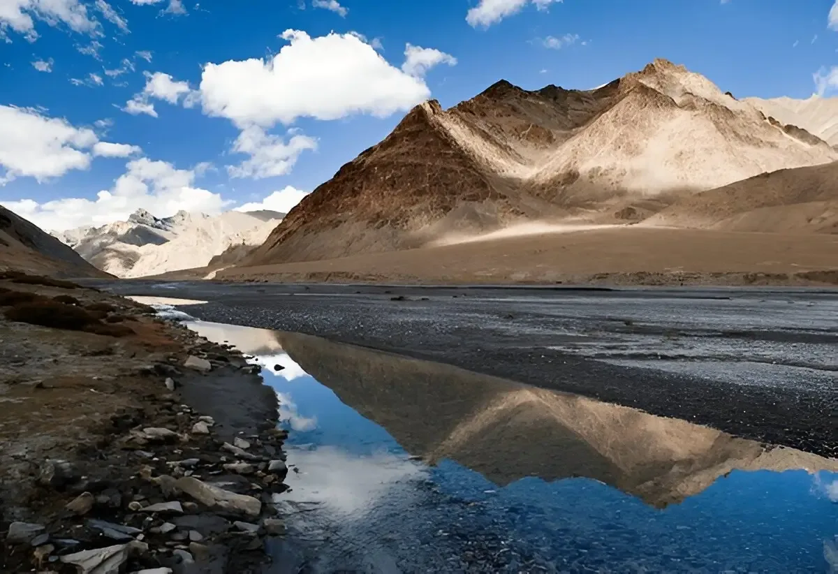
The Parang La Trek is a classic trans-Himalayan expedition linking Spiti Valley in Himachal Pradesh with the Changthang plateau of Ladakh. Crossing the 18,300 ft Parang La and finishing at Tso Moriri, it is among India's finest high-altitude crossover treks for experienced and well-acclimatized hikers.

Trek Highlights

Parang La Summit

An 18,300 ft saddle offering views of the Spiti ranges behind and the vast Tibetan plateau ahead.

Pare Chu Valley

A surreal, sweeping desert valley cut by a braiding, silver river.

Tso Moriri Lake

A massive, high-altitude lake whose water shifts from turquoise to deep navy blue throughout the day.

View Complete Trek Guide

Common Questions

Is the Parang La trek suitable for beginners?
Absolutely not. This is an Expedition Grade trek. It requires multiple days of walking above 15,000 ft, crossing a massive glacier, and surviving sub-zero river crossings. Extensive prior high-altitude trekking experience is mandatory.
How difficult are the river crossings?
The Pare Chu river crossings are one of the most hazardous parts of the trek. You will have to cross the freezing, fast-flowing river multiple times. Crossings must be done in the early morning before glacial melt swells the river.
Do I need technical mountaineering gear?
While it is technically a trek, the approach and descent of the Parang La pass involve crossing a heavily crevassed glacier. Microspikes and ropes may be required depending on the snow conditions and the operator's safety protocol.
How is the AMS risk on this trek?
Extreme. You start at Kibber (14,200 ft), cross a pass at 18,300 ft, and spend an entire week above 15,000 ft. A strict acclimatization schedule in Kaza and Kibber prior to starting is non-negotiable.
Where does the trek end?
The trek concludes at Korzok village, on the shores of Tso Moriri in Ladakh. From Korzok, you must arrange a 6-7 hour drive to Leh to fly or drive out.
Is there any mobile connectivity?
Once you leave Kibber, you will be entirely off the grid for 7-8 days until you reach Korzok, where a BSNL network sporadically works. Operators must carry satellite phones.
What is the best time to do the Parang La trek?
The only viable window is from late July to early September. June has too much snow on the pass, and by late September, the temperatures plummet to lethal levels.
What happens in a medical emergency?
Evacuation is incredibly difficult. For the first few days, returning to Kaza is the only option. Once over the pass, you must either rely on a satellite phone for a military helicopter rescue or ride out on a horse to the nearest roadhead in Ladakh.
Is the Parang La trek suitable for beginners?
Absolutely not. This is an Expedition Grade trek. It requires multiple days of walking above 15,000 ft, crossing a massive glacier, and surviving sub-zero river crossings. Extensive prior high-altitude trekking experience is mandatory.
How difficult are the river crossings?
The Pare Chu river crossings are one of the most hazardous parts of the trek. You will have to cross the freezing, fast-flowing river multiple times. Crossings must be done in the early morning before glacial melt swells the river.
Do I need technical mountaineering gear?
While it is technically a trek, the approach and descent of the Parang La pass involve crossing a heavily crevassed glacier. Microspikes and ropes may be required depending on the snow conditions and the operator's safety protocol.
How is the AMS risk on this trek?
Extreme. You start at Kibber (14,200 ft), cross a pass at 18,300 ft, and spend an entire week above 15,000 ft. A strict acclimatization schedule in Kaza and Kibber prior to starting is non-negotiable.
Where does the trek end?
The trek concludes at Korzok village, on the shores of Tso Moriri in Ladakh. From Korzok, you must arrange a 6-7 hour drive to Leh to fly or drive out.
Is there any mobile connectivity?
Once you leave Kibber, you will be entirely off the grid for 7-8 days until you reach Korzok, where a BSNL network sporadically works. Operators must carry satellite phones.
What is the best time to do the Parang La trek?
The only viable window is from late July to early September. June has too much snow on the pass, and by late September, the temperatures plummet to lethal levels.
What happens in a medical emergency?
Evacuation is incredibly difficult. For the first few days, returning to Kaza is the only option. Once over the pass, you must either rely on a satellite phone for a military helicopter rescue or ride out on a horse to the nearest roadhead in Ladakh.

Are you a local operator?

Join our platform to list your verified packages for this trek.

Apply to join
MountRoutes Dispatch

Planning Parang La Trek?

Get route conditions, operator updates, and season windows before booking.

Don't miss out! Follow us for route updates@mountroutes|LinkedIn

No spam. Only useful trek updates.

Explore Collections

Not sure where to go next?

View all