
Explore
Intelligence
Essential Planning Guide
Parang La Trek — Complete Guide (2026)
Vibe & Scenery
The Experience
Introduction
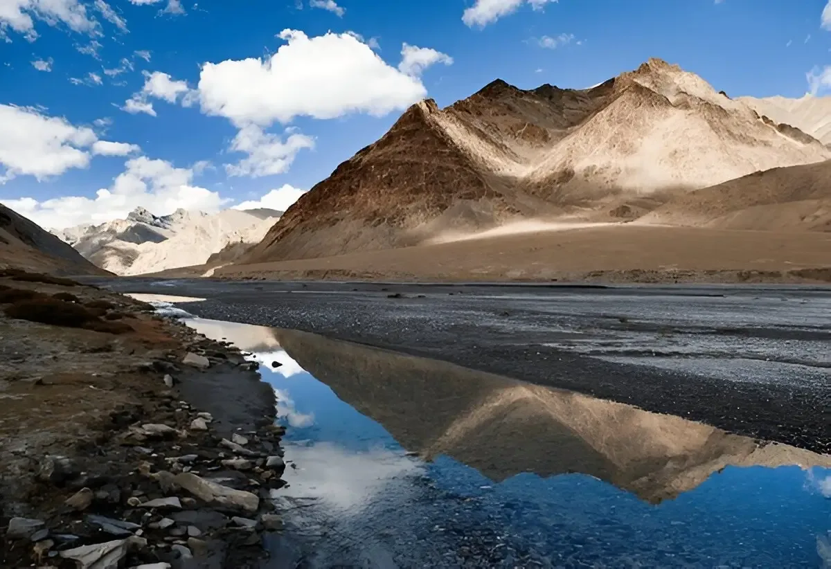
Following an ancient trade route between Spiti and Ladakh, the Parang La Trek is one of the Himalayas' great high-altitude traverses. Beginning from Kibber, the trail gradually climbs across the cold desert landscapes of Spiti before crossing the glaciated Parang La at approximately 18,300 ft.
The descent follows the braided channels of the Pare Chu River through vast, isolated valleys before reaching the spectacular shores of Tso Moriri, one of Ladakh's highest and most beautiful lakes.
Continuous travel above 15,000 ft, multiple river crossings, and complete self-sufficiency over several days make Parang La suitable only for experienced trekkers with excellent acclimatization.
Quick Facts
Duration
Max Altitude
Difficulty
Best Time
Trek Distance
Trail Atmosphere
Stargazing
Class 1 Dark Sky
Scent Profile
Silence Level
~10 dB
Vertigo Factor
6 / 10
Iconic Spots
Parang La Summit
Pare Chu Valley
Tso Moriri Lake
Environment
Nature & Culture
Flora & Fauna
Flora
Fauna
Parang La was a bustling trade route connecting the Spitians and the Changpa nomads of Tibet/Ladakh. They traded barley from Spiti for salt and wool from Tibet.
— Local folklore
Spiritual & Cultural Significance
The trail is dotted with ancient mani walls and chortens. Korzok Monastery at the end is a highly revered 300-year-old Tibetan Buddhist gompa.
🕐 Shrine Timings: N/A
Temple Protocols
- •Walk clockwise around chortens and mani walls.
Festivals & Dates
Technical Details
Challenge & Preparation
Primarily a cardio demand and altitude exposure challenge
A demanding expedition with extreme cardio demand and altitude exposure.
Personal Readiness
Am I ready?
Planning
Logistics & Trail Intel
Getting There
Route to Base
Fly to Kullu (Bhuntar) or travel to Manali
From Manali, take the Atal Tunnel and drive through Spiti via Kunzum Pass to reach Kaza (10-12 hours)
Kibber is a 45-minute drive from Kaza
Base Village
Kibber
14,200 ft
Last ATM
Kaza
Nearest Medical Facility
Kaza District Hospital (Start), Leh Sonam Norboo Hospital (End).
Mobile Signal
Zero signal between Kibber and Korzok.
Water Sources
Rivers and glacial streams. The Pare Chu water is highly silted; heavy filtration and purification tablets are mandatory to prevent giardia.
Charging
Total blackout from Kibber to Korzok.
For Drivers
Road Condition
Manali to Kaza is a brutal, jarring 12-hour drive over Kunzum Pass. Ensure you have buffer days for road closures.
Kaza
Trail Culinary & Diet
Don't miss the Thukpa
Buy specialized diet items at Kaza
The Content & Remote Hub
No DronesDrones are strictly prohibited near Tso Moriri and the Ladakh border regions without explicit military clearance.Top Vlog Spots
Video Calls
low
Est. 2 Mbps
UPI Reliability
2/10
Base WiFi Available
Permits and Regulations
An Inner Line Permit (ILP) is required for the Spiti side (obtainable in Kaza). Upon reaching Korzok, Ladakh wildlife and environmental permits are required. Foreigners require a Protected Area Permit (PAP).
Learn more about how we vet operators and ensure transparency on our why MountRoutes page.
Packing List
Core Clothing Layers
- Heavyweight thermal base layers (top and bottom, x2)
- Expedition-grade Down jacket (rated to -15°C)
- High-quality Gore-Tex waterproof hard-shell jacket and pants
- Thick fleece mid-layers (x2)
- Trekking pants (x3, robust against scree)
Footwear & Protection
- Heavy-duty, high-ankle waterproof trekking boots (Vibram sole)
- Water sandals or Crocs (MANDATORY for deep, freezing river crossings)
- Merino wool trekking socks (x5 pairs)
- Waterproof gaiters for snow and river protection
Head & Hands
- Heavy fleece beanie and balaclava
- Category 4 UV-protection glacier glasses (snow blindness is a major risk)
- Sun-hoodie and wide-brimmed hat
- Waterproof insulated outer gloves and lightweight inner liners
Gear & Accessories
- 60-70 litre expedition backpack
- Trekking poles with snow baskets
- High-lumen headlamp with spare lithium batteries
- Water purification tablets (essential for the Pare Chu river)
- Comprehensive medical kit containing Diamox and blister care
- High-calorie trail mix (nuts, energy bars, chocolates)
Deep Dives
Explore Further
Editor's Notes
Explore In Detail
Day by Day Itinerary
8-day route reaching 18,300ft. Covers 95.0km of varied terrain.
→ See full itinerary with altitude profileDifficulty & Fitness
Rated challenging. The trek is a masterclass in extreme environments: scree-filled gorges in Spiti, heavily crevassed glaciers at 18,300 ft, freezing riverbeds, and high-altitude sandy plains in Ladakh.
→ See difficulty breakdown and fitness guideCost & Pricing
Packages range from 35,000 - 50,000 INR. Inclusions and hidden costs vary by operator tier.
→ See full cost breakdownFrequently Asked Questions
Is the Parang La trek suitable for beginners?
Absolutely not. This is an Expedition Grade trek. It requires multiple days of walking above 15,000 ft, crossing a massive glacier, and surviving sub-zero river crossings. Extensive prior high-altitude trekking experience is mandatory.
How difficult are the river crossings?
The Pare Chu river crossings are one of the most hazardous parts of the trek. You will have to cross the freezing, fast-flowing river multiple times. Crossings must be done in the early morning before glacial melt swells the river.
Do I need technical mountaineering gear?
While it is technically a trek, the approach and descent of the Parang La pass involve crossing a heavily crevassed glacier. Microspikes and ropes may be required depending on the snow conditions and the operator's safety protocol.
How is the AMS risk on this trek?
Extreme. You start at Kibber (14,200 ft), cross a pass at 18,300 ft, and spend an entire week above 15,000 ft. A strict acclimatization schedule in Kaza and Kibber prior to starting is non-negotiable.
Where does the trek end?
The trek concludes at Korzok village, on the shores of Tso Moriri in Ladakh. From Korzok, you must arrange a 6-7 hour drive to Leh to fly or drive out.
Is there any mobile connectivity?
Once you leave Kibber, you will be entirely off the grid for 7-8 days until you reach Korzok, where a BSNL network sporadically works. Operators must carry satellite phones.
What is the best time to do the Parang La trek?
The only viable window is from late July to early September. June has too much snow on the pass, and by late September, the temperatures plummet to lethal levels.
What happens in a medical emergency?
Evacuation is incredibly difficult. For the first few days, returning to Kaza is the only option. Once over the pass, you must either rely on a satellite phone for a military helicopter rescue or ride out on a horse to the nearest roadhead in Ladakh.
Still deciding?
Compare routes side-by-side to find the perfect match for your fitness, dates, and budget.
Everything you need to know, in one place. Someone else in your group needs to see this.
Planning Parang La Trek?
Get route conditions, operator updates, and season windows before booking.
Don't miss out! Follow us for route updates@mountroutes|LinkedIn
No spam. Only useful trek updates.
Ready to walk this route?
You’ve read the guide, now find the perfect local team to take you there. Compare our verified list of operators.
Compare verified operators