
Explore
Intelligence
Detailed Route
Nubra Valley Trek Itinerary — Day by Day Route & Camps
A 5-day, 59km wilderness traverse starting from the barren Indus Valley at Phyang, crossing the mighty Lasermo La, and descending into the lush meadows and sand dunes of the Nubra Valley.
Standard RouteThis is the standard mountain pacing for this trek. Specific operators may add an acclimatization day or alter the starting point. Check individual operator schedules for their exact logistics.
Duration
5 Days
Total Distance
59.8 KM
Max Altitude
17,841 FT
Trek Type
linear
Permits Required Before You Go
Permit Cost
Where to Get
DC Office, Leh or online via LAHDC portal
Documents
Aadhar Card / Passport, Passport Photos
Foreign Nationals
Foreigners must apply through a registered local agency in groups of 2 or more.
Foreigner Process
Protected Area Permit (PAP) required for Nubra Valley. Must be processed by a local agent in groups of 2+.
Nearest Embassy Hub
New Delhi
Day by Day Breakdown
Camp Alt
14,700 ft
Day Gain
+3,200 ft
Drive Leh to Phyang and Trek to Phyang Phu
After driving the short distance to Phyang, the trek begins behind the famous Phyang Monastery. The trail follows a gorge, steadily ascending into a vast, open valley used as summer pastures (Phu) by local villagers. The altitude gain is significant, making pacing critical.
Key Landmarks
Staying At
Vegetation gives way to barren glacial debris as the route enters the expansive moraine basin and ablation zone of the glaciated upper watershed.
Camp Alt
15,800 ft
Day Gain
+1,100 ft
Trek from Phyang Phu to South Base Camp
A very short but physically demanding day designed specifically for acclimatization. The trail leaves the grassy pastures and enters the moraine and rocky terrain at the foot of Lasermo La. The afternoon is spent resting and hydrating in preparation for the pass crossing.
Key Landmarks
Staying At
Vegetation gives way to barren glacial debris as the route enters the expansive moraine basin and ablation zone of the glaciated upper watershed.
Field Notes
Use Trekking Poles
Trekking poles are highly recommended to save your knees on the descent.
INFOSlower Progress
Progress will be significantly slower and more taxing on your ankles than trail distance suggests.
Camp Alt
15,200 ft
Day Gain
-600 ft
Today's Objective
🏔 Cross Cross Lasermo La To North Base Camp North Base Camp
The hardest and most spectacular day. Starting before dawn, you face a ascent over loose scree and possibly snow to reach Lasermo La. At the summit, the sweeping views of the Karakoram are breathtaking. The descent involves navigating a small glaciated section before dropping down into the Nubra side valley.
Key Landmarks
Staying At
The route crosses the pass crest at Lasermo La, dropping into the Nubra valley basin.
Field Notes
Use Trekking Poles
Trekking poles are highly recommended to save your knees on the descent.
INFOSlower Progress
Progress will be significantly slower and more taxing on your ankles than trail distance suggests.
Camp Alt
13,150 ft
Day Gain
-2,050 ft
Trek North Base Camp to Hunder Dok
A long descent day. The barren landscape gradually gives way to stunningly beautiful alpine meadows and grazing grounds. You will have to cross several freezing glacial streams. The camp at Hunder Dok is set in a lush, green valley, a stark contrast to the previous days.
Key Landmarks
Staying At
The rocky alpine basin descends down a steep gorge toward the Hunder Dok settlement.
Field Notes
KEY ACTIONRiver Crossings
Plan to cross early in the day before snowmelt swells the water levels. Unclip backpack waist belts before crossing.
Camp Alt
10,300 ft
Day Gain
-2,850 ft
Trek Hunder Dok to Hunder Village
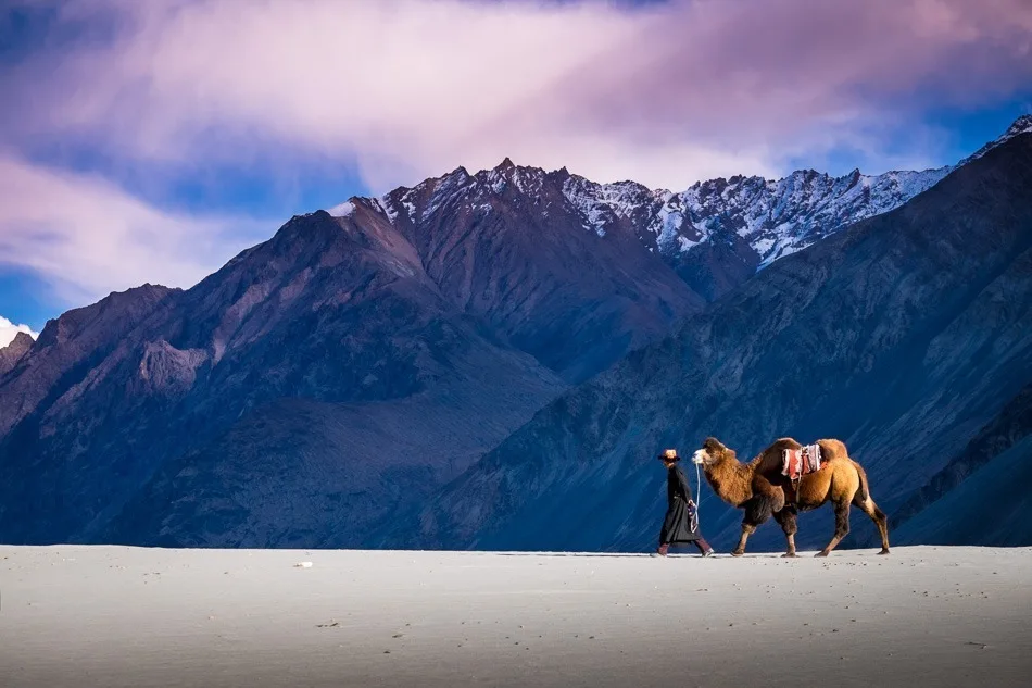
The final leg follows the river down a dramatic, narrow gorge. Suddenly, the gorge opens up to reveal the vast expanse of the Nubra Valley, the Shyok River, and the famous silver sand dunes of Hunder. The expedition concludes here.
Key Landmarks
Staying At
The gorge trail widens and descends into the broad desert basin of Hunder Village.
Field Notes
KEY ACTIONRiver Crossings
Plan to cross early in the day before snowmelt swells the water levels. Unclip backpack waist belts before crossing.
Trek Extensions & Add-ons
Turtuk Village Excursion
+2 DaysAfter arriving in Hunder, extend your trip by driving to Turtuk, a stunning Balti village near the Line of Control, known for its unique culture and apricots.
Plan Your Trek:
Ready to book? Compare verified operators for Nubra Valley Trek — transparent pricing, no paid rankings.
Still deciding?
Compare routes side-by-side to find the perfect match for your fitness, dates, and budget.
Day by day, camp by camp. Send this to your group so everyone's on the same page.
Step 4: Cost & Logistics
You understand the route.
Now see what services, permits, and logistics actually cost.
View Cost Breakdown