
Explore
Intelligence
Essential Planning Guide
Nubra Valley Trek — Complete Guide (2026)
Vibe & Scenery
The Experience
Introduction
The Phyang to Hunder traverse is one of Ladakh's classic high-altitude expeditions, connecting the Indus Valley with Nubra across the formidable Lasermo La Pass. For centuries, this route formed part of the network of caravan trails linking remote Himalayan settlements.
The trek climbs steadily from Phyang through isolated valleys before reaching Lasermo La at approximately 17,841 ft, where panoramic views extend across the Karakoram, Ladakh, and Zanskar ranges. Beyond the pass, the landscape gradually transforms as alpine valleys descend towards the famous sand dunes and oasis villages of Hunder.
Extreme altitude defines this expedition far more than technical difficulty. Long days, thin air, glacial terrain, and complete remoteness demand careful acclimatization and strong endurance. For experienced trekkers, it remains one of Ladakh's most rewarding mountain crossings.
Quick Facts
Duration
Max Altitude
Difficulty
Best Time
Trek Distance
Trail Atmosphere
Stargazing
Class 1 Dark Sky
Scent Profile
Silence Level
~15 dB
Vertigo Factor
5 / 10
Iconic Spots
Lasermo La Summit
Hunder Sand Dunes
Environment
Nature & Culture
Flora & Fauna
Flora
Fauna
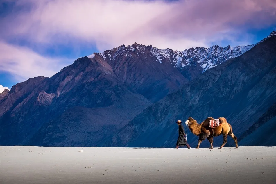
The route was historically used by Silk Road traders. The double-humped Bactrian camels found in Hunder today are descendants of the animals abandoned by traders centuries ago.
— Local folklore
Spiritual & Cultural Significance
The trail is an ancient trade route. You will pass Buddhist stupas and Mane walls.
🕐 Shrine Timings: Phyang Monastery opens early morning.
Temple Protocols
- •Always walk to the left (clockwise) of Mane walls and Stupas.
- •Dress modestly when visiting monasteries.
Festivals & Dates
Technical Details
Challenge & Preparation
Primarily a cardio demand and altitude exposure challenge
A capable trekker's route dominated by extreme cardio demand.
Personal Readiness
Am I ready?
Planning
Logistics & Trail Intel
Getting There
Route to Base
Fly directly to Kushok Bakula Rimpochee Airport in Leh
Road trips via Manali or Srinagar take 2 days and are subject to pass closures
Base Village
Leh
11,500 ft
Last ATM
Leh
Nearest Medical Facility
SNM Hospital in Leh. Basic clinic in Diskit (near Hunder).
Mobile Signal
None.
Water Sources
Glacial streams are frequent but must be purified due to heavy silt and animal grazing upstream.
Charging
None. Rely on high-capacity power banks.
For Drivers
Road Condition
The drive from Leh to Phyang is short and on good roads. The return from Hunder to Leh involves crossing Khardung La, which can be rough.
Leh
Trail Culinary & Diet
Don't miss the Thukpa and Momo in Hunder.
Buy specialized diet items at Leh
The Content & Remote Hub
No DronesDrones are strictly banned in Ladakh due to its status as a highly sensitive border region.Top Vlog Spots
Video Calls
none
Est. 5 Mbps
UPI Reliability
4/10
Base WiFi Available
Permits and Regulations
Indian nationals require an Inner Line Permit (ILP). Foreigners require a Protected Area Permit (PAP) to enter the Nubra Valley, which must be arranged through a registered travel agent in Leh. Strict Leave No Trace principles apply; all non-biodegradable waste must be packed out to Leh.
Learn more about how we vet operators and ensure transparency on our why MountRoutes page.
Packing List
Clothing & Outerwear
- Expedition-grade down jacket (-15°C rating)
- Gore-Tex windproof/waterproof hardshell jacket and pants
- Quick-dry, abrasion-resistant trekking pants
- Merino wool baselayers (2 sets, top and bottom)
- Heavy fleece mid-layers
- Balaclava and UV-protective neck gaiter (Buff) for dust
- Waterproof alpine gloves and thermal liner gloves
Footwear
- High-ankle, stiff-soled waterproof mountaineering/trekking boots
- Camp shoes (sturdy sandals or sneakers)
- Heavy woolen trekking socks (4 pairs)
- Moisture-wicking liner socks
- Gaiters (essential for scree and snow at Lasermo La)
Gear & Accessories
- 60-70L expedition backpack with heavy-duty rain cover
- Sleeping bag rated for -15°C comfort
- Anti-shock trekking poles (mandatory for steep descents)
- High-lumen headlamp with spare lithium batteries
- Category 4 UV protection sunglasses (glacier glasses)
- Insulated Nalgene water bottles (2L capacity)
Health & Hygiene
- Comprehensive Altitude First Aid Kit (Diamox, Dexamethasone)
- High SPF (50+) sunscreen and zinc oxide lip balm
- Water purification tablets or mechanical filter
- Biodegradable wet wipes and hand sanitizer
- Personal oximeter
Deep Dives
Explore Further
Editor's Notes
Explore In Detail
Day by Day Itinerary
5-day route reaching 17,841ft. Covers 59.8km of varied terrain.
→ See full itinerary with altitude profileDifficulty & Fitness
Rated moderate. The trail transitions from dry, dusty paths to steep, loose scree, glaciated snow fields on the pass, and multiple freezing river crossings on the descent.
→ See difficulty breakdown and fitness guideCost & Pricing
Packages range from ₹28,000 - ₹45,000. Inclusions and hidden costs vary by operator tier.
→ See full cost breakdownFrequently Asked Questions
How difficult is the Lasermo La pass crossing?
It is highly challenging. Lasermo La sits at nearly 18,000 ft. The ascent from the South Base involves steep, loose scree, and the descent often requires navigating a small glacier or snowfield. The thin air makes every step exhausting.
Do I need to acclimatize before this trek?
Absolutely mandatory. You must spend a minimum of two to three full days in Leh (11,500 ft) doing light walks before attempting this trek. Moving directly to the 13,000+ ft camps without acclimatization invites severe Acute Mountain Sickness (AMS).
Are there river crossings on this route?
Yes. The descent from the North Base towards Hunder Dok involves crossing glacial melt streams. These must be crossed early in the morning; by afternoon, they swell dangerously with glacial meltwater.
Is this a teahouse trek?
No. This is a pure wilderness expedition. There are no teahouses or permanent settlements between Phyang and Hunder Dok. You must be fully self-sufficient with tents, food, and a dedicated crew/ponies.
Will I see snow on this trek?
Yes, regardless of the month, you are highly likely to encounter snow and ice at the top of Lasermo La. Early season (June) trekkers will face significant snowpack on the pass.
Is there mobile connectivity?
You will have a signal at Phyang (start) and Hunder (end). During the 4 days in the middle of the trek, there is absolutely zero connectivity.
Can I do this without a guide?
No. The route over the pass can be obscured by snow, and the trails in the vast valleys are easily lost. Pack ponies and a local Ladakhi guide who knows the specific terrain and river crossings are essential for survival.
What kind of wildlife might I see?
The high valleys are home to Blue Sheep (Bharal), Marmots, Golden Eagles, and occasionally the elusive Snow Leopard or Tibetan Wolf.
Still deciding?
Compare routes side-by-side to find the perfect match for your fitness, dates, and budget.
Everything you need to know, in one place. Someone else in your group needs to see this.
Planning Nubra Valley Trek?
Get route conditions, operator updates, and season windows before booking.
Don't miss out! Follow us for route updates@mountroutes|LinkedIn
No spam. Only useful trek updates.
Ready to walk this route?
You’ve read the guide, now find the perfect local team to take you there. Compare our verified list of operators.
Compare verified operators