Detailed Route
Nanda Devi East Base Camp Trek Itinerary — Day by Day Route & Camps
Standard RouteThis is the standard mountain pacing for this trek. Specific operators may add an acclimatization day or alter the starting point. Check individual operator schedules for their exact logistics.
Duration
10 Days
Total Distance
103 KM
Max Altitude
13,615 FT
Trek Type
linear
Permits Required Before You Go
Permit Cost
Where to Get
SDM Office Munsiyari
Documents
Aadhar Card, 2 Passport Photos, Medical Auto-declaration
Foreign Nationals
Extremely difficult. Requires MHA clearance out of Delhi. Denials are common if border relations are tense.
Foreigner Process
Highly complex. Requires inner-line clearance filed months in advance.
Nearest Embassy Hub
New Delhi
Day by Day Breakdown
Arrive in Munsiyari / Permit Acquisition
An exceptionally long, punishing drive from the plains via Almora to Munsiyari. This day is reserved for travel and completing the intricate Inner Line Permit paperwork at the SDM office.
Key Landmarks
Staying At
Drive to Dhapa, Trek to Lilam
A short drive to the roadhead at Dhapa/Chilamdar. The trek starts with a steep, hot descent into the Gori Ganga valley to reach the village of Lilam. The climate here is surprisingly tropical.
Key Landmarks
Staying At
Trek Lilam to Bugdiyar
The valley narrows violently. You walk on narrow rock-cut sections above the Gori Ganga. Reach Bugdiyar and register at your first high-altitude ITBP camp.
Key Landmarks
Staying At
Trek Bugdiyar to Martoli
A grueling uphill day breaking through the gorge. The trees vanish entirely into alpine desert. Martoli is an incredibly atmospheric, partially abandoned historic trading village on a high plateau. The first distant peaks of Nanda Devi become visible.
Key Landmarks
Staying At
Trek Martoli to Ganghar
Leave the main Milam route and branch into the Lawan valley towards Nanda Devi. The trail descends slightly through beautiful alpine meadows. Ganghar is a tiny, ancient settlement facing the massive peaks.
Key Landmarks
Staying At
Trek Ganghar to Pachhu (Base Camp)
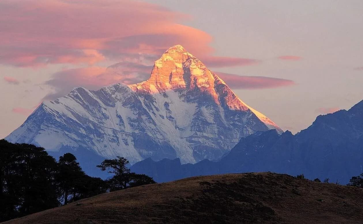
The apex day. Ascend a steady, oxygen-deprived trail winding up the moraine. You suddenly arrive at the Pachhu meadows directly beneath the staggering, vertical 24,000 ft eastern wall of Nanda Devi. The scale of the east face dominates the entire upper valley.
Key Landmarks
Staying At
Explore Base Camp and Descend to Ganghar / Martoli
Wake at 4:30 AM to watch the first light ignite the ice walls of Nanda Devi. After breakfast, pack up and begin the long process of retracing your route back down the valley to Ganghar.
Key Landmarks
Staying At
Trek Ganghar to Bugdiyar
A massive descent knocking out two previous days of hiking in one. You drop steeply off the high plateau back into the claustrophobic Gori Ganga rock gorge.
Key Landmarks
Staying At
Trek Bugdiyar to Dhapa, Drive to Munsiyari
Follow the raging river back down to Lilam, climb out of the valley basin to the roadhead at Dhapa, and take your waiting jeeps the final stretch back up to Munsiyari for a hot shower.
Key Landmarks
Staying At
Drive Munsiyari to Kathgodam
The grueling final driving day, navigating 280km of winding roads back to the railhead in the plains, concluding the 10-day expedition.
Key Landmarks
Trek Extensions & Add-ons
Milam Glacier Intercept
+2 DaysAt Martoli, continue straight up the main valley to visit the massive Milam Glacier before returning and turning toward base camp.
Also on this trek
Ready to book? Compare verified operators for Nanda Devi East Base Camp Trek — transparent pricing, no paid rankings.
Still deciding?
Compare routes side-by-side to find the perfect match for your fitness, dates, and budget.
Day by day, camp by camp. Send this to your group so everyone's on the same page.
Love this itinerary?
Find operators who follow this exact route with verified acclimatization days.
Find matching operators