Detailed Route
Mukteshwar Binsar Connect Trek Itinerary — Day by Day Route & Camps
A 5-day immersive expedition traversing diverse Himalayan landscapes and alpine altitudes.
Standard RouteThis is the standard mountain pacing for this trek. Specific operators may add an acclimatization day or alter the starting point. Check individual operator schedules for their exact logistics.
Duration
5 Days
Total Distance
48 KM
Max Altitude
8,100 FT
Trek Type
linear
Day by Day Breakdown
Arrive in Mukteshwar & Explore Colonial Ridge
Drive from Kathgodam (3 hrs). Check into a heritage lodge. Spend the evening exploring the cliffside ''Chauli-ki-Jaali'', known for its vertical rock faces and panoramic views of the Almora valley. Visit the 350-year-old Shiva temple at the highest point of the ridge.
Key Landmarks
Reach Peora
A gradual descent from the high ridges into the ''Fruit Bowl'' of Kumaon. Walk through terraced fields of potatoes and beans. Peora is famous for its dak bungalow and heritage homestays. The valley views here are intimate and serene.
Key Landmarks
Reach Dhaulchhina
Crossing the valley floor and rising toward the Dhaulchhina ridge. This section is rich in rural Kumaoni culture. You''ll interact with farmers and see traditional stone-roofed houses. Dhaulchhina offers spectacular views of the Almora valley lights at night.
Key Landmarks
Reach Binsar Sanctuary
The most beautiful trekking day. Enter the Binsar Wildlife Sanctuary and climb through dense forests of oak and rhododendron. The air turns cold and the forest is eerily silent, save for bird calls. Reach the sanctuary rest house area or a forest lodge.
Key Landmarks
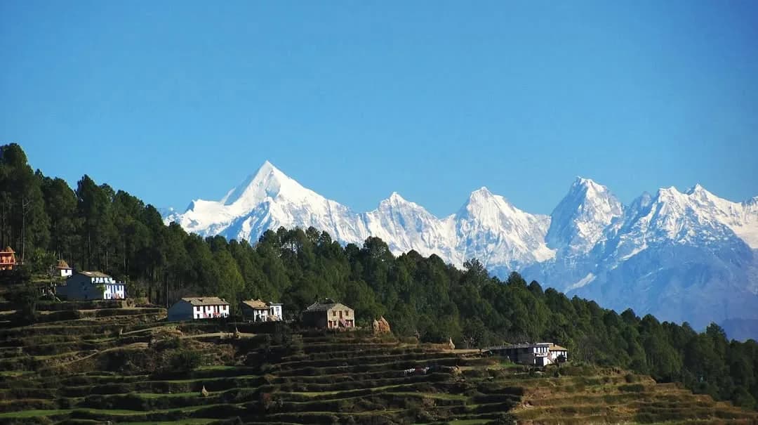
Visit Zero Point, Trek to Binsar Ridge & Drive to Kathgodam
A morning hike to ''Zero Point'', the highest point in the sanctuary. On a clear day, the entire range from Kedarnath to Nanda Devi to Panchachuli is visible in a single panoramic arc. Drive back to Kathgodam in the afternoon.
Key Landmarks
Trek Extensions & Add-ons
Also on this trek
Ready to book? Compare verified operators for Mukteshwar Binsar Connect Trek — transparent pricing, no paid rankings.
Still deciding?
Compare routes side-by-side to find the perfect match for your fitness, dates, and budget.
Day by day, camp by camp. Send this to your group so everyone's on the same page.
Love this itinerary?
Find operators who follow this exact route with verified acclimatization days.
Find matching operators