
Explore
Intelligence
Detailed Route
Miyar Valley Trek Itinerary — Day by Day Route & Camps
A 7-day remote expedition driving from Manali to the edges of Zanskar, hiking through endless meadows, and exploring a massive glacier snout.
Standard RouteThis is the standard mountain pacing for this trek. Specific operators may add an acclimatization day or alter the starting point. Check individual operator schedules for their exact logistics.
Duration
7 Days
Total Distance
70.0 KM
Max Altitude
14,000 FT
Trek Type
circuit
Permits Required Before You Go
Permit Cost
Where to Get
Udaipur Forest Office / Police Post.
Documents
Aadhar Card / Passport, Passport size photos, Medical Fitness Certificate
Foreign Nationals
Foreigners require standard passport registration at Udaipur. Inner line permit not needed unless attempting to cross Kang La into Zanskar.
Foreigner Process
Standard passport/visa registration at Udaipur police check-post. Inner Line Permit only required if crossing into Zanskar via Kang La.
Nearest Embassy Hub
New Delhi
Day by Day Breakdown
Camp Alt
11,100 ft
Day Gain
+4,400 ft
Drive from Manali to Shukto / Khanjar via Atal Tunnel
A spectacular drive crossing from the lush Kullu valley into the arid Lahaul via the Atal Tunnel. The road from Udaipur to Shukto is narrow, winding, and rugged. Safety: Drink plenty of water as the altitude gain from Manali to Shukto is rapid.
Key Landmarks
Staying At
The mountain highway crosses the Pir Panjal divide, entering the rugged Miyar valley gorge.
Camp Alt
12,100 ft
Day Gain
+1,000 ft
Trek from Shukto to Yolling / Thanpattan
Walk through Khanjar, the last inhabited village in the valley. The trail is gentle, winding through blooming potato and barley fields before opening up into vast grazing meadows. Technical: Mostly flat walking with minimal gradient. Excellent acclimatization day.
Key Landmarks
Staying At
The Shukto roadhead emerges onto a desert trail following the Miyar river basin.
Field Notes
KEY ACTIONRiver Crossings
Plan to cross early in the day before snowmelt swells the water levels. Unclip backpack waist belts before crossing.
Camp Alt
12,800 ft
Day Gain
+700 ft
Trek from Yolling to Zardong
The valley begins to widen incredibly, resembling the flat expanses of Yosemite. You will negotiate several glacial streams. Technical: Watch your footing on the boulder sections. Stream crossings require unlacing boots and wading through freezing water.
Key Landmarks
Staying At
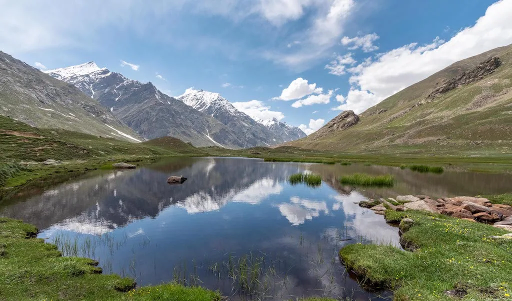
Tree line disappears as the valley broadens into a spectacular high-altitude alpine meadow basin, replacing the dense forests with expansive grazing pastures.
Field Notes
KEY ACTIONRiver Crossings
Plan to cross early in the day before snowmelt swells the water levels. Unclip backpack waist belts before crossing.
Use Trekking Poles
Trekking poles are highly recommended to save your knees on the descent.
INFOSlower Progress
Progress will be significantly slower and more taxing on your ankles than trail distance suggests.
Camp Alt
13,400 ft
Day Gain
+600 ft
Trek from Zardong to Palpu / Kesar Yon Chha
The landscape becomes dramatically alpine. The meadows give way to terminal moraine and sandy glacial outwash. You may detour to view the emerald lakes hidden behind lateral moraines. Safety: Winds pick up significantly here. Layer up immediately upon reaching camp.
Key Landmarks
Staying At
The Miyar pastures transition into a rocky approach toward the Miyar glacier basin.
Field Notes
Use Trekking Poles
Trekking poles are highly recommended to save your knees on the descent.
INFOSlower Progress
Progress will be significantly slower and more taxing on your ankles than trail distance suggests.
Camp Alt
13,400 ft
Day Gain
0 ft
Today's Objective
🧊 Reach Miyar Valley
A day hike to the very edge of the 28km long Miyar Glacier. The terrain is entirely loose rock, ice, and moraine debris. Technical: Do not step onto the glacier without ropes and spikes; explore the snout and ice caves from a safe distance. Return to Palpu for the night.
Key Landmarks
Staying At
Crossing the high-altitude pass bridges two distinct watershed systems, shifting the expedition over the glaciated divide and down into a new river basin.
Field Notes
Use Trekking Poles
Trekking poles are highly recommended to save your knees on the descent.
INFOSlower Progress
Progress will be significantly slower and more taxing on your ankles than trail distance suggests.
Camp Alt
12,100 ft
Day Gain
-1,300 ft
Trek from Palpu to Yolling
A massive descent day covering two days of ascent in one push. The gradient is flat/downhill, allowing for a fast pace. Safety: The long distance can cause blistering. Stop to air out feet and change socks if necessary.
Key Landmarks
Staying At
The rocky glacial basin descends into the broad desert pastures of the Miyar valley.
Field Notes
KEY ACTIONRiver Crossings
Plan to cross early in the day before snowmelt swells the water levels. Unclip backpack waist belts before crossing.
Camp Alt
6,700 ft
Day Gain
-5,400 ft
Descend to Shukto and Drive to Manali
A short morning walk back to civilization at Shukto, followed by the long drive back to Manali. Technical: Vehicles will be waiting at the roadhead.
Key Landmarks
The high alpine meadows narrow into forested river terraces as tree line vegetation reappears in the lower mountain river corridor.
Trek Extensions & Add-ons
Kang La Pass Expedition
+6 DaysFor hardcore mountaineers, the trek can be extended to cross the massive 24km Miyar Glacier and navigate the lethal Kang La Pass (17,800 ft) into Zanskar.
Plan Your Trek:
Ready to book? Compare verified operators for Miyar Valley Trek — transparent pricing, no paid rankings.
Still deciding?
Compare routes side-by-side to find the perfect match for your fitness, dates, and budget.
Day by day, camp by camp. Send this to your group so everyone's on the same page.
Step 4: Cost & Logistics
You understand the route.
Now see what services, permits, and logistics actually cost.
View Cost Breakdown