
Explore
Intelligence
Difficulty & Readiness Guide
Is Miyar Valley Trek Difficult? — Fitness & Altitude Guide
A massive, sweeping valley trek testing muscular endurance over long, flat distances rather than steep cardiovascular climbs.
The Question
Can I do this trek?
Preparation Required
Intermediate
Prior Experience
Recommended: 1-2 easy Himalayan treks or regular hiking experience.
Expert Verdict
Highly technical trek requiring physical and mental preparation.
Miyar Valley Trek
Himalayan Placement · Index 47Route Knowledge
Why is it difficult?
Exertion Index
Primary Challenge
Route Identity
Fast-paced or high-mileage route demanding excellent cardiovascular fitness across a trek featuring loose moraine.
Primary Drivers
- Maximum sleeping altitude of 13,400 ft
- 2 consecutive high-output trekking days
- Peak daily distance of 21 km
View Full Route Analysis
Physiological Demand
Expect long, exhausting days of sustained climbing at high intensity. Your cardiovascular system will be pushed to its absolute limit.
Notable elevation gains and losses requiring good leg strength and joint resilience.
Below the major effects of altitude sickness. Air remains relatively dense.
Comfortable pacing with good recovery options.
Well-defined, stable trails with no technical maneuvers required.
Terrain Breakdown
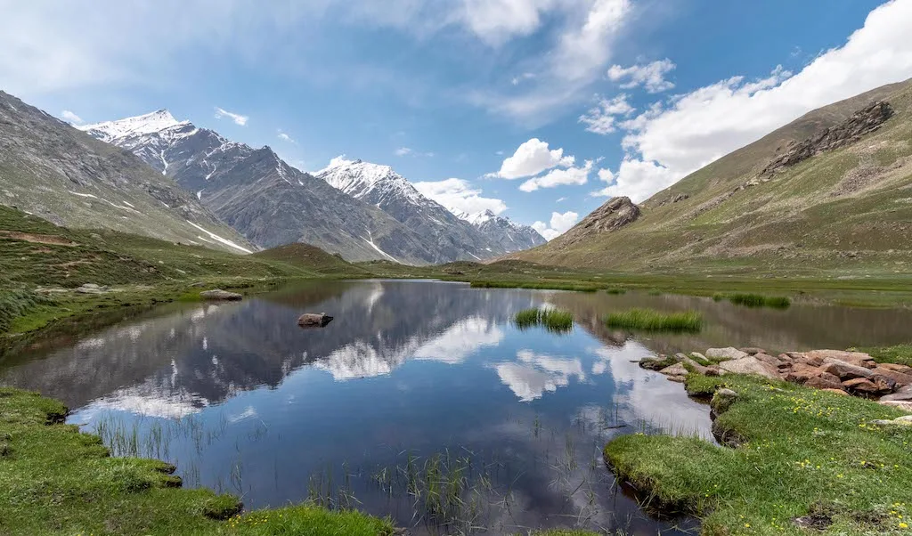
The trail is predominantly characterized by wide, flat valley floors, massive alpine meadows, and intermittent boulder fields. The final stretch to the glacier snout involves unstable lateral and terminal moraine.
Summit Day Notes
The excursion to the glacier snout is rocky and physically draining due to the loose scree and debris, but does not feature extreme steep gradients.
The Descent
The return journey involves very long 20+ km days. While the gradient is gently downward, the sheer distance can cause knee fatigue and severe blistering.
Altitude Profile
The altitude gain is slow and highly favorable for acclimatization, capping out around 14,000 ft. AMS risk is much lower here compared to rapid ascent treks.
Run AMS Risk Audit →Trail Performance Data
Max Gradient
15%
Hydration
0.5L per km recommended
Loose Surface Sections
- •Terminal moraine leading to the glacier snout
- •Boulder hopping between Zardong and Palpu
Personal Readiness
Am I ready?
What this route demands
People who feel comfortable on this route can usually:
Who Can Do This Trek?
Min Age
12+
Max Age
60
Western Toilets at Base
No
Solo Female Travelers
The valley is incredibly remote but the Gaddi shepherds and Lahauli locals are highly respectful. Still, guided group trekking is recommended for safety during river crossings.
Hazard Profile
What goes wrong?
Common Mistakes on Miyar Valley Trek
Most injuries and failures on this trail can be avoided by making smarter decisions early on.
Wearing non-waterproof boots, resulting in frozen feet during stream crossings
Underestimating the wind chill in the wide, unprotected valley
Carrying insufficient blister prevention tape for the long 20km return day
Assuming the lack of a 'steep pass' means the trek requires low fitness
Safety & Medical Risks
Key Risks
Hypothermia from freezing river crossings
Blisters and foot infections from wet boots
Acute Mountain Sickness (AMS)
Rockfall near the terminal moraine of the glacier
AMS (Altitude Sickness)
The gradual altitude gain reduces AMS risk, but sleeping at 13,400 ft at Palpu can trigger mild symptoms. Hydration is critical.
Evacuation Route
Manual stretcher or horseback retreat to Shukto. Road evacuation via Udaipur to Kullu Regional Hospital.
Solo Trekking
Possible for highly experienced navigators, but river crossings alone are extremely dangerous. Hiring at least a local guide is strongly recommended.
Common Trail Ailments
🏥 Nearest ICU: Regional Hospital, Kullu / Fortis Kangra (via Heli)
Tactical Emergency Hub
> Because the valley is flat, horseback evacuation to Shukto is highly effective for non-spinal injuries. Critical trauma requires heli-evac to Kullu.
Auditability
How is this calculated?
Understand This Route Further
Before attempting this route:
Still deciding?
Compare routes side-by-side to find the perfect match for your fitness, dates, and budget.
Still think it's doable? Share this with your trek mate and see if they agree.
Step 2: Seasonal Safety
You know how demanding this route is.
Now find the safest and most reliable season to attempt it.
Check Best Time to Go