
Explore
Intelligence
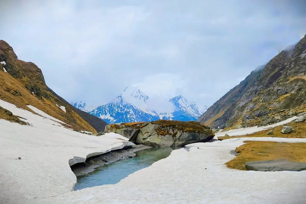
Detailed Route
Marinda Tal Trek Itinerary — Day by Day Route & Camps
A 7-day trek starting from Sankri, hiking through ancient villages and the Har Ki Dun valley to reach the serene Marinda Tal lake at 12,800 ft.
Standard RouteThis is the standard mountain pacing for this trek. Specific operators may add an acclimatization day or alter the starting point. Check individual operator schedules for their exact logistics.
Duration
7 Days
Total Distance
50.0 KM
Max Altitude
12,800 FT
Trek Type
circuit
Permits Required Before You Go
Permit Cost
Where to Get
Forest check post at Netwar (on the way to Sankri)
Documents
Aadhar Card / Passport, Passport Size Photos
Foreign Nationals
Foreigners pay a higher permit fee (approx ₹600) and require passport/visa copies.
Foreigner Process
Foreigners pay a higher park entry fee at Netwar checkpost. Passport/Visa copies required.
Nearest Embassy Hub
New Delhi
Day by Day Breakdown
Camp Alt
6,455 ft
Day Gain
+4,995 ft
Drive from Dehradun to Sankri
A beautiful, long drive through the pine forests of the Garhwal Himalayas. Sankri is a bustling trekker's hub and the basecamp for multiple treks in the region.
Key Landmarks
Staying At
The mountain road navigates upward from the plains into the Tons river valley.
Camp Alt
8,200 ft
Day Gain
+1,745 ft
Drive to Taluka and Trek to Pauni Garaat
A bumpy 12km jeep ride takes you to Taluka. From here, the trek begins through dense mixed forests alongside the roaring Supin river to the clearing at Pauni Garaat.
Key Landmarks
Staying At
The vehicle route ends, transitioning into a forested trail following the Supin river gorge.
Field Notes
KEY ACTIONRiver Crossings
Plan to cross early in the day before snowmelt swells the water levels. Unclip backpack waist belts before crossing.
Camp Alt
9,800 ft
Day Gain
+1,600 ft
Trek from Pauni Garaat to Kalkattidhar / Boslo
The trail ascends to the ancient, wooden village of Osla, famous for its unique architecture and Someshwar temple. Beyond Osla, the trail climbs to the sweeping meadows of Kalkattidhar/Boslo.
Key Landmarks
Staying At
The forested Supin valley opens into the broad alpine pastures at Kalkattidhar.
Camp Alt
9,800 ft
Day Gain
0 ft
Today's Objective
🏔 Cross Marinda Tal
The summit day. Trek into the majestic Har Ki Dun amphitheater. After a brief rest, push 3 km further up a moderate incline to reach the serene waters of Marinda Tal at 12,800 ft. Spend time at the lake before returning to Kalkattidhar camp.
Key Landmarks
Staying At
Crossing the high-altitude pass bridges two distinct watershed systems, shifting the expedition over the glaciated divide and down into a new river basin.
Camp Alt
8,200 ft
Day Gain
-1,600 ft
Trek from Kalkattidhar back to Pauni Garaat
Retrace your steps down through Osla village, enjoying the gradual descent and the changing perspectives of the valley.
Key Landmarks
Staying At
The high alpine meadows narrow into forested river terraces as tree line vegetation reappears in the lower mountain river corridor.
Field Notes
KEY ACTIONRiver Crossings
Plan to cross early in the day before snowmelt swells the water levels. Unclip backpack waist belts before crossing.
Camp Alt
6,455 ft
Day Gain
-1,745 ft
Descend to Taluka and Drive to Sankri
The final leg of the trek brings you back to the roadhead at Taluka. From here, hop into a jeep for the bumpy ride back to the comforts of Sankri.
Key Landmarks
Staying At
The forested trail follows the Supin river gorge back to the Taluka roadhead.
Camp Alt
1,460 ft
Day Gain
-4,995 ft
Drive Sankri to Dehradun
Morning departure from Sankri. Expect to reach Dehradun by late afternoon or early evening. Onward travel should be booked after 8 PM.
Key Landmarks
The return journey descends from the Tons river valley back to Dehradun.
Trek Extensions & Add-ons
Ruinsara Tal
+2 DaysFrom Osla, the trail bifurcates to another stunning alpine lake, Ruinsara Tal, nestled at the base of Black Peak.
Bali Pass
+4 DaysA highly technical crossover from Ruinsara Tal into the Yamunotri valley, meant only for advanced trekkers.
Plan Your Trek:
Ready to book? Compare verified operators for Marinda Tal — transparent pricing, no paid rankings.
Still deciding?
Compare routes side-by-side to find the perfect match for your fitness, dates, and budget.
Day by day, camp by camp. Send this to your group so everyone's on the same page.
Step 4: Cost & Logistics
You understand the route.
Now see what services, permits, and logistics actually cost.
View Cost Breakdown