Detailed Route
Kinnaur Kailash Trek Itinerary — Day by Day Route & Camps
Standard RouteThis is the standard mountain pacing for this trek. Specific operators may add an acclimatization day or alter the starting point. Check individual operator schedules for their exact logistics.
Duration
3 Days
Total Distance
35 KM
Max Altitude
15,750 FT
Trek Type
circuit
Permits Required Before You Go
Permit Cost
Where to Get
Online (Kinnaur Admin) or Reckong Peo DC Office.
Documents
Aadhar/Passport, Medical Fitness Certificate, Passport Photos
Foreign Nationals
Foreigners require Inner Line Permits to visit Kinnaur, obtainable at Peo.
Foreigner Process
ILP required for Kinnaur (Peo DC office).
Nearest Embassy Hub
Delhi
Day by Day Breakdown
Drive: Reckong Peo to Tangling & Trek to Ganesh Park
A massive 5,000+ ft gain on Day 1. The trail is relentlessly steep from the river bed. Hydrate aggressively. Ganesh Park is a beautiful alpine meadow where yatra tents are usually pitched. Technical: The climb starts from Tangling (7,050 ft) and goes through thick forest before opening into high-altitude meadows. Safety: High risk of exhaustion. Maintain a steady pace.
Key Landmarks
Staying At
Summit Push: Ganesh Park to Shivling via Parvati Kund & Back
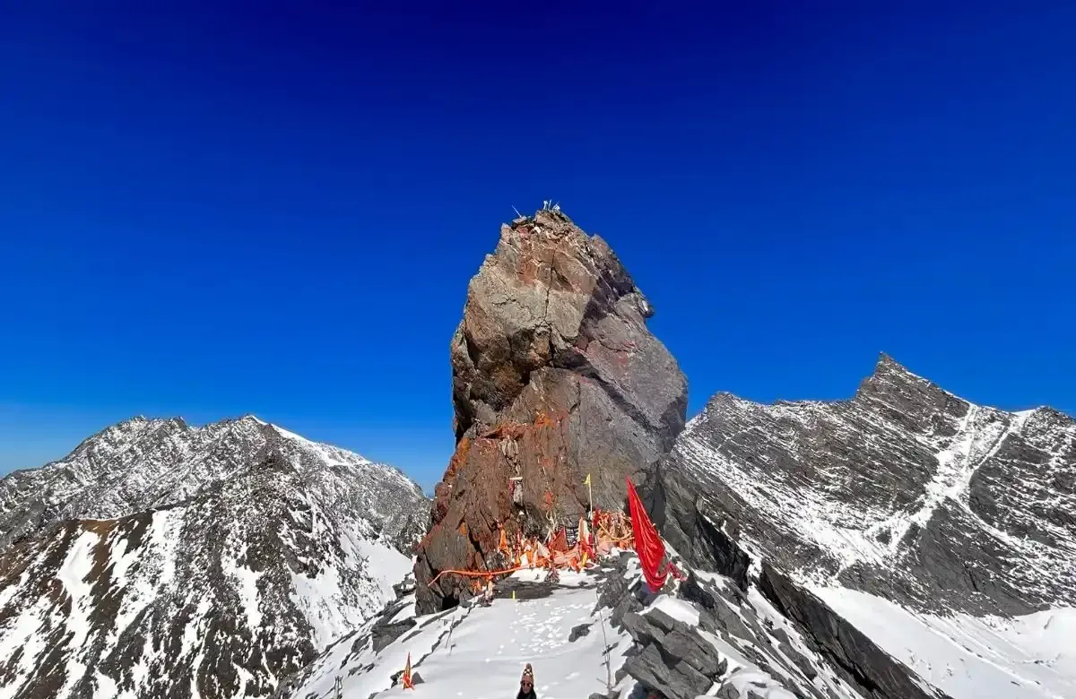
Start at 3 AM. The trail from Ganesh Park to Parvati Kund (14,900 ft) is a mix of steep slopes and boulder fields. From the Kund to the Shivling, the path is almost entirely over large boulders and can be extremely slippery if frosted. Reaching the base of the 79ft Shivling is the goal. Landscape: The Shivling stands isolated against the sky, with the massive Jorkanden Peak (21,237 ft) in the backdrop. Safety: Very high AMS risk. Shooting stones are common in the early morning as ice melts. Turnback time is strictly 11 AM to ensure a safe descent before dark.
Key Landmarks
Staying At
Descent: Ganesh Park to Tangling & Return to Reckong Peo
The descent is very hard on the knees. Use poles. Once at Tangling, cross back to the main road for the drive to Peo or Kalpa.
Trek Extensions & Add-ons
Charang La Parikrama
+5 DaysThe full spiritual parikrama of the Kinnaur Kailash range crossing the high Charang La pass.
Also on this trek
Ready to book? Compare verified operators for Kinnaur Kailash Trek — transparent pricing, no paid rankings.
Still deciding?
Compare routes side-by-side to find the perfect match for your fitness, dates, and budget.
Day by day, camp by camp. Send this to your group so everyone's on the same page.
Love this itinerary?
Find operators who follow this exact route with verified acclimatization days.
Find matching operators