Detailed Route
Kheerganga Trek Itinerary — Day by Day Route & Camps
Standard RouteThis is the standard mountain pacing for this trek. Specific operators may add an acclimatization day or alter the starting point. Check individual operator schedules for their exact logistics.
Duration
2 Days
Total Distance
24 KM
Max Altitude
9,700 FT
Trek Type
circuit
Day by Day Breakdown
Trek: Barshaini to Kheerganga
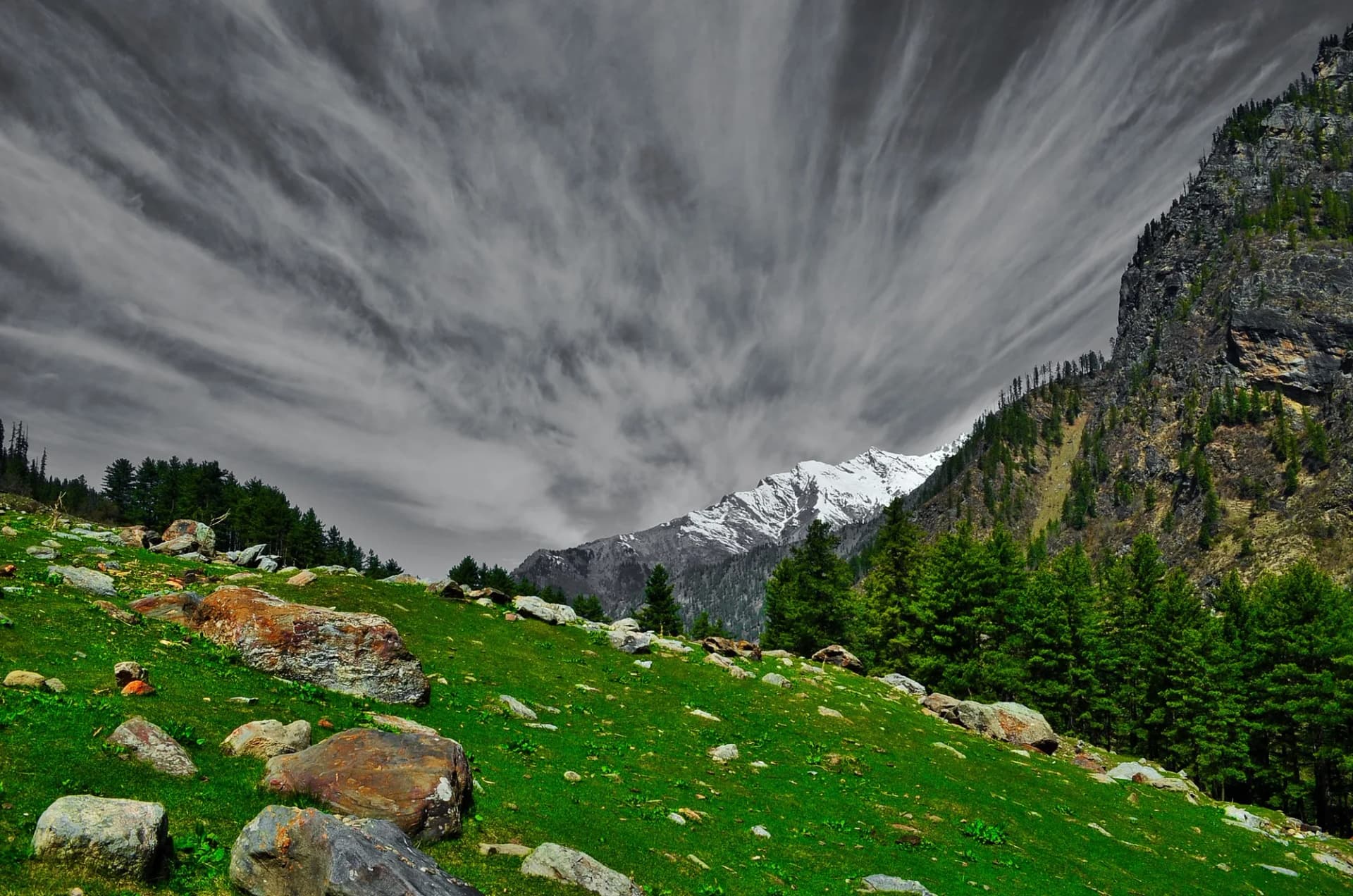
Tent or shelter camp at Kheerganga meadow. Evening soak in the hot spring is the main event. Several seasonal cafés operate at the top serving hot meals and chai. Technical: Two routes exist — via Nakthan village (longer, easier, scenic) and via the direct steep trail. We recommend Nakthan for the cultural experience. Trail is well-defined but narrow in places. One major river crossing on a wooden bridge. The last 2 km is a steep climb through dense forest. In monsoon, the trail is slippery and leeches are active below 8,000 ft. Landscape: Nakthan village is one of the most ancient settlements in the Parvati Valley. The wooden Shiva temple here predates written records. The village economy revolves around apple orchards and traditional agriculture. The Rudra Nag waterfall, midway on the trek, is a sacred cascade believed to mark the spot where Shiva's serpent (Nag) struck the rock. Safety: Hydrate well — the climb is sustained and can be dehydrating. In monsoon, carry leech-proof socks and salt. The hot spring area is slippery — wear camp shoes with grip.
Key Landmarks
Staying At
Descent: Kheerganga to Barshaini
Reach Barshaini by noon. Drive to Kasol (30 mins) or Bhuntar (1.5 hours). Technical: Descent is fast. The same trail in reverse. Hard on knees on the steep sections. In monsoon, the trail can be muddy. Reach Barshaini by noon. Landscape: The morning descent offers stunning views of the Parvati Valley with the river far below. The transition from the alpine meadow back into the dense forest is a beautiful journey. Safety: Watch footing on wet stones. Use poles for the steep descent sections.
Key Landmarks
Trek Extensions & Add-ons
Bunbuni Pass Hike
+1 DayShort extension to a less-crowded ridge for vast views of the Parvati valley peaks.
Also on this trek
Ready to book? Compare verified operators for Kheerganga Trek — transparent pricing, no paid rankings.
Still deciding?
Compare routes side-by-side to find the perfect match for your fitness, dates, and budget.
Day by day, camp by camp. Send this to your group so everyone's on the same page.
Love this itinerary?
Find operators who follow this exact route with verified acclimatization days.
Find matching operators