
Explore
Intelligence
Detailed Route
Kedartal Trek Itinerary — Day by Day Route & Camps
A 7-day immersive expedition traversing diverse Himalayan landscapes and alpine altitudes.
Standard RouteThis is the standard mountain pacing for this trek. Specific operators may add an acclimatization day or alter the starting point. Check individual operator schedules for their exact logistics.
Duration
7 Days
Total Distance
36 KM
Max Altitude
15,500 FT
Trek Type
circuit
Day by Day Breakdown
Camp Alt
10,200 ft
Day Gain
+8,100 ft
Drive to Gangotri
Pick up from Dehradun Railway Station at 6:30 AM. A spectacular drive following the Bhagirathi river. Harsil is perfect for a quick snack stop. Gangotri is your base at 10,200ft. Night stay in a hotel. This 8,000ft gain in 10 hours is the first shock to the body — stay super hydrated today. Visit the temple for the evening Aarti for a spiritual start.
Key Landmarks
The motorable road navigates deeper into the Bhagirathi river gorge, where the landscape transitions from lower foothills into the steep, pine-clad canyons.
Camp Alt
10,200 ft
Day Gain
0 ft
Today's Objective
☕ Acclimatization & Recovery
Non-negotiable rest day. Walk to the confluence where the turbulent Kedar Ganga meets the Bhagirathi. This is the water you will be following for the next 5 days. Spend time at 10,000ft+ to prepare your lungs for the 12,000ft+ climb tomorrow. Check gear and finalize permits at the Forest Range Office.
Key Landmarks
An active recovery phase near the high-altitude Bhagirathi river basin.
Camp Alt
12,400 ft
Day Gain
+2,200 ft
Reach Bhojkharak
One of the steepest Day-1s in Indian trekking. You start climbing immediately behind the temple. The 'Spider Wall' is a 50-meter ledge on a granite cliff with limited footprints — you must lean into the wall. Below you, the Kedar Ganga thunders through a narrow gorge. Campsite is a small, tight clearing in the Bhojpatra forest. Very cold nights.
Key Landmarks
Staying At
The settlement broadens into a steep ascent through the Kedar Ganga river gorge.
Camp Alt
14,100 ft
Day Gain
+1,700 ft
Reach Kedarkharak
Terrain changes from forest to high-altitude alpine meadows (Kharaks). The ascent remains steep but the views open up significantly. You are now in the home of the Bharal. Kedarkharak is a massive, beautiful meadow. You are now above the tree line. The air is noticeably thinner here.
Key Landmarks
Staying At
The forested gorge leads into the barren alpine pastures of Kedarkharak.
Field Notes
KEY ACTIONHelmet Mandatory
Helmet mandatory. Move quickly and quietly through the rockfall zone without stopping to rest.
Camp Alt
14,100 ft
Day Gain
0 ft
Today's Objective
💧 Reach Kedartal
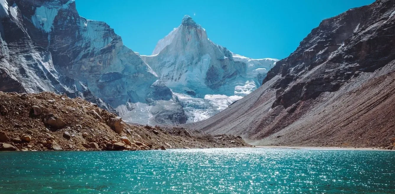
The technical climax. Navigate a 3km field of unstable boulders on the Kedar glacier moraine. One wrong step can lead to a twisted ankle. Kedartal is a stark, absolute emerald lake at the base of the Thalay Sagar vertical wall. It is silent and spiritually powerful. Spend time at the lake for photos and prayer, then carefully descend back to Kedarkharak.
Key Landmarks
Staying At
The route navigates the rocky moraine basin surrounding the Kedartal glacial lake.
Field Notes
Use Trekking Poles
Trekking poles are highly recommended to save your knees on the descent.
INFOSlower Progress
Progress will be significantly slower and more taxing on your ankles than trail distance suggests.
Camp Alt
10,200 ft
Day Gain
-3,900 ft
Descend to Gangotri
A massive descent. Be extremely careful at the Spider Wall — it's harder descending than ascending. Use trekking poles. Your knees will feel the 3,900ft drop. Reach Gangotri by evening. Hot shower and a warm bed at the hotel is your reward.
Key Landmarks
The alpine pastures drop rapidly back through the forested gorge to the Gangotri settlement.
Camp Alt
2,100 ft
Day Gain
-8,100 ft
Drive to Dehradun
Same return route. Reach Dehradun by 8:00 PM. Highly recommended to book your flight or train for the NEXT morning to allow for buffer.
The mountain valley topography transitions back into the lower foothill river plains.
Trek Extensions & Add-ons
Patangni Dhar Ridge Line
+2 DaysExtra climb to the Patangni Dhar ridge for a 360-degree view of the entire Gangotri range peaks.
Plan Your Trek:
Ready to book? Compare verified operators for Kedartal Trek — transparent pricing, no paid rankings.
Still deciding?
Compare routes side-by-side to find the perfect match for your fitness, dates, and budget.
Day by day, camp by camp. Send this to your group so everyone's on the same page.
Step 4: Cost & Logistics
You understand the route.
Now see what services, permits, and logistics actually cost.
View Cost Breakdown