
Explore
Intelligence
Detailed Route
Kalicho Pass Trek Itinerary — Day by Day Route & Camps
A brutal 10-day crossing from the green valleys of Chamba to the dry Buddhist lands of Lahaul, featuring a terrifying 16,370 ft summit day.
Standard RouteThis is the standard mountain pacing for this trek. Specific operators may add an acclimatization day or alter the starting point. Check individual operator schedules for their exact logistics.
Duration
9 Days
Total Distance
59.0 KM
Max Altitude
16,370 FT
Trek Type
linear
Permits Required Before You Go
Permit Cost
Where to Get
SDM Office Bharmour / Local Forest Checkpost.
Documents
Aadhar Card / Passport, Passport size photos, Medical Fitness Certificate (Strictly checked), Risk Declaration Form
Foreign Nationals
Foreigners require standard passport registration. If exploring further deep into Lahaul-Spiti towards the border, an Inner Line Permit may be required.
Foreigner Process
Standard registration at Bharmour police station.
Nearest Embassy Hub
New Delhi
Day by Day Breakdown
Camp Alt
7,150 ft
Day Gain
+6,060 ft
Drive Pathankot to Bharmour
A long, scenic mountain drive through the historic Chamba Valley along the Ravi River. Technical: Rest well and hydrate. Bharmour is the base camp where final provisions are purchased.
Key Landmarks
Staying At
The motorable road navigates deeper into the mountain river corridor, where the landscape transitions from lower foothills into the steep, dense forested valleys.
Camp Alt
7,150 ft
Day Gain
0 ft
Acclimatization Trek to Bharmani Mata Temple
A steep uphill acclimatization walk to the sacred Bharmani Mata temple. Local lore dictates that passing through the region without paying respects here brings bad luck. Return to Bharmour for the night.
Key Landmarks
Staying At
The trail follows the mountain river corridor through a narrow, forested gorge, moving past traditional settlements into increasingly dense dense forested valleys.
Camp Alt
8,500 ft
Day Gain
+1,350 ft
Drive to Bhadra and Trek into the Forest
Drive via bumpy mountain roads to the trailhead. From there, it's a short trek to Bhadra, the last inhabited village on the route. Technical: A good warmup day to test backpacks and boots.
Key Landmarks
Staying At
The team holds position within the alpine meadow basin, monitoring weather patterns and adapting to the thinning atmosphere.
Camp Alt
10,500 ft
Day Gain
+2,000 ft
Trek from Bhadra to Leundi
The trail leaves civilization behind, ascending through dense coniferous forests. The path is narrow and steep in sections. Safety: Watch out for slippery pine needles on steep descents to stream beds.
Key Landmarks
Staying At
The trail follows the mountain river corridor through a narrow, forested gorge, moving past traditional settlements into increasingly dense dense forested valleys.
Field Notes
KEY ACTIONRiver Crossings
Plan to cross early in the day before snowmelt swells the water levels. Unclip backpack waist belts before crossing.
Camp Alt
12,800 ft
Day Gain
+2,300 ft
Trek from Leundi to Bansar Goth (Alyas / Base Camp)
The landscape transforms as you cross the tree line into alpine meadows and glacial moraine. Alyas refers to the traditional base camp area before the pass. Technical: The altitude jump is significant; rest properly and hydrate to stave off AMS.
Key Landmarks
Staying At
Vegetation gives way to barren glacial debris as the route enters the expansive moraine basin and ablation zone of the glaciated upper watershed.
Field Notes
Use Trekking Poles
Trekking poles are highly recommended to save your knees on the descent.
INFOSlower Progress
Progress will be significantly slower and more taxing on your ankles than trail distance suggests.
Camp Alt
12,800 ft
Day Gain
0 ft
Rest and Acclimatization at Bansar Goth
A mandatory rest day. Do a short acclimatization walk up the moraine ridge and return to sleep low. Safety: Prepare technical gear (microspikes, ice axe) for the summit push. Sleep early.
Key Landmarks
Staying At
The team holds position within the alpine meadow basin, monitoring weather patterns and adapting to the thinning atmosphere.
Field Notes
Use Trekking Poles
Trekking poles are highly recommended to save your knees on the descent.
INFOSlower Progress
Progress will be significantly slower and more taxing on your ankles than trail distance suggests.
Camp Alt
13,100 ft
Day Gain
+300 ft
Today's Objective
🏔 Cross Bansar Goth To Kalicho Pass
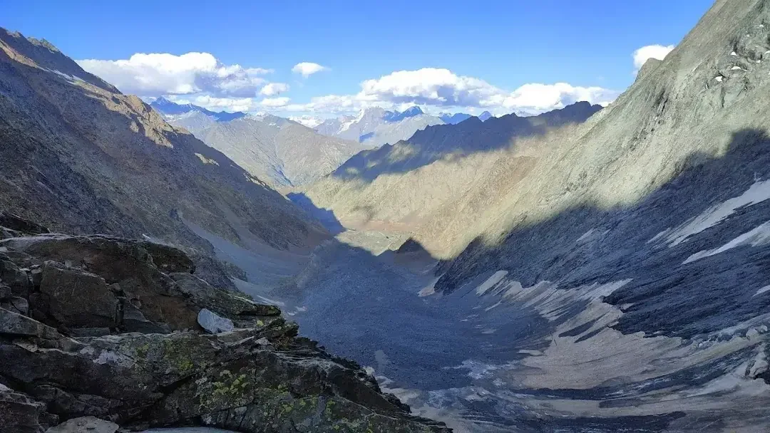
Start at 3:00 AM. A 3,500 ft near-vertical ascent over ice, boulders, and loose scree. At the pass, offer prayers at the small Kali shrine. The descent into Lahaul is equally punishing, a 60-degree drop over unstable scree. Technical: Follow the guide's exact footsteps. Ropes may be required if ice is hard. One slip on the descent can be fatal.
Key Landmarks
Staying At
Crossing the high-altitude pass bridges two distinct watershed systems, shifting the expedition over the glaciated divide and down into a new river basin.
Field Notes
Use Trekking Poles
Trekking poles are highly recommended to save your knees on the descent.
INFOSlower Progress
Progress will be significantly slower and more taxing on your ankles than trail distance suggests.
Camp Alt
9,000 ft
Day Gain
-4,100 ft
Trek from Alyas to Trilokinath / Udaipur
A massive descent into the stark, dry mountains of Lahaul. Arrive at the holy Trilokinath temple, revered by both Hindus and Buddhists. Technical: Knees will be severely tested on this long, continuous downhill.
Key Landmarks
Staying At
The high alpine pass descends into the Lahaul valley basin at Trilokinath.
Camp Alt
6,700 ft
Day Gain
-2,300 ft
Drive from Trilokinath to Manali
Drive back to civilization via the Atal Tunnel, transitioning from the harsh Lahaul desert back to the green Kullu valley. Expedition ends in Manali.
Key Landmarks
The motorable road navigates deeper into the Chandra and Bhaga valleys, where the landscape transitions from lower foothills into the steep, rain-shadow desert.
Trek Extensions & Add-ons
Kugti Pass Traverse
+8 DaysFor elite mountaineers, combining Kalicho with the nearby Kugti Pass creates an epic, multi-week trans-Himalayan traverse.
Plan Your Trek:
Ready to book? Compare verified operators for Kalicho Pass Trek — transparent pricing, no paid rankings.
Still deciding?
Compare routes side-by-side to find the perfect match for your fitness, dates, and budget.
Day by day, camp by camp. Send this to your group so everyone's on the same page.
Step 4: Cost & Logistics
You understand the route.
Now see what services, permits, and logistics actually cost.
View Cost Breakdown