
Explore
Intelligence
Essential Planning Guide
Kalicho Pass Trek — Complete Guide (2026)
Vibe & Scenery
The Experience
Introduction
Kalicho Pass is one of Himachal Pradesh's most demanding mountain crossings, connecting the lush valleys of Chamba with the stark landscapes of Lahaul. For generations, Gaddi shepherds have used this remote route while moving livestock between seasonal grazing grounds, creating one of the state's oldest traditional mountain passages.
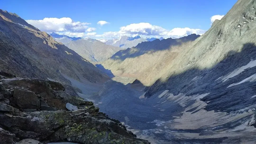
The expedition climbs gradually through forests and alpine meadows before entering increasingly rugged terrain dominated by moraines, glaciers, loose rock, and steep scree. Crossing Kalicho Pass at approximately 16,370 ft demands endurance, route-finding ability, and confidence in difficult mountain conditions where weather can change rapidly.
Local traditions associate the pass with Goddess Bhadrakali, adding cultural significance to an already remarkable landscape. Far from commercial trekking circuits, Kalicho Pass remains a true wilderness expedition best attempted by experienced trekkers supported by knowledgeable local guides.
Quick Facts
Duration
Max Altitude
Difficulty
Best Time
Trek Distance
Trail Atmosphere
Stargazing
Class 1 Dark Sky
Scent Profile
Silence Level
~10 dB
Vertigo Factor
10 / 10
Iconic Spots
Kalicho Pass Summit
Bansar Goth (Alyas)
Environment
Nature & Culture
Flora & Fauna
Flora
Fauna
The pass is sacred to Goddess Bhadrakali. Gaddi shepherds sacrifice sheep or offer strong alcohol to the deity to ensure a safe crossing for their flocks.
— Local folklore
Spiritual & Cultural Significance
Deeply sacred to the Gaddi tribe and dedicated to Goddess Bhadrakali.
🕐 Shrine Timings: Open all day
Temple Protocols
- •Do not pollute the water sources near the shrines
- •Offering prayers before the pass is a strict cultural norm
Festivals & Dates
Technical Details
Challenge & Preparation
Primarily a cardio demand and cumulative fatigue challenge
A demanding expedition with extreme cardio demand and cumulative fatigue.
Personal Readiness
Am I ready?
Planning
Logistics & Trail Intel
Getting There
Route to Base
Take a train or flight to Pathankot, then drive 6-8 hours via Dalhousie and Chamba to Bharmour
Base Village
Bharmour (Start) / Trilokinath (End)
7,150 ft
Last ATM
Bharmour (SBI ATM is usually reliable).
Nearest Medical Facility
Civil Hospital, Bharmour / Regional Hospital, Kullu (post-trek)
Mobile Signal
Complete dead zone for 6 days between Bhadra and Trilokinath.
Water Sources
Streams are present up to Bansar Goth. On summit day, water must be carried or snow must be melted. Filter all glacial water.
Charging
Zero charging points after Bharmour/Bhadra. High-capacity power bank mandatory.
For Drivers
Road Condition
The road from Pathankot to Bharmour is notoriously narrow and prone to monsoon landslides. The road in Lahaul is rugged tarmac.
Chamba Town / Bharmour
Trail Culinary & Diet
Don't miss the Rajma Chawal in Bharmour.
Buy specialized diet items at Pathankot / Dalhousie
The Content & Remote Hub
Top Vlog Spots
Video Calls
none
UPI Reliability
3/10
Permits and Regulations
Forest permits and permissions from the local Sub-Divisional Magistrate (SDM) in Bharmour are mandatory. Due to the high risk, authorities may check the experience level of the group and ensure a registered local guide is leading. Registration at the local police station in Bharmour and at the exit point in Trilokinath/Udaipur is required. Indian nationals must carry Aadhar/Voter ID, while foreigners need valid passports, visas, and occasionally an Inner Line Permit (if extending deep into Lahaul/Spiti).
Learn more about how we vet operators and ensure transparency on our why MountRoutes page.
Packing List
High Altitude Clothing
- Heavy down jacket rated to -10°C
- Waterproof/Windproof Hardshell jacket and pants
- 3 pairs of merino wool thermal baselayers
- 2 heavy fleece mid-layers
- Waterproof alpine gloves with thermal liners
- Balaclava, woolen cap, and neck gaiter
- 4 pairs of heavy woolen trekking socks
Technical Footwear & Terrain Gear
- Sturdy waterproof mountaineering/trekking boots (high ankle, Vibram sole)
- Professional Microspikes or 10-point crampons (depending on snow)
- Waterproof gaiters (knee-high)
- 2 sturdy anti-shock trekking poles
- Ice axe (carried by guide, but good to know how to use)
Survival & Camping Gear
- Sleeping bag rated to -15°C
- High-lumen headlamp with extra lithium batteries
- UV400 Polarized Category 4 Sunglasses
- Comprehensive First Aid Kit with Diamox and Dexamethasone
- Personal GPS tracker / Garmin inReach (if available)
- Insulated water thermos (1 Liter)
Deep Dives
Explore Further
Editor's Notes
Explore In Detail
Day by Day Itinerary
9-day route reaching 16,370ft. Covers 59.0km of varied terrain.
→ See full itinerary with altitude profileDifficulty & Fitness
Rated challenging. Extremely varied and hostile. Thick, unmarked forest trails transitioning to treacherous boulder fields, glacial ice, and 60-degree loose scree slopes near the pass.
→ See difficulty breakdown and fitness guideCost & Pricing
Packages range from ₹25,000 – ₹40,000. Inclusions and hidden costs vary by operator tier.
→ See full cost breakdownFrequently Asked Questions
How difficult is the Kalicho Pass trek?
It is rated as Extreme. The route is unmarked, involves incredibly steep ascents (60-degree gradients), crossing active glaciers, and navigating unstable moraine and scree. It is significantly harder than standard commercial passes.
Do I need prior mountaineering experience?
Yes. This is not a trek for beginners. You must have prior experience crossing high-altitude passes (above 15,000 ft), excellent cardiovascular fitness, and familiarity with walking on snow and ice.
Is an experienced local guide mandatory?
Absolutely. There is no defined trail for a large portion of this route. The Gaddi shepherds and local guides from Bharmour are the only ones who know the safe paths through the crevasses and rockfalls.
What is the cultural significance of this pass?
The pass is named after Goddess Kali (Bhadrakali). Trekkers traditionally visit the Bharmani Mata Temple and the Banni Mata Temple to seek blessings and permission before commencing the dangerous ascent.
When is the best time to cross the Kalicho Pass?
The window is extremely narrow: from mid-August to late September. Before August, the pass is buried under dangerous amounts of snow. By October, extreme winter conditions return.
Are there any river crossings?
Yes. You will have to cross several fast-flowing, freezing glacial streams, particularly on the Lahaul side during the descent. Crossing early in the morning is critical.
Where does the trek end?
The trek concludes in the Lahaul Valley, typically near Trilokinath or Udaipur, marking a dramatic transition from the green Chamba valley to the barren Buddhist landscapes of Lahaul.
Is there mobile connectivity on the trail?
No. Mobile networks (BSNL/Jio) cut off shortly after leaving Bharmour and the village of Bhadra. You will be entirely off-grid for at least 5-6 days until you reach Lahaul.
Still deciding?
Compare routes side-by-side to find the perfect match for your fitness, dates, and budget.
Everything you need to know, in one place. Someone else in your group needs to see this.
Planning Kalicho Pass Trek?
Get route conditions, operator updates, and season windows before booking.
Don't miss out! Follow us for route updates@mountroutes|LinkedIn
No spam. Only useful trek updates.
Ready to walk this route?
You’ve read the guide, now find the perfect local team to take you there. Compare our verified list of operators.
Compare verified operators