
Explore
Intelligence
Detailed Route
Hampta Pass Trek Itinerary — Day by Day Route & Camps
A spectacular 5-day crossover expedition traversing from the lush Kullu valley to the barren high-altitude deserts of Spiti.
Standard RouteThis is the standard mountain pacing for this trek. Specific operators may add an acclimatization day or alter the starting point. Check individual operator schedules for their exact logistics.
Duration
5 Days
Total Distance
35 KM
Max Altitude
14,010 FT
Trek Type
linear
Day by Day Breakdown
Camp Alt
10,170 ft
Day Gain
+3,440 ft
Drive to Jobra & Trek to Chika
Short 1-hour drive from Manali to Jobra roadhead. Trek 2km through pine and maple forest to Chika campsite. Easy acclimatisation day. No ATMs beyond Manali — withdraw cash before departure.
Key Landmarks
Staying At
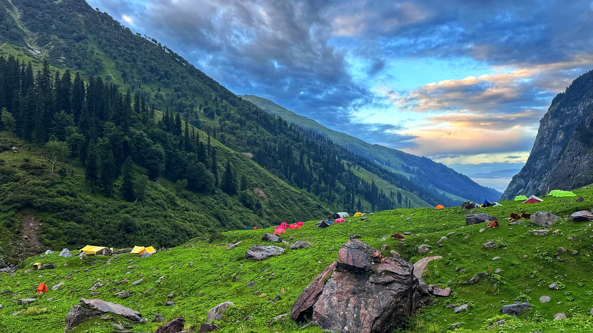
The urban environment of Manali is replaced by dense forest cover. The valley opens up at Chika, introducing alpine meadows and the constant sound of the river.
Camp Alt
12,200 ft
Day Gain
+2,030 ft
Reach Balu Ka Ghera
Gradual ascent through expanding meadows with wildflowers in July–August. River crossings on approach — thigh-deep in June and July mornings, knee-deep by September. Balu Ka Ghera is a wide boulder field campsite at the head of the Kullu Valley, directly below the pass.
Key Landmarks
Staying At
Forest cover disappears entirely, giving way to wildflower meadows. The valley widens significantly as the trail approaches Balu Ka Ghera, transitioning into a barren, rocky landscape directly below the pass.
Field Notes
KEY ACTIONRiver Crossings
Plan to cross early in the day before snowmelt swells the water levels. Unclip backpack waist belts before crossing.
Use Trekking Poles
Trekking poles are highly recommended to save your knees on the descent.
INFOSlower Progress
Progress will be significantly slower and more taxing on your ankles than trail distance suggests.
Camp Alt
12,800 ft
Day Gain
+600 ft
Today's Objective
🏔 Cross Hampta Pass
Longest and most demanding day. Steep 500m climb to the pass. Summit views of Indrasan (6,221m) and Deo Tibba (6,001m). Dramatic landscape shift at the pass — lush green Kullu valley gives way to stark arid Lahaul. Steep descent into Lahaul valley. Start early.
Key Landmarks
Staying At
Crossing the pass marks a complete geographic transition: the green Kullu valley disappears behind, replaced instantly by the arid barren landscape of the Lahaul desert.
Field Notes
KEY ACTIONRiver Crossings
Plan to cross early in the day before snowmelt swells the water levels. Unclip backpack waist belts before crossing.
Use Trekking Poles
Trekking poles are highly recommended to save your knees on the descent.
INFOSlower Progress
Progress will be significantly slower and more taxing on your ankles than trail distance suggests.
Camp Alt
11,000 ft
Day Gain
-1,800 ft
Reach Chatru
Easy descent along the Lahaul valley floor to Chatru. Optional 3-hour drive to Chandratal Lake (4,250m) — a crescent-shaped glacial lake, one of the most beautiful in Himachal. Camp at Chandratal if included in package. Most operators charge ₹1,000–1,500 extra for Chandratal extension.
Key Landmarks
Staying At
The high alpine meadows narrow into forested river terraces as tree line vegetation reappears in the lower Chandra and Bhaga valleys.
Field Notes
KEY ACTIONRiver Crossings
Plan to cross early in the day before snowmelt swells the water levels. Unclip backpack waist belts before crossing.
Camp Alt
6,726 ft
Day Gain
-4,274 ft
Drive to Manali via Chandratal
Return drive to Manali via Atal Tunnel or Rohtang Pass depending on conditions. 4–5 hours. Book onward travel from Manali after 7 PM to be safe.
Key Landmarks
The dry environment of Lahaul is abruptly replaced by the lush, green forests of the Kullu valley upon crossing through the tunnel or pass. The descent reintroduces heavy vegetation and the dense settlement of Manali.
Trek Extensions & Add-ons
Chandratal Lake Visit
+1 DayPost-trek drive to the high-altitude holy lake in Spiti valley.
Plan Your Trek:
Ready to book? Compare verified operators for Hampta Pass Trek — transparent pricing, no paid rankings.
Still deciding?
Compare routes side-by-side to find the perfect match for your fitness, dates, and budget.
Day by day, camp by camp. Send this to your group so everyone's on the same page.
Step 4: Cost & Logistics
You understand the route.
Now see what services, permits, and logistics actually cost.
View Cost Breakdown