
Explore
Intelligence
Difficulty & Readiness Guide
Is Hampta Pass Trek Difficult? — Fitness & Altitude Guide
Requires solid leg strength and balance for steep descents and river crossings; prior high-altitude experience is highly recommended.
The Question
Can I do this trek?
Preparation Required
Intermediate
Prior Experience
Recommended: 1-2 easy Himalayan treks or regular hiking experience.
Expert Verdict
Highly technical trek requiring physical and mental preparation.
Hampta Pass Trek
Himalayan Placement · Index 35Route Knowledge
Why is it difficult?
Exertion Index
Primary Challenge
Route Identity
Fast-paced or high-mileage route demanding excellent cardiovascular fitness across a pass-crossing route featuring river crossings and loose moraine.
Primary Drivers
- Maximum sleeping altitude of 12,800 ft
- Grueling summit push with 1,810 ft of elevation gain
- 2 consecutive high-output trekking days
View Full Route Analysis
Physiological Demand
Challenging daily distances and steady climbs. Good cardiovascular fitness is required.
Below the major effects of altitude sickness. Air remains relatively dense.
Well-defined, stable trails with no technical maneuvers required.
Comfortable pacing with good recovery options.
Rolling or gradual terrain with minimal harsh impact on joints.
Terrain Breakdown
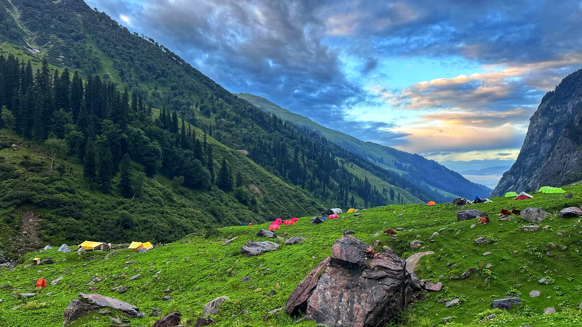
More varied and challenging than Kedarkantha. Kullu side has forest and meadow trails with river crossings. Pass section involves steep climb on snow or loose scree depending on season. Lahaul descent is steep on loose rock. River crossings on Days 2–3 are the most technically demanding element — not height, not snow, but balance in icy flowing water.
Summit Day Notes
Day 3 is the crux — Balu Ka Ghera to Shea Goru via the pass. 500m climb to the pass followed by steep descent into Lahaul. Total 7–8km but terrain is demanding throughout. No fixed ropes or technical gear required. Trekking poles critical for river crossings and descent.
The Descent
Lahaul side descent from the pass is steep and loose. Rocks can be slippery. Take it slow. Unlike Kedarkantha, the descent is technical — not just long.
Altitude Profile
Maximum altitude 4,270m at the pass. Chandratal adds 4,250m. Acclimatisation is built in via the gradual Kullu approach. AMS is possible but the 2-day ascent before the pass day gives adequate adjustment time for most trekkers.
Run AMS Risk Audit →Trail Performance Data
Max Gradient
30%
Hydration
0.4L per km recommended
Loose Surface Sections
- •Descent from Pass to Shea Goru
Personal Readiness
Am I ready?
What this route demands
People who feel comfortable on this route can usually:
Who Can Do This Trek?
Min Age
12+
Max Age
60
Western Toilets at Base
Yes
Solo Female Travelers
High; very popular trail with multiple group departures daily in season.
Hazard Profile
What goes wrong?
Common Mistakes on Hampta Pass Trek
Most injuries and failures on this trail can be avoided by making smarter decisions early on.
Crossing rivers at the wrong time — cross in the morning before peak snowmelt, never in the afternoon
Not unbuckling the hip strap before river crossings — if you fall, you need to ditch the pack quickly
Underestimating the pass day — it is longer and harder than it looks on the map
Skipping Chandratal — most people regret not adding this extension
Not carrying Croc sandals or water shoes for river crossings — soaked boots ruin the next two days
Safety & Medical Risks
Key Risks
River crossings — thigh-deep icy water in June and July with real risk of being swept
AMS at Hampta Pass 14,010ft and Chandratal 14,100ft
Steep loose descent on Lahaul side — ankle twist risk
Rapid weather change at the pass — clear morning to whiteout in 2 hours
AMS (Altitude Sickness)
The pass at 4,270m and Chandratal at 4,250m are real AMS risk points. The 2-day gradual approach helps. Watch for symptoms on Day 3 evening at Shea Goru. Most operators carry supplemental oxygen and pulse oximeters.
Evacuation Route
From Kullu side — return to Manali via Jobra. From Lahaul side — proceed to Chatru where vehicle access is possible. Helicopter available from Chatru in clear weather.
Solo Trekking
Not recommended solo, specifically due to river crossings. Crossing alone with no one to assist if you fall is genuinely dangerous in June–July. September crossings are safer and solo is more manageable then.
Common Trail Ailments
🏥 Nearest ICU: Lady Willingdon Hospital (Mission Hospital), Manali
Tactical Emergency Hub
> Fastest evacuation via Chattru and Atal Tunnel back to Manali hospital hubs.
Auditability
How is this calculated?
Understand This Route Further
Before attempting this route:
Still deciding?
Compare routes side-by-side to find the perfect match for your fitness, dates, and budget.
Still think it's doable? Share this with your trek mate and see if they agree.
Step 2: Seasonal Safety
You know how demanding this route is.
Now find the safest and most reliable season to attempt it.
Check Best Time to Go