
Explore
Intelligence
Detailed Route
Gurez Trek Itinerary — Day by Day Route & Camps
A 5-day journey from Srinagar over the Razdan Pass into the restricted Gurez Valley, trekking up through ancient pine forests to the hidden twin lakes of Patalwansar.
Standard RouteThis is the standard mountain pacing for this trek. Specific operators may add an acclimatization day or alter the starting point. Check individual operator schedules for their exact logistics.
Duration
5 Days
Total Distance
34.0 KM
Max Altitude
13,200 FT
Trek Type
circuit
Permits Required Before You Go
Permit Cost
Where to Get
District Commissioner Office, Bandipora or Srinagar
Documents
Aadhar Card / Original Passport, Passport Sized Photographs
Foreign Nationals
Foreigners face extreme scrutiny and are often denied entry to Gurez. If permitted, clearance takes several weeks through the Ministry of Home Affairs.
Foreigner Process
Extremely difficult to obtain. Requires clearance from the Ministry of Home Affairs in New Delhi, taking weeks or months.
Nearest Embassy Hub
New Delhi
Day by Day Breakdown
Camp Alt
8,000 ft
Day Gain
+2,800 ft
Drive Srinagar to Dawar & Acclimatization
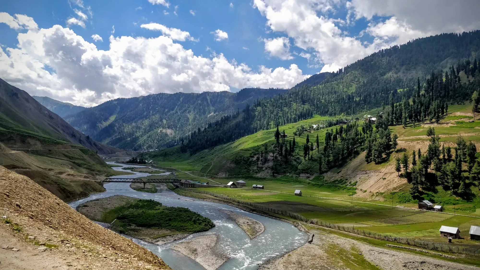
The journey begins with a stunning drive from Srinagar, skirting the edges of Wular Lake (Asia's largest freshwater lake) before climbing sharply to cross the Razdan Pass. Multiple military checkpoints will verify your permits. You descend into the Gurez Valley, arriving at the main township of Dawar, situated on the banks of the turquoise Kishanganga River. Spend the evening walking around the village to acclimatize.
Key Landmarks
Staying At
The route follows the river valley. The path breaches the mountain barrier crossing the watershed.
Camp Alt
10,500 ft
Day Gain
+2,500 ft
Trek Dawar to Khaari/Dison
Your trek begins by crossing the Kishanganga River and immediately ascending through thick, untouched forests of pine and fir. The trail is an ancient shepherd route, steep in sections but deeply shaded. As you break the tree line, you enter the expansive meadows of Khaari/Dison, offering your first unobstructed views of the pyramid-like Habba Khatoon peak.
Key Landmarks
Staying At
The route moves through forested zones. The environment transitions into open alpine meadows. The route follows the river valley.
Field Notes
KEY ACTIONRiver Crossings
Plan to cross early in the day before snowmelt swells the water levels. Unclip backpack waist belts before crossing.
Camp Alt
13,000 ft
Day Gain
+2,500 ft
Today's Objective
🏔 Cross Patalwansar Lakes
Today, you leave the tree line completely behind and enter a raw alpine environment. The trail ascends over rolling, grassy ridges that gradually transition into rocky moraine. After a final steep push over a ridge line, you drop into the hidden basin holding the twin Patalwan Lakes. These lakes are crystal clear, freezing cold, and surrounded by jagged peaks.
Key Landmarks
Staying At
Crossing the high-altitude pass bridges two distinct watershed systems, shifting the expedition over the glaciated divide and down into a new river basin.
Field Notes
Use Trekking Poles
Trekking poles are highly recommended to save your knees on the descent.
INFOSlower Progress
Progress will be significantly slower and more taxing on your ankles than trail distance suggests.
Camp Alt
8,000 ft
Day Gain
-5,000 ft
Return to Dawar
A massive descent day. You retrace your steps from the glacial lake basin, passing back through the Khaari meadows and plunging down the steep forest trail to the Kishanganga river. It is a long, knee-punishing day, but the rich oxygen at lower altitudes provides a second wind. Arrive in Dawar by late afternoon.
Key Landmarks
Staying At
The route moves through forested zones. The environment transitions into open alpine meadows. The route follows the river valley. The path breaches the mountain barrier crossing the watershed.
Field Notes
KEY ACTIONRiver Crossings
Plan to cross early in the day before snowmelt swells the water levels. Unclip backpack waist belts before crossing.
Camp Alt
5,200 ft
Day Gain
-2,800 ft
Drive Dawar to Srinagar
After breakfast in Dawar, board your vehicles for the long drive back to Srinagar, crossing the Razdan Pass one final time and clearing the military checkpoints. Expect to reach Srinagar by late afternoon.
Key Landmarks
The motorable road navigates deeper into the mountain river corridor, where the landscape transitions from lower foothills into the steep, dense forested valleys.
Trek Extensions & Add-ons
Tulail Valley Exploration
+1 DayAdd a day to drive deeper into the restricted Tulail valley, famous for its untouched wooden villages and stunning river landscapes.
Plan Your Trek:
Ready to book? Compare verified operators for Gurez Trek — transparent pricing, no paid rankings.
Still deciding?
Compare routes side-by-side to find the perfect match for your fitness, dates, and budget.
Day by day, camp by camp. Send this to your group so everyone's on the same page.
Step 4: Cost & Logistics
You understand the route.
Now see what services, permits, and logistics actually cost.
View Cost Breakdown