
Explore
Intelligence
Essential Planning Guide
Gurez Trek — Complete Guide (2026)
Vibe & Scenery
The Experience
Introduction
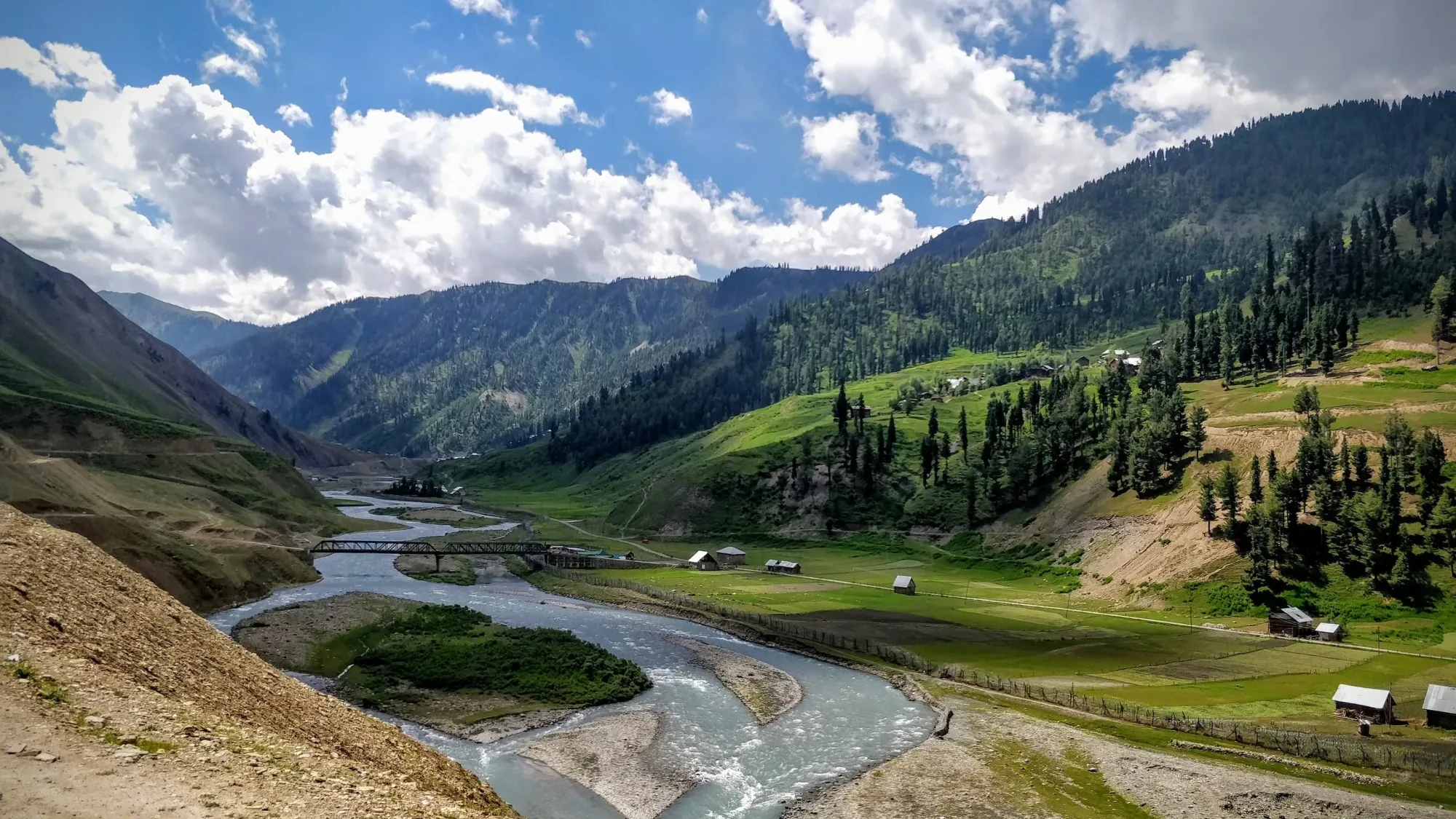
Nestled close to the Line of Control in northern Kashmir, Gurez Valley is one of the Himalayas' least-visited trekking regions. Home to the Dard-Shin community, the valley preserves a distinct cultural identity alongside dramatic mountain landscapes shaped by the Kishanganga River.
The trek gradually leaves traditional villages behind, climbing through conifer forests and alpine meadows to reach the twin Patalwansar Lakes at approximately 13,200 ft. Along the way, trekkers enjoy magnificent views of Habba Khatoon Peak and the surrounding mountains.
Limited tourism, remote campsites, and the valley's frontier setting make this trek especially appealing to experienced hikers seeking solitude and authentic Himalayan culture.
Quick Facts
Duration
Max Altitude
Difficulty
Best Time
Trek Distance
Trail Atmosphere
Stargazing
Class 1 Dark Sky
Scent Profile
Silence Level
~10 dB
Vertigo Factor
3 / 10
Iconic Spots
Patalwansar Lakes
Habba Khatoon Peak
Khaari Meadows
Environment
Nature & Culture
Flora & Fauna
Flora
Fauna
Legend has it that Habba Khatoon, the peasant queen and poetess, still wanders the valley searching for her imprisoned husband, the last king of Kashmir.
— Local folklore
Spiritual & Cultural Significance
The Dard-Shin tribe has a unique cultural heritage blending ancient animist traditions with Islam.
Temple Protocols
Festivals & Dates
Technical Details
Challenge & Preparation
Primarily a joint & muscle impact and cardio demand challenge
A capable trekker's route dominated by extreme joint & muscle impact.
Personal Readiness
Am I ready?
Planning
Logistics & Trail Intel
Getting There
Route to Base
Fly into Srinagar International Airport
Take a private taxi (6-7 hours) via Bandipora and Razdan Pass to reach Dawar
Base Village
Dawar (Gurez)
8,000 ft
Last ATM
Srinagar (Do not rely on the single, often empty J&K Bank ATM in Dawar).
Nearest Medical Facility
Sub-District Hospital, Dawar. For major emergencies, Army Base Hospital in Srinagar.
Mobile Signal
Total blackout after Dawar.
Water Sources
Pristine alpine streams are available throughout. Water must still be purified due to livestock.
Charging
Total blackout after Dawar. (Dawar itself has frequent power cuts).
For Drivers
Road Condition
The road from Srinagar to Bandipora is good. The climb to Razdan pass is steep and often broken. The descent to Gurez is rough dirt and gravel.
Bandipora
Trail Culinary & Diet
Don't miss the Wazwan (in Srinagar before/after)
Buy specialized diet items at Srinagar
The Content & Remote Hub
No DronesStrictly prohibited. Confiscation and legal action guaranteed.Top Vlog Spots
Video Calls
none
Est. 0 Mbps
UPI Reliability
1/10
Permits and Regulations
An Inner Line Permit (ILP) is strictly mandatory. You must clear multiple Indian Army and J&K Police checkposts on the drive from Srinagar to Dawar (especially at Razdan Pass). Do not fly drones under any circumstances—it is a sensitive border zone and illegal.
Learn more about how we vet operators and ensure transparency on our why MountRoutes page.
Packing List
Core Clothing Layers
- Heavyweight down jacket (-10°C rating)
- Gore-Tex windproof/waterproof jacket and pants
- Merino wool base layers (upper and lower)
- Fleece mid-layer sweater
- Quick-dry trekking trousers (x2)
Technical Gear & Footwear
- Rigid, high-ankle trekking boots with aggressive tread
- Trekking poles with snow baskets
- Waterproof gaiters (for river crossings and early summer snow)
- Headlamp with spare lithium batteries
- Microspikes (if trekking in early July)
Camping & Survival
- 4-season sleeping bag (-10°C comfort)
- Insulated sleeping mat (R-value 3+)
- Category 4 UV protection sunglasses
- Comprehensive high-altitude first aid kit (with Diamox)
- Military-grade water purification tablets
Accessories
- 50-60 litre expedition backpack with heavy-duty rain cover
- 2x 1L reusable water bottles (Nalgene)
- High SPF 50+ sunscreen and zinc lip balm
- Original Government ID and multiple photocopies (Crucial for Army checkposts)
- High-energy trail snacks (dry fruits, energy bars)
Deep Dives
Explore Further
Editor's Notes
Explore In Detail
Day by Day Itinerary
5-day route reaching 13,200ft. Covers 34.0km of varied terrain.
→ See full itinerary with altitude profileDifficulty & Fitness
Rated moderate. The terrain is generally more forgiving than the Dhauladhar or Garhwal Himalayas. The trails are softer, consisting mostly of pine needles and alpine grass, though the final approach to the lakes involves rocky moraine.
→ See difficulty breakdown and fitness guideCost & Pricing
Packages range from 16,000 - 22,000 INR (Srinagar to Srinagar). Inclusions and hidden costs vary by operator tier.
→ See full cost breakdownFrequently Asked Questions
Is it safe to trek in Gurez given its proximity to the Line of Control (LoC)?
Yes, provided you follow the rules. The Indian Army heavily heavily monitors the region. You must stay on the designated trekking routes, carry your Inner Line Permit at all times, and avoid photographing military installations. The area itself is extremely peaceful.
How difficult is the trek to Patalwan Lakes?
It is rated as Moderate to Difficult. While the gradient is generally gradual compared to Himachal treks, the isolation, lack of defined trails, and high altitude (13,000 ft) make it physically demanding. You must be completely self-sufficient.
Do I need a special permit for the Gurez Trek?
Yes. An Inner Line Permit (ILP) is mandatory for all civilians entering the Gurez Valley. This must be obtained from the District Commissioner's office in Bandipora or Srinagar before starting your journey.
Will my mobile phone work during the trek?
No. Gurez is a communication black hole. You might get a faint, unreliable BSNL or Jio signal in Dawar (the base village), but once you start the trek towards the lakes, you will have absolutely zero connectivity.
Are there any tea houses or local villages on the trail?
There are a few seasonal Gujjar (shepherd) settlements on the lower meadows, but no commercial tea houses. You must carry all your camping gear, stoves, and food from Srinagar or Dawar.
What is the risk of altitude sickness?
Moderate to High. You sleep at around 10,500 ft on Day 1 and push to 13,000 ft on Day 2. Proper acclimatization in Dawar before starting the trek is essential to minimize AMS risks.
Can I do this trek solo?
No. The Indian Army will likely not permit a solo trekker to wander near the LoC. Furthermore, the trails are unmarked shepherd routes. A registered local guide is strictly mandatory.
What wildlife might I encounter?
The region is home to the Himalayan Brown Bear, Snow Leopards (rarely seen in summer), Ibex, and Marmots. Always maintain a clean campsite to avoid attracting bears.
Still deciding?
Compare routes side-by-side to find the perfect match for your fitness, dates, and budget.
Everything you need to know, in one place. Someone else in your group needs to see this.
Planning Gurez Trek?
Get route conditions, operator updates, and season windows before booking.
Don't miss out! Follow us for route updates@mountroutes|LinkedIn
No spam. Only useful trek updates.
Ready to walk this route?
You’ve read the guide, now find the perfect local team to take you there. Compare our verified list of operators.
Compare verified operators