
Explore
Intelligence
Detailed Route
Gulabi Kantha Trek Itinerary — Day by Day Route & Camps
A 5-day scenic wilderness trek exploring the vibrant alpine meadows of the Yamuna valley.
Standard RouteThis is the standard mountain pacing for this trek. Specific operators may add an acclimatization day or alter the starting point. Check individual operator schedules for their exact logistics.
Duration
5 Days
Total Distance
30 KM
Max Altitude
12,500 FT
Trek Type
linear
Permits Required Before You Go
Permit Cost
Where to Get
Uttarkashi / Barkot Forest Office
Documents
Aadhar/Passport
Foreign Nationals
No strict border restrictions apply.
Foreigner Process
No special permits required for foreigners beyond standard visa and forest entry fee.
Nearest Embassy Hub
New Delhi
Day by Day Breakdown
Camp Alt
7,900 ft
Day Gain
+5,700 ft
Drive to Hanuman Chatti
A beautiful, winding drive up the Yamuna river valley following the famous Chardham Yatra route. Arrive at the bustling hub of Hanuman Chatti to rest and acclimatize.
Key Landmarks
Staying At
The road journey links the from the plains into the Yamuna river valley.
Camp Alt
10,500 ft
Day Gain
+2,600 ft
Reach Dodital / Kanday Camp
Leave the chaotic pilgrim traffic behind. The trail aggressively climbs a steep spine away from the river, plunging immediately into incredibly dense, dark oak and rhododendron forests. Camp in a high forest clearing.
Key Landmarks
Staying At
The rugged alpine terrain opens up to reveal a spectacular high-altitude glacial tarn, serving as a critical hydrological node in the upper watershed.
Field Notes
KEY ACTIONRiver Crossings
Plan to cross early in the day before snowmelt swells the water levels. Unclip backpack waist belts before crossing.
Camp Alt
11,800 ft
Day Gain
+1,300 ft
Reach Gulabi Kantha Meadows
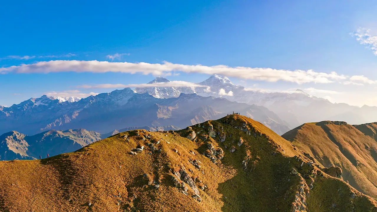
A shorter, highly rewarding day. As you push past 11,000 ft, the dense trees abruptly stop, revealing vast, rolling alpine plains. Establish sweeping open camps with titanic mountains looming overhead.
Key Landmarks
Staying At
Crossing the high-altitude pass bridges two distinct watershed systems, shifting the expedition over the glaciated divide and down into a new river basin.
Camp Alt
9,500 ft
Day Gain
-2,300 ft
Today's Objective
🏔 Summit Gulabi Kantha
Hike the highest points of the undulating ridge line. Look down into the sheer drops on the northern face and soak in the full 360 panorama of the Garhwal peaks. Afterward, pack camp and begin the long descent back into the tree cover.
Key Landmarks
Staying At
The team holds position within the alpine meadow basin, monitoring weather patterns and adapting to the thinning atmosphere.
Camp Alt
7,900 ft
Day Gain
-1,600 ft
Return to Dehradun
A quick, steep morning descent dropping you straight back onto the Yamunotri highway. Board your vehicles for the long drive back down to Dehradun.
Key Landmarks
The mountain valley topography transitions back into the lower foothill river plains.
Trek Extensions & Add-ons
Yamunotri Temple Add-on
+1 DayAfter descending, take a day to hike up the paved path from Janaki Chatti to the sacred Yamunotri temple.
Plan Your Trek:
Ready to book? Compare verified operators for Gulabi Kantha Trek — transparent pricing, no paid rankings.
Still deciding?
Compare routes side-by-side to find the perfect match for your fitness, dates, and budget.
Day by day, camp by camp. Send this to your group so everyone's on the same page.
Step 4: Cost & Logistics
You understand the route.
Now see what services, permits, and logistics actually cost.
View Cost Breakdown