
Explore
Intelligence
Essential Planning Guide
Gulabi Kantha Trek — Complete Guide (2026)
Vibe & Scenery
The Experience
Introduction
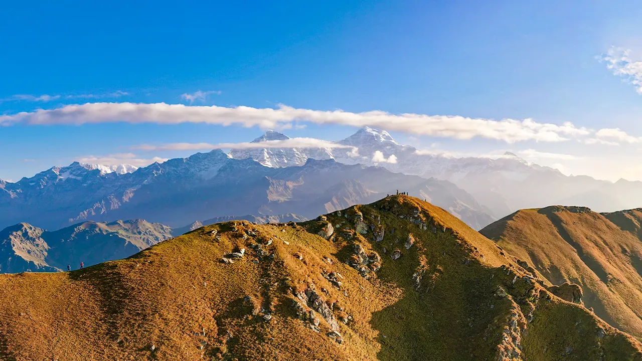
The Gulabi Kantha Trek ascends from the Yamunotri region through oak, rhododendron, and birch forests before reaching an extensive alpine ridgeline at approximately 12,500 ft. During late spring and early summer, sections of the meadows are covered with seasonal wildflowers, giving the ridge its distinctive character.
From the upper slopes, trekkers enjoy broad views of major Garhwal peaks including Bandarpoonch and Black Peak (Kalanag), while the quiet campsites and open grasslands provide a strong sense of wilderness despite the trek's moderate altitude.
Suitable for trekkers seeking uncrowded mountain landscapes and alpine meadow scenery, Gulabi Kantha offers an excellent combination of forests, ridgelines, and panoramic Himalayan views.
Quick Facts
Duration
Max Altitude
Difficulty
Best Time
Trek Distance
Trail Atmosphere
Stargazing
Class 2 Dark Sky
Scent Profile
Silence Level
~25 dB
Vertigo Factor
2 / 10
Iconic Spots
The Open Vastness
Environment
Nature & Culture
Flora & Fauna
Flora
Fauna
The ridges are ancient grazing routes. Shepherds believe the pink flowers only bloom if the mountain gods are pleased with the harvest below.
— Local folklore
Spiritual & Cultural Significance
Located near the Yamunotri region, a sacred pilgrimage area.
🕐 Shrine Timings: N/A
Temple Protocols
Technical Details
Challenge & Preparation
Primarily a cardio demand challenge
A capable trekker's route that balances cardio demand and joint & muscle impact.
Personal Readiness
Am I ready?
Planning
Logistics & Trail Intel
Getting There
Route to Base
Bus or shared jeep from Dehradun ISBT towards Barkot, then onward to Hanuman Chatti
Base Village
Hanuman Chatti
7,900 ft
Nearest Railhead
Rishikesh Railway Station
Nearest Airport
Jolly Grant Airport, Dehradun
Last ATM
Barkot
Nearest Medical Facility
Barkot Civil Hospital
Mobile Signal
Jio works at base and intermittently on top.
Water Sources
Forest streams. The high ridge is notoriously dry, carry extra water from base camp.
Charging
Zero once leaving Hanuman Chatti.
For Drivers
Road Condition
The Yamunotri highway is paved but heavily trafficked in summer by pilgrim buses.
Barkot
Trail Culinary & Diet
Don't miss the N/A
Buy specialized diet items at Dehradun
The Content & Remote Hub
Video Calls
none
Est. 5 Mbps
UPI Reliability
2/10
Permits and Regulations
Standard Uttarkashi forest trekking permits are required. Since it sits on the flanks of the Govind Pashu Vihar National Park buffer, strict leave-no-trace policies apply.
Learn more about how we vet operators and ensure transparency on our why MountRoutes page.
Packing List
Meadow & Forest Layering
- Lightweight, breathable rain shell (The Yamunotri valley catches sudden, heavy afternoon squalls)
- Sturdy ankle-supporting hiking boots (The descent through the oak forest is notoriously slippery when wet)
- Trekking poles (Essential for the steep, relentless climb on Day 1)
High Ridge Protection
- High-grade windproof jacket (The 12,500 ft ridge is entirely exposed to freezing northern gales)
- Warm down layer for the summit camp (Temperatures crash at night due to the lack of tree cover)
Deep Dives
Explore Further
Editor's Notes
The ridge acts as a weather divide. You can often watch a storm tearing up the Yamunotri valley while standing in perfect sunshine.
Explore In Detail
Day by Day Itinerary
5-day route reaching 12,500ft. Covers 30km of varied terrain.
→ See full itinerary with altitude profileDifficulty & Fitness
Rated moderate. Forest trails transitioning into vast rolling meadows. Snow-covered in winter.
→ See difficulty breakdown and fitness guideCost & Pricing
Packages range from ₹6,000 – ₹11,500. Inclusions and hidden costs vary by operator tier.
→ See full cost breakdownFrequently Asked Questions
How difficult is the Gulabi Kantha Trek?
It is classified as a moderate trek. It takes 5 days and reaches a maximum altitude of 12500 ft. Trekkers should have steady cardiovascular endurance.
What is the risk of Acute Mountain Sickness (AMS) on the Gulabi Kantha Trek?
Since the trail climbs up to 12500 ft, there is a distinct risk of AMS. Proper hydration, progressive pacing, and gradual acclimatization are highly advised.
When is the absolute best time to do Gulabi Kantha Trek?
Gulabi Kantha holds dual appeal: Go in May/June to see the 'pink' floral explosion, or go in December/January for a spectacular, uncrowded winter snow climb.
Will I get mobile network or internet connectivity during Gulabi Kantha Trek?
Connectivity is highly sporadic. The last reliable mobile signal is at Hanuman Chatti is a booming hub. Signal drops in the forest but returns strongly on the summit ridge.. Expect complete digital isolation on the trail.
Where is the last reliable ATM before starting the Gulabi Kantha Trek?
The last active ATM is located at Barkot. It is strongly recommended to withdraw sufficient cash at major transit hubs before starting.
Is the drinking water safe on the Gulabi Kantha Trek trail?
Fresh stream water is abundant, but water treatment is mandatory. Boil stream water.
Can I rent trekking gear at Hanuman Chatti?
Yes, basic items like trekking poles, down jackets, and sleeping bags can be rented at Rent in Dehradun before departure..
What permits are required for the Gulabi Kantha Trek?
Standard Uttarkashi forest trekking permits are required. Since it sits on the flanks of the Govind Pashu Vihar National Park buffer, strict leave-no-trace policies apply.
What is the emergency evacuation protocol on the Gulabi Kantha Trek?
Mule evacuation down the main path is extremely fast and reliable. In case of extreme emergencies, helicopter evacuation can be coordinated if weather allows.
Where is the nearest specialized ICU or hospital for Gulabi Kantha Trek?
The nearest specialized ICU is Dehradun. For minor injuries, the nearest primary health center is located at Barkot Civil Hospital.
Is it safe to do the Gulabi Kantha Trek as a solo female or solo traveler?
Feasible for experienced hikers due to the clear trails and close proximity to the highway, but local guides are cheap and highly recommended. The local communities are exceptionally welcoming and hospitable, but having a guide is highly recommended.
Are foreign nationals allowed to do the Gulabi Kantha Trek?
Yes, foreign nationals are fully permitted with standard tourist permits and passport logging at regional checkpoints.
What kind of food is served during the Gulabi Kantha Trek?
We serve highly nutritious, warm vegetarian meals suitable for high altitudes. You will also get to taste N/A on the trail.
Are digital UPI/online payments accepted at the base village of Hanuman Chatti?
While some local shops accept UPI at Hanuman Chatti, connection is highly unreliable due to network dropouts. Make sure to carry physical cash.
What is the local cultural significance or folklore associated with Gulabi Kantha Trek?
The ridges are ancient grazing routes. Shepherds believe the pink flowers only bloom if the mountain gods are pleased with the harvest below.
Still deciding?
Compare routes side-by-side to find the perfect match for your fitness, dates, and budget.
Everything you need to know, in one place. Someone else in your group needs to see this.
Planning Gulabi Kantha Trek?
Get route conditions, operator updates, and season windows before booking.
Don't miss out! Follow us for route updates@mountroutes|LinkedIn
No spam. Only useful trek updates.
Ready to walk this route?
You’ve read the guide, now find the perfect local team to take you there. Compare our verified list of operators.
Compare verified operators