
Explore
Intelligence
Detailed Route
Chenap Bugyal Trek Itinerary — Day by Day Route & Camps
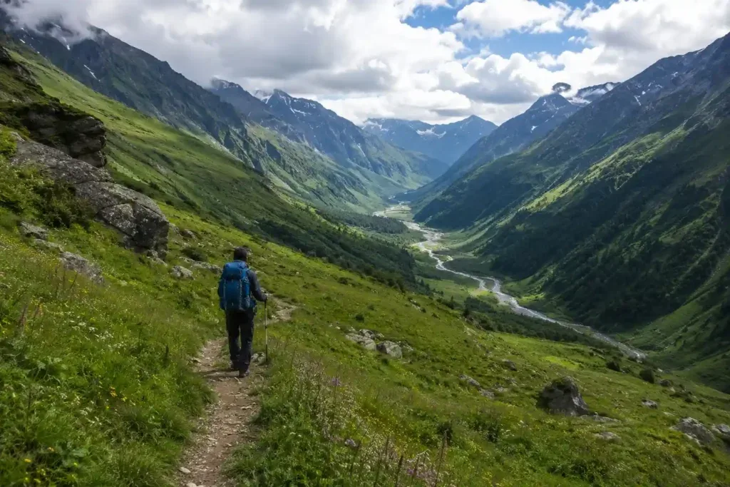
A 6-day offbeat journey starting from Joshimath, climbing through the remote village of Thaing, piercing dense forests, and emerging into the majestic, untouched alpine meadows of Chenap.
Standard RouteThis is the standard mountain pacing for this trek. Specific operators may add an acclimatization day or alter the starting point. Check individual operator schedules for their exact logistics.
Duration
6 Days
Total Distance
10.0 KM
Max Altitude
13,125 FT
Trek Type
circuit
Permits Required Before You Go
Permit Cost
Where to Get
Forest Office, Joshimath
Documents
Original Aadhar/Passport, Two Passport Photos, Medical Fitness Certificate
Foreign Nationals
Foreigners require standard forest clearance. Copies of passport and valid visa must be submitted at Joshimath.
Foreigner Process
Foreigners require a forest permit and may be subject to inner-line regulations depending on current border policies. Check in Joshimath.
Nearest Embassy Hub
New Delhi
Day by Day Breakdown
Camp Alt
6,150 ft
Day Gain
+4,684 ft
Drive to Joshimath
A very long, scenic drive along the Alaknanda river, crossing multiple holy confluences (Prayags) to reach the mountain town of Joshimath.
Key Landmarks
Staying At
The motorable road navigates deeper into the mountain river corridor, where the landscape transitions from lower foothills into the steep, dense forested valleys.
Camp Alt
6,900 ft
Day Gain
+750 ft
Drive to Thaing Village
A short drive to the trailhead, followed by a relatively easy ascent through agricultural fields to the traditional Garhwali village of Thaing.
Key Landmarks
Staying At
Crossing the high-altitude pass bridges two distinct watershed systems, shifting the expedition over the glaciated divide and down into a new river basin.
Camp Alt
9,100 ft
Day Gain
+2,200 ft
Reach Dhar Kharak
The trail enters thick, ancient forests. It is a sustained, steep climb through the tree line, emerging into a small clearing known as Dhar Kharak.
Key Landmarks
Staying At
The trail follows the mountain river corridor through a narrow, forested gorge, moving past traditional settlements into increasingly dense dense forested valleys.
Camp Alt
13,000 ft
Day Gain
+3,900 ft
Today's Objective
🔭 Reach Chenap Bugyal
A massive altitude gain pushing past the tree line into the vast, undulating alpine meadows of Chenap. The final push offers breathtaking views of the Greater Himalayas.
Key Landmarks
Staying At
Crossing the high-altitude pass bridges two distinct watershed systems, shifting the expedition over the glaciated divide and down into a new river basin.
Camp Alt
6,150 ft
Day Gain
-6,850 ft
Trek to Thaing & Drive to Joshimath
A rapid, knee-testing descent all the way back through the forests to Thaing village, followed by the short drive back to civilization in Joshimath.
Key Landmarks
Staying At
The trail follows the mountain river corridor through a narrow, forested gorge, moving past traditional settlements into increasingly dense dense forested valleys.
Camp Alt
1,466 ft
Day Gain
-4,684 ft
Joshimath to Dehradun
Return drive to Dehradun, completing the trek.
Key Landmarks
The mountain valley topography transitions back into the lower foothill river plains.
Trek Extensions & Add-ons
Auli Ropeway and Meadows
+1 DaySpend an extra day in Joshimath to take the cable car up to the famous ski resort and meadows of Auli for massive views of Nanda Devi.
Plan Your Trek:
Ready to book? Compare verified operators for Chenap Bugyal Trek — transparent pricing, no paid rankings.
Still deciding?
Compare routes side-by-side to find the perfect match for your fitness, dates, and budget.
Day by day, camp by camp. Send this to your group so everyone's on the same page.
Step 4: Cost & Logistics
You understand the route.
Now see what services, permits, and logistics actually cost.
View Cost Breakdown