
Explore
Intelligence
Essential Planning Guide
Chenap Bugyal Trek — Complete Guide (2026)
Vibe & Scenery
The Experience
Introduction
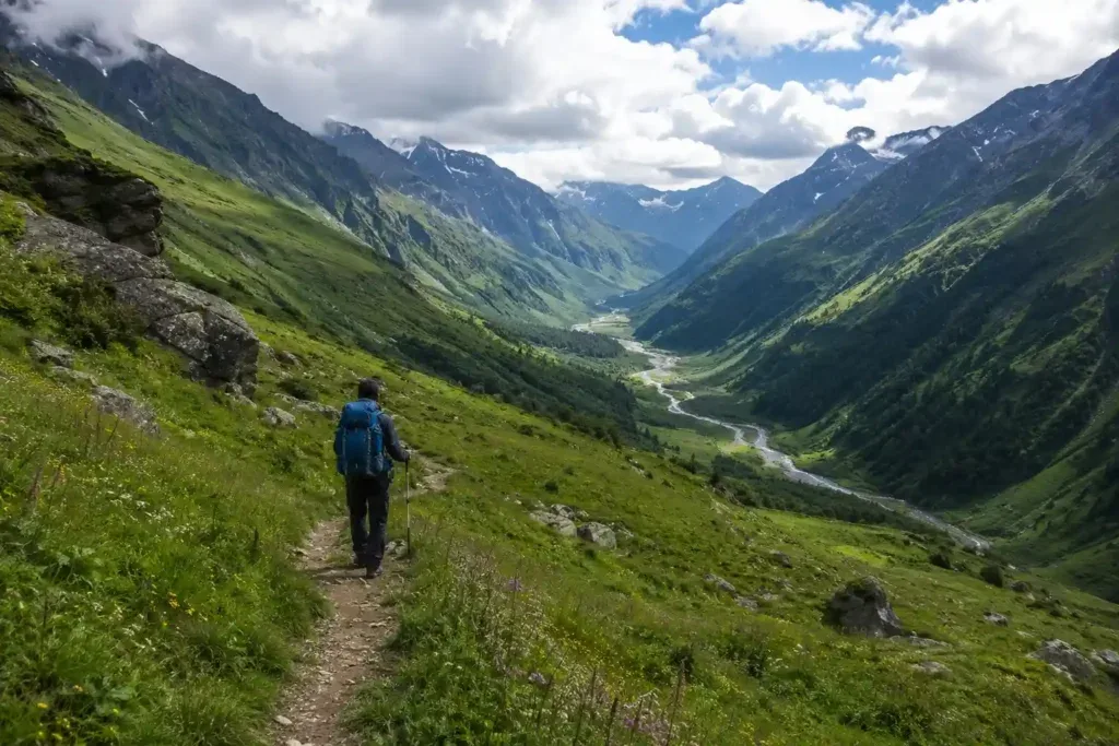
Hidden within the lesser-known valleys bordering the Nanda Devi Biosphere Reserve, the Chenap Bugyal Trek offers a rewarding journey through one of Kumaon's quietest alpine landscapes. The trail climbs gradually through oak, deodar, and rhododendron forests before reaching expansive meadows that bloom with Himalayan wildflowers during summer.
Throughout the trek, panoramic views extend towards Nanda Devi, Dronagiri, and Nanda Kot, while the absence of large trekking groups creates a peaceful wilderness experience. Rich alpine vegetation and varied mountain habitats also make the valley attractive for nature lovers, photographers, and birdwatchers.
Moderate altitude combined with remote camping makes Chenap Bugyal well suited to trekkers seeking solitude beyond Uttarakhand's better-known trekking destinations.
Quick Facts
Duration
Max Altitude
Difficulty
Best Time
Trek Distance
Trail Atmosphere
Stargazing
Class 2 Dark Sky
Scent Profile
Silence Level
~20 dB
Vertigo Factor
2 / 10
Iconic Spots
Thaing Village
Chenap Meadows
Sona Shikhar
Environment
Nature & Culture
Flora & Fauna
Flora
Fauna
The meadows are revered by the locals of Thaing. It is considered disrespectful to pluck the Brahmakamal flowers, which are offered to the local deities.
— Local folklore
Spiritual & Cultural Significance
The entire Nanda Devi biosphere is considered the sanctuary of the Goddess Nanda. Complete reverence for nature is expected.
🕐 Shrine Timings: N/A
Temple Protocols
- •No littering or loud music in the meadows
- •Do not pluck the sacred Brahmakamal flowers
Festivals & Dates
Technical Details
Challenge & Preparation
Primarily a joint & muscle impact and cardio demand challenge
A demanding expedition dominated by extreme joint & muscle impact.
Personal Readiness
Am I ready?
Planning
Logistics & Trail Intel
Getting There
Route to Base
Joshimath is 295 km from Dehradun
The drive takes 10-11 hours along the main Badrinath highway
Shared taxis and buses are easily available from Rishikesh/Dehradun early morning
Base Village
Joshimath
6,150 ft
Last ATM
Joshimath
Nearest Medical Facility
Community Health Centre (CHC), Joshimath.
Mobile Signal
Total blackout past Thaing.
Water Sources
Natural streams are available near Thaing and Dhar Kharak. Carry 2 liters for the climb to Chenap.
Charging
None after Thaing village.
For Drivers
Road Condition
The highway to Joshimath is a major route (part of Char Dham) but is prone to landslides during the monsoon.
Joshimath
Trail Culinary & Diet
Don't miss the Mandua ki Roti (Finger millet bread) with local greens
Buy specialized diet items at Joshimath
The Content & Remote Hub
No DronesDrones are strictly prohibited in the Nanda Devi Biosphere buffer zone without high-level government clearance.Top Vlog Spots
Video Calls
high_at_base
Est. 10 Mbps
UPI Reliability
8/10
Base WiFi Available
Permits and Regulations
Forest entry permits are required as the region falls under the Nanda Devi Biosphere buffer zone. These are obtained at the Forest Department office in Joshimath. Independent trekkers will face scrutiny; it is best to go through a registered operator.
Learn more about how we vet operators and ensure transparency on our why MountRoutes page.
Packing List
Core Clothing Layers
- Dry-fit thermals (top and bottom, x2)
- Fleece jacket or wool sweater for mid-layer insulation
- Lightweight down or synthetic jacket (rated to 0°C)
- Waterproof and breathable shell jacket (mandatory for rain/wind)
- Trekking pants (quick-dry, x2)
- Water-resistant trekking pants or over-pants
Footwear & Protection
- Waterproof trekking boots with ankle support
- Merino wool trekking socks (x3 pairs) and cotton liner socks
- Waterproof gaiters (for early June or post-monsoon mud)
- Camp sandals or lightweight slip-on shoes
- Spare boot laces
Head & Hands
- Fleece beanie for cold evenings
- Wide-brimmed sun hat or trekking cap
- UV-protection sunglasses (Category 3)
- Lightweight fleece liner gloves
- Waterproof outer gloves
Gear & Accessories
- 50-60 litre backpack with a heavy-duty rain cover
- Trekking poles (highly recommended for steep forest ascents)
- Headlamp with spare lithium batteries
- Hydration bladder (2L) or two 1L water bottles
- Personal medical kit (blister tape, AMS medication, pain relief)
- Camera gear with waterproof dry bags
Deep Dives
Explore Further
Editor's Notes
Explore In Detail
Day by Day Itinerary
6-day route reaching 13,125ft. Covers 10.0km of varied terrain.
→ See full itinerary with altitude profileDifficulty & Fitness
Rated challenging. The terrain transitions from village paths to dense, unmaintained forest trails, and finally to open alpine grass. There are no scree or boulder fields, making the footing generally soft but potentially slippery.
→ See difficulty breakdown and fitness guideCost & Pricing
Packages range from 9,000 - 13,000 INR. Inclusions and hidden costs vary by operator tier.
→ See full cost breakdownFrequently Asked Questions
How does the Chenap Bugyal compare to the Valley of Flowers?
While both offer stunning alpine floral blooms, the Valley of Flowers is a well-paved, highly commercialized route with thousands of visitors. Chenap Bugyal is completely offbeat, with raw, unbroken trails, zero commercial infrastructure, and absolute solitude. It requires actual wilderness camping.
Is it safe to trek without a guide?
No. The trail past Thaing village is rarely used and poorly marked. The forest is dense, and it is very easy to lose your way. A local guide from Thaing or Joshimath who knows the shepherds' routes is strictly mandatory.
What kind of flowers will I see on this trek?
Depending on the month (primarily July to September), you can spot Brahmakamal, Blue Poppies, Himalayan Bellflowers, Potentillas, and various species of wild orchids and anemones.
Are there any technical or dangerous sections on the trail?
There are no technical mountaineering sections. However, the forest trails can become extremely muddy and slippery if it rains, and navigating the dense undergrowth requires caution to avoid twisted ankles.
Will I get mobile network coverage during the trek?
You will have a network in Joshimath and intermittently at Thaing village. Once you leave Thaing for the higher camps like Dhar Kharak, there is absolutely zero mobile connectivity.
Where is the nearest medical emergency facility?
The nearest medical facility is the Community Health Centre (CHC) in Joshimath. Any evacuation from Chenap Bugyal must be done manually by stretcher or mule back to Thaing village, which can take 6-8 hours.
Can beginners attempt this trek?
Yes, physically fit beginners can attempt this trek. It is graded Easy to Moderate. The altitude gain is gradual, but the lack of infrastructure means you must be comfortable with raw wilderness camping.
Are mules or porters available to carry backpacks?
Yes, mules and local porters can be arranged from Thaing village. However, this must be coordinated well in advance through your trekking operator in Joshimath, as the village is small and resources are limited.
Still deciding?
Compare routes side-by-side to find the perfect match for your fitness, dates, and budget.
Everything you need to know, in one place. Someone else in your group needs to see this.
Planning Chenap Bugyal Trek?
Get route conditions, operator updates, and season windows before booking.
Don't miss out! Follow us for route updates@mountroutes|LinkedIn
No spam. Only useful trek updates.
Ready to walk this route?
You’ve read the guide, now find the perfect local team to take you there. Compare our verified list of operators.
Compare verified operators