
Explore
Intelligence
Detailed Route
Chaainsheel Bugyal Trek Itinerary — Day by Day Route & Camps
A classic 6-day bugyal trek. Drive to the base village of Himari, hike up through dense oak forests over two days, and spend Day 4 exploring a massive, panoramic alpine ridge.
Standard RouteThis is the standard mountain pacing for this trek. Specific operators may add an acclimatization day or alter the starting point. Check individual operator schedules for their exact logistics.
Duration
6 Days
Total Distance
40.0 KM
Max Altitude
11,750 FT
Trek Type
circuit
Permits Required Before You Go
Permit Cost
Where to Get
Mori / Forest Checkpost
Documents
Original Aadhar Card / Passport
Foreign Nationals
No special restrictions, standard permit applies. Carry passport copies.
Foreigner Process
Standard forest registration. Keep passport copies handy.
Nearest Embassy Hub
New Delhi
Day by Day Breakdown
Camp Alt
5,500 ft
Day Gain
+3,400 ft
Drive Dehradun to Himari Base Camp
A long and scenic drive from Dehradun. You pass through the popular hill station of Mussoorie, drive through the pine forests of Purola, and follow the Tons River deep into the Uttarkashi district. Himari is a quiet, traditional Garhwali village where you will spend your first night acclimatizing.
Key Landmarks
Staying At
The route moves through forested zones. The route follows the river valley. The path breaches the mountain barrier crossing the watershed.
Camp Alt
8,800 ft
Day Gain
+3,300 ft
Reach Akhoti Thach
The trek begins with a steady climb out of Himari village. You quickly enter a dense canopy of ancient oak and pine trees. The trail is well-shaded, and you will cross several small streams, including the Estari Gad. The gradient is moderate but continuous. Akhoti Thach is a beautiful clearing in the forest, perfect for your first wilderness camp.
Key Landmarks
Staying At
The route moves through forested zones. The route follows the river valley.
Field Notes
KEY ACTIONRiver Crossings
Plan to cross early in the day before snowmelt swells the water levels. Unclip backpack waist belts before crossing.
Camp Alt
10,500 ft
Day Gain
+1,700 ft
Reach Gujar Hat
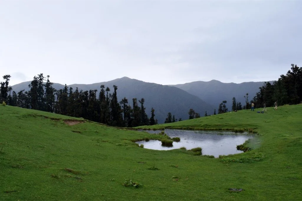
Today is a shorter, incredibly scenic day. You leave the dense oak forests and begin to see the first glimpses of the high alpine meadows. The tree line thins out into beautiful rhododendron shrubs. You will arrive at Gujar Hat by lunchtime. This area is frequented by local Gujjar shepherds during the summer months.
Key Landmarks
Staying At
The route moves through forested zones. The environment transitions into open alpine meadows.
Camp Alt
10,500 ft
Day Gain
0 ft
Today's Objective
🏔 Summit Explore Chaainsheel Bugyal
The highlight of the trek. You leave your heavy bags at camp and hike up to the massive, rolling expanse of Chaainsheel Bugyal. The meadow stretches for kilometers along the ridge that divides Uttarakhand and Himachal Pradesh. The views of the Swargarohini and Bandarpunch peaks are staggering. Spend hours exploring the bugyals before descending back to your camp at Gujar Hat.
Key Landmarks
Staying At
The environment transitions into open alpine meadows. The route ascends to an exposed ridge line.
Camp Alt
5,500 ft
Day Gain
-5,000 ft
Return to Himari
A long descent day. You pack up camp and retrace your steps entirely, walking back down through Akhoti Thach and plunging into the deep oak forests. The 5,000 ft descent is tough on the knees, but the increased oxygen levels make it physically easier. You will reach Himari village by late afternoon.
Key Landmarks
Staying At
The high alpine meadows narrow into forested river terraces as tree line vegetation reappears in the lower mountain river corridor.
Camp Alt
2,100 ft
Day Gain
-3,400 ft
Drive Himari to Dehradun
After breakfast in Himari, board your vehicles for the long drive back through the Tons valley to Dehradun. You will reach the Dehradun railway station or ISBT by early evening, concluding the trek.
Key Landmarks
The mountain valley topography transitions back into the lower foothill river plains.
Trek Extensions & Add-ons
Chanshal Pass Link
+2 DaysExperienced trekkers can traverse the ridge further into Himachal Pradesh to connect with the famous Chanshal Pass.
Plan Your Trek:
Ready to book? Compare verified operators for Chaainsheel Bugyal Trek — transparent pricing, no paid rankings.
Still deciding?
Compare routes side-by-side to find the perfect match for your fitness, dates, and budget.
Day by day, camp by camp. Send this to your group so everyone's on the same page.
Step 4: Cost & Logistics
You understand the route.
Now see what services, permits, and logistics actually cost.
View Cost Breakdown