Difficulty & Readiness Guide
Is Brahmatal Trek Difficult? — Fitness & Altitude Guide
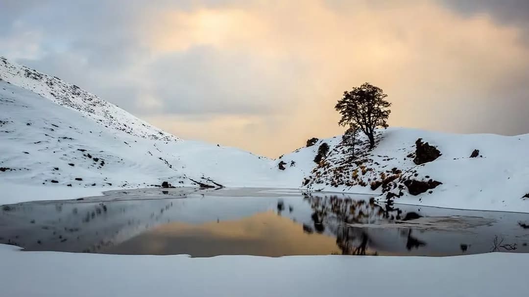
Graded Moderate, Brahmatal Trek needs 4 weeks of cardio — the steep knee-deep snow climb to Brahmatal Top is the crux.
Preparation Required
Intermediate
Prior Experience
Recommended: 1-2 easy Himalayan treks or regular hiking experience.
Score Engine v3
Why This Score?
Stamina
20/100
Based on average nightly altitude gain, highest campsite, and daily distance. Reflects how hard the average day feels.
Spike Day
29/100
Based on max altitude reached, summit day elevation gain, and summit day distance. Reflects the hardest single day.
Why Brahmatal Trek Feels Difficult
A capable trekker's route dominated by extreme joint & muscle impact.
Physiological Demand
Steep, punishing ascents and descents that will heavily tax your knees, ankles, and overall joint stability.
Significant time spent above 12,000ft. Expect shortness of breath and slower pacing.
Rough, uneven trails with occasional scrambling or minor exposure.
Comfortable pacing with moderate daily distances.
Comfortable pacing with good recovery options.
Crux Section
Day 4 — Oxygen Peak
Highest exposure point at 12,250ft.
Brahmatal Trek/ 35
Reality check
Key point
The hardest part of this trek is not the summit — it is the wind exposure at Tilandi Top and Jhandi Top. Clear sky does not mean calm conditions at the ridge. A windproof layer is non-negotiable, not optional.
Caution
Day 4 is longer than it looks — summit plus full descent to Lohajung in one day is 12 km and 9 hours total. Start by 5 AM. Trekkers who start late get caught descending in the dark.
Tip
Do not skip the Brahmatal Lake sunrise on Day 3 morning before moving to camp. It is the emotional highlight of the trek and only 500 m from camp — most people who skip it regret it.
Terrain Breakdown
Forest trails of oak and rhododendron for the first two days. Tilandi and Jhandi Top are open ridge sections with panoramic views but exposed to wind. Summit approach is a ridge walk with gradual gains — no steep technical section.
Summit Day Notes
Ridge walk across Chota and Bada Jhandidar with valleys on both sides throughout. Challenge is sustained walking, not technical difficulty. Same-day descent to Lohajung makes it a long day total.
The Descent
Descent from summit back through forest to Lohajung approximately 9km. Gradual trail but cumulative fatigue makes it tiring. Start early to arrive before dark.
Preparation
Easier than Kedarkantha in total ascent. First day climb from Lohajung to Bekaltal is the steepest section at roughly 1,300ft gain. Running 4–5km comfortably is sufficient base fitness.
Altitude Profile
Maximum altitude 12,250ft — well below serious AMS threshold. Gain spread gradually over 3 trekking days. No single aggressive altitude push.
Run AMS Risk Audit →Route Stress Forecast
Highest exposure point at 12,250ft.
Deep 4,650ft descent will test joint stability.
Day 2 requires the highest sustained output.
*Forecast derived from route geometry and altitude profile. External variables (weather/group) remain the final authority.
Trail Performance Data
Max Gradient
22%
Hydration
0.35L per km recommended
Loose Surface Sections
- •Descent from Tilandi to Lohajung
Common Mistakes on Brahmatal Trek
Most injuries and failures on this trail can be avoided by making smarter decisions early on.
Underestimating wind exposure at Tilandi Top even in clear weather
Visiting without snow — the trek's appeal is heavily winter-dependent
Not carrying enough water — no reliable source between Bekaltal and summit
Skipping the Brahmatal Lake sunrise visit — it is the emotional highlight of the trek
Safety & Medical Risks
Key Risks
Wind exposure at Tilandi Top and Jhandi Top
AMS unlikely but possible above 10,000ft
Slippery trails in winter snow
AMS (Altitude Sickness)
Maximum altitude 12,250ft — AMS risk is low. Hydration and pacing are key. Watch for headache or nausea on Day 3.
Evacuation Route
Descend to Lohajung. Road accessible from Lohajung for evacuation.
Solo Trekking
Manageable solo in non-winter months. In winter, joining an organized group is strongly recommended due to snow and route-finding above Tilandi.
Common Trail Ailments
🏥 Nearest ICU: Brij Lal Hospital, Haldwani / Mattrix Hospital, Kathgodam
Tactical Emergency Hub
> Dewal/Lohajung are the emergency roadheads. Evac to Kathgodam takes 10+ hours.
Who Can Do This Trek?
Min Age
10+
Max Age
65
Western Toilets at Base
Yes
Solo Female Travelers
Highly safe; popular route with helpful local communities.
Expert Verdict
Highly technical trek requiring physical and mental preparation.
Ready to book? Compare verified operators for Brahmatal Trek — transparent pricing, no paid rankings.
Want to know which operators carry certified guides and medical support? See operator safety ratings for Brahmatal Trek
Also on this trek
Still deciding?
Compare routes side-by-side to find the perfect match for your fitness, dates, and budget.
Still think it's doable? Share this with your trek mate and see if they agree.
Fit for the challenge?
For challenging treks, safety is paramount. Find operators prioritizing medical support and guide expertise.
Compare operator safety scores