Compare operators for
Borasu Pass Expedition
No operators listed yet
Interested in this expedition?
We are currently vetting local partners for Borasu Pass Expedition to ensure the highest safety standards. Be the first to know when it's open for booking.
Are you a local operator?
Join our platform to list your verified packages for Borasu Pass Expedition and reach thousands of climbers directly.
Summit Readiness Audit
Before booking your expedition, run your profile through our clinical safety checks. Generate your gear manifest and AMS protocol.
About Borasu Pass Expedition
Borasu Pass at 17,880 ft is one of the highest trekking passes in Uttarakhand, connecting the Har Ki Dun valley to Kinnaur in Himachal Pradesh. This 8-day expert-level trek crosses glacial moraines, crevassed snowfields, and a dramatic pass that straddles two states. Borasu is the ultimate trans-Himalayan crossing for experienced high-altitude trekkers seeking a genuine expedition-grade challenge with virtually zero commercial traffic.
Expedition Highlights
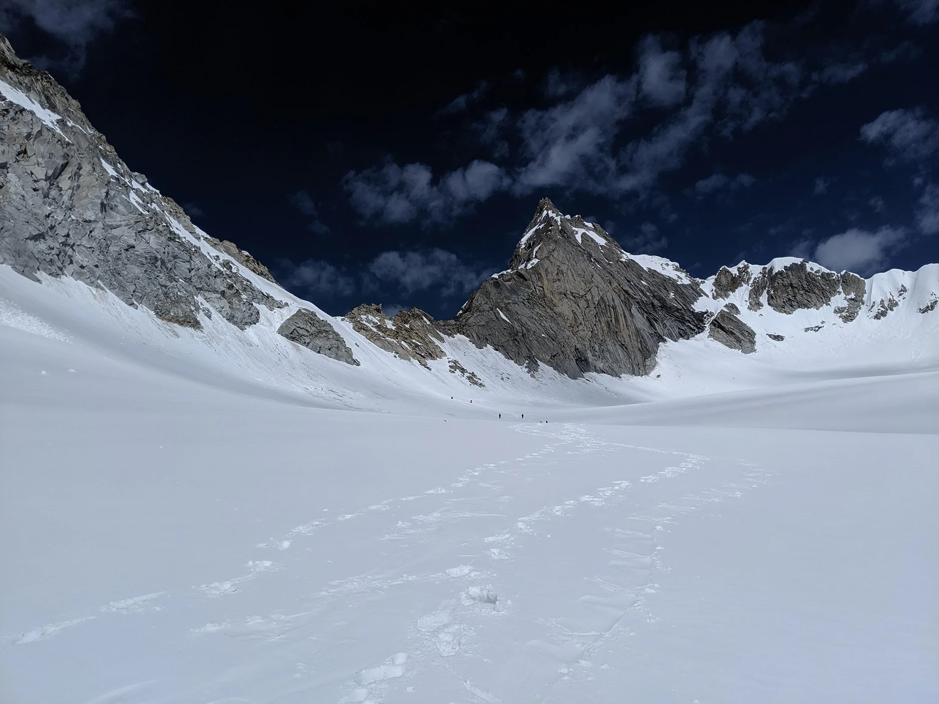
Borasu Summit Crest
360-degree view of Garhwal and Kinnaur snow-peaks meeting at 17,220 ft.
Chitkul Village
The last Indian village on the Indo-Tibetan border terminal with distinct wooden architecture.
Common Questions
How difficult is the Borasu Pass trekking crossover?
Where does the trek start and end?
Do I need a Border Permit?
What is the best month for snow in Borasu?
What peaks can we see from Borasu?
Is it suitable for solo trekkers?
How cold it gets at the base camp?
How difficult is the Borasu Pass trekking crossover?
Where does the trek start and end?
Do I need a Border Permit?
What is the best month for snow in Borasu?
What peaks can we see from Borasu?
Is it suitable for solo trekkers?
How cold it gets at the base camp?
Are you a local operator?
Join our platform to list your verified packages for this expedition.
Get Trek Intelligence Before You Book
Route conditions, operator changes, and the best season windows — once a week.
Don't miss out! Follow us for route updates@mountroutes
No spam. Only useful trek updates.