Traverse Safety & Risk
Sin La Pass Expedition — Safety Guide
Altitude physiology, pass crossing go/no-go criteria, evacuation protocol, and insurance requirements.
Primary Hazards
Death-zone altitude (18,000ft+)
Technical glacier fall
Severe isolation/No exit
AMS Protocol
Mandatory acclimatization at Bidang. Prophylactic Diamox highly advised.
Altitude Physiology — SpO₂ by Camp
Diamox (Acetazolamide)
Recommended
Expedition Medical Kit
Pass Crossing Protocol
GO Conditions
- ✓ Full moon or clear starlight at 1 AM
- ✓ No wind at Bidang
NO-GO Conditions
- ✗ Sudden drop in barometric pressure
- ✗ Visibility < 50m
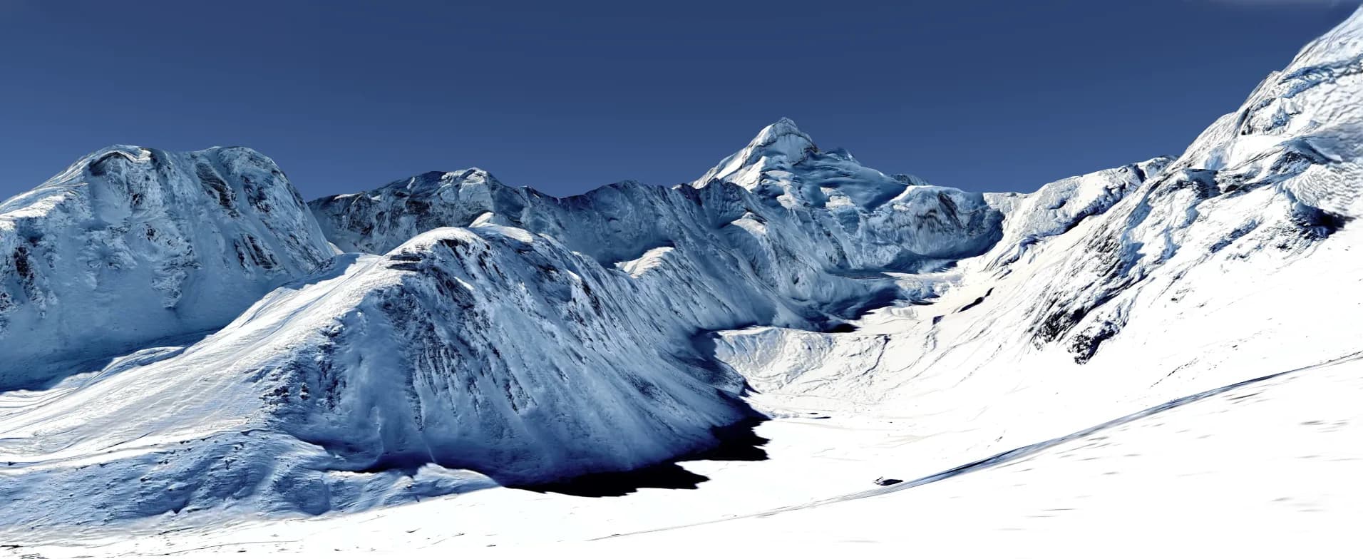
Glacier Hazards — Sin La Glacier
Crevasse Zone
East Face approach to the col
Avalanche Path
South face of Adi Kailash massif
Bergschrund
Historical Safety Record
We publish verified incident records to help trekkers and operators make informed decisions. Names and personal identifiers are anonymized.
Documented
6
verified incidents
Fatalities
0
none recorded
Near Misses
4
logged
We have analysed 6 documented incidents for this expedition to extract critical safety lessons.
Due to the nature of mountaineering — where most non-fatal incidents go unreported — experts estimate 16+ total historical incidents on this route. Estimated historical fatalities: 2. We present the documented record as-is rather than speculate on undocumented cases.
Year
2020
HAPE — High Altitude Pulmonary Edema
Outcome
Assisted descent by team
Contributing Cause
Rapid ascent without adequate rest days
Key Safety Lesson
Always hAPE can strike suddenly. The only cure is immediate descent, regardless of the time of day.
Year
2019
Fall — Rocky Terrain
Outcome
Self-recovered
Contributing Cause
Loose scree and insufficient footwear traction
Key Safety Lesson
Always move quickly and quietly through steep gorges. Helmets must be worn at all times.
Year
2018
Fall — Rocky Terrain
Outcome
Self-recovered
Contributing Cause
Loose scree and insufficient footwear traction
Key Safety Lesson
Always the final ascent to Sin La is steep scree. Wear helmets to protect against rocks dislodged by climbers above.
Year
2018
Lost / Navigation Failure
Outcome
Self-recovered
Contributing Cause
Whiteout conditions with no GPS track loaded
Key Safety Lesson
Always without a GPS track, a whiteout on a glacier is a death trap. Always carry redundant navigation.
Year
2017
Crevasse Fall
Outcome
Rescue by external team
Contributing Cause
Contributing factors not fully documented
Key Safety Lesson
Always snow bridges weaken in the afternoon. Cross glaciers strictly between 3 AM and 8 AM.
Year
2015
Fall — Rocky Terrain
Outcome
Medical treatment at base camp
Contributing Cause
Contributing factors not fully documented
Key Safety Lesson
Always global warming is loosening mountain faces. Be hyper-vigilant when crossing below rock walls.
Source: Public Records / News Reports
Why estimates differ from records: IMF and news sources only capture permitted expeditions and helicopter rescues. Non-fatal near-misses (AMS, frostbite, falls with self-rescue) are almost never filed. Peaks with multi-decade climbing histories compound these gaps significantly.
Emergency Contacts
Evacuation Route
Helicopter from Bidang or Jolingkong (Military pads)
Compare Operators on Safety Standards
See which operators carry certified guides, satellite comms, and medical support for Sin La Pass Expedition.
View OperatorsStill deciding?
Compare routes side-by-side to find the perfect match for your fitness, dates, and budget.
Knowledge Integrity
Help us keep this data ground-truth accurate.
This encyclopedia entry for Sin La Pass Expedition is curated from a mix of public survey records, first-hand climber accounts, and official permit logs. However, mountains are dynamic. If you have been on this route recently and noticed a change in terrain, water availability, or local regulations, we want to hear from you.
Community Vetted
Last Verified: May 2026
EXPEDITION DATABASE