
Explore
Intelligence
Detailed Route
Ralam Dhurra Pass Expedition Itinerary — Day by Day Route & Camps
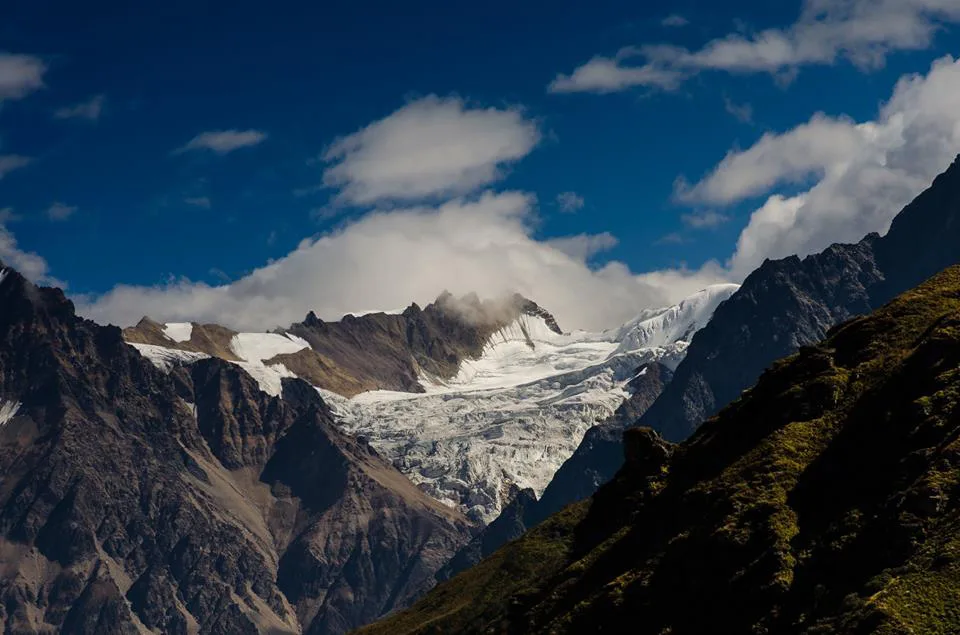
A 12-day hyper-remote traverse from Munsiyari (Johar Valley) over the massive Ralam and Yangchari glaciers, crossing Ralam Dhurra to end in Darma Valley.
Standard RouteThis is the baseline pacing strategy for this expedition. Expedition leaders frequently modify rotation schedules, add reserve weather days, or adjust high camps based on real-time mountain conditions. Consult the operator's expedition dossier for their precise approach.
Duration
12 Days
Total Distance
54.0 KM
Max Altitude
18,471 FT
Trek Type
circuit
Permits Required Before You Go
Permit Cost
Foreigner Process
Requires IMF clearance and Inner Line Permits. Complex process.
Nearest Embassy Hub
New Delhi
Day by Day Breakdown
Camp Alt
7,200 ft
Day Gain
+5,500 ft
Drive to Munsiyari
A 10-12 hour drive deep into the Kumaon Himalayas. Munsiyari serves as the logistical base for all Johar valley expeditions.
Key Landmarks
Staying At
The road climbs through the dense forests and terraced fields of the Kumaon foothills, culminating in the panoramic ridge settlements of Munsiyari.
Camp Alt
10,500 ft
Day Gain
+3,300 ft
Drive to Lilam & Trek into Ralam Valley
A short drive drops the team at the Paton trailhead. The trek begins with a steep ascent through dense rhododendron and bamboo forests to the high pastures of Lungriyani.
Key Landmarks
Staying At
The motorable road ends, transitioning the journey into the narrow, steep-sided gorges that mark the entrance to the remote Ralam valley.
Field Notes
KEY ACTIONHelmet Mandatory
Helmet mandatory. Move quickly and quietly through the rockfall zone without stopping to rest.
KEY ACTIONRiver Crossings
Plan to cross early in the day before snowmelt swells the water levels. Unclip backpack waist belts before crossing.
Camp Alt
12,000 ft
Day Gain
+1,500 ft
Reach Ralam Village
The trail pushes higher above the tree line. Ralam is a remote, seasonal Bhotiya settlement and the last inhabited point on this route. Acclimatization begins to kick in.
Key Landmarks
Staying At
The trail follows the Ralam Gad river, breaking out of the confined gorge into the high-altitude pastoral meadows surrounding Ralam Village.
Field Notes
KEY ACTIONHelmet Mandatory
Helmet mandatory. Move quickly and quietly through the rockfall zone without stopping to rest.
Use Trekking Poles
Trekking poles are highly recommended to save your knees on the descent.
INFOSlower Progress
Progress will be significantly slower and more taxing on your ankles than trail distance suggests.
Camp Alt
12,000 ft
Day Gain
0 ft
Today's Objective
☕ Acclimatization & Recovery
Mandatory rest day. The team will perform a short acclimatization hike towards the snout of the Ralam Glacier to inspect equipment and gauge fitness.
Staying At
The expedition remains within the pastoral bowl of Ralam village, surrounded by barren alpine ridges and the distant glacial peaks of the Kumaon Himalaya.
Camp Alt
14,500 ft
Day Gain
+2,500 ft
Reach Yangchari Base Camp
Leaving civilization entirely. The route moves onto the lateral moraine of the Ralam Glacier system, navigating massive boulders and icy streams to establish camp below the Yangchari Glacier.
Key Landmarks
Staying At
Vegetation gives way to rocky moraine as the route ascends deeper into the high ablation zone toward Yangchari base camp.
Field Notes
KEY ACTIONRoped Travel
Requires roped glacier travel.
KEY ACTIONStart Early
Start before sunrise to ensure snow bridges remain solid.
KEY ACTIONHelmet Mandatory
Helmet mandatory. Move quickly and quietly through the rockfall zone without stopping to rest.
KEY ACTIONRiver Crossings
Plan to cross early in the day before snowmelt swells the water levels. Unclip backpack waist belts before crossing.
Use Trekking Poles
Trekking poles are highly recommended to save your knees on the descent.
Camp Alt
16,500 ft
Day Gain
+2,000 ft
Reach Ralam Dhurra Base Camp
A highly technical day. The team transitions onto hard glacier ice. Crampons and roped travel are mandatory from here on. The camp is established on the ice, directly beneath the pass headwall.
Key Landmarks
Staying At
The terrain shifts entirely to technical glacier travel, ascending deep into a severe, freezing ice basin directly beneath the pass headwall.
Field Notes
KEY ACTIONRoped Travel
Requires roped glacier travel.
KEY ACTIONStart Early
Start before sunrise to ensure snow bridges remain solid.
KEY ACTIONHarness Gear
Harness-compatible gear is mandatory.
KEY ACTIONHelmet Mandatory
Helmet mandatory. Move quickly and quietly through the rockfall zone without stopping to rest.
Use Trekking Poles
Trekking poles are highly recommended to save your knees on the descent.
Camp Alt
16,500 ft
Day Gain
0 ft
Route Opening & Ice Gully Preparation
Lead climbers navigate severe avalanche zones and steep ice gullies to fix essential static ropes. The primary team undergoes mandatory rest at base camp to preserve energy for the massive technical crossing ahead.
Staying At
The route focuses strictly on vertical progression, pushing above the broken glacier basin onto the sheer ice gullies guarding the watershed divide.
Field Notes
KEY ACTIONRoped Travel
Requires roped glacier travel.
KEY ACTIONStart Early
Start before sunrise to ensure snow bridges remain solid.
KEY ACTIONEarly Movement
Prioritize early morning movement and strictly avoid lingering beneath loaded snow slopes.
KEY ACTIONHarness Gear
Harness-compatible gear is mandatory.
INFOPacing Delays
Slower pacing expected due to bottlenecking on fixed lines.
Camp Alt
11,500 ft
Day Gain
-5,000 ft
Today's Objective
🏔 Cross Cross Ralam Dhurra Pass
A 1:00 AM alpine start jumaring up fixed ropes over steep blue ice. The descent into the Darma valley is a steep and technical drop, requiring multiple rappels into a complex, crevassed glacier system before reaching Sipu.
Key Landmarks
Staying At
Crossing the pass bridges the Ralam and Darma valleys, shifting the expedition over the watershed divide and down onto the heavily broken glaciers of the eastern slopes.
Field Notes
KEY ACTIONRoped Travel
Requires roped glacier travel.
KEY ACTIONStart Early
Start before sunrise to ensure snow bridges remain solid.
KEY ACTIONHarness Gear
Harness-compatible gear is mandatory.
KEY ACTIONHelmet Mandatory
Helmet mandatory. Move quickly and quietly through the rockfall zone without stopping to rest.
Use Trekking Poles
Trekking poles are highly recommended to save your knees on the descent.
Camp Alt
10,000 ft
Day Gain
-1,500 ft
Descend to Sipu & Explore Panchachuli Base Camp
A relatively relaxed day trekking through the gorgeous Darma valley alongside the Lassar Yankti river. Unbelievable views of the eastern face of the Panchachuli peaks dominate the horizon.
Key Landmarks
Staying At
The fractured ice and moraine of the upper basin transition quickly back into alpine meadows and the remote high-altitude settlements of the Darma valley.
Field Notes
KEY ACTIONHelmet Mandatory
Helmet mandatory. Move quickly and quietly through the rockfall zone without stopping to rest.
KEY ACTIONRiver Crossings
Plan to cross early in the day before snowmelt swells the water levels. Unclip backpack waist belts before crossing.
Use Trekking Poles
Trekking poles are highly recommended to save your knees on the descent.
INFOSlower Progress
Progress will be significantly slower and more taxing on your ankles than trail distance suggests.
Camp Alt
3,500 ft
Day Gain
-6,500 ft
Trek to Dharchula & Drive to Pithoragarh
Trek down to the roadhead at Duktu/Dar, then board 4x4 vehicles for the bone-rattling descent to Dharchula on the banks of the Kali river.
Key Landmarks
Staying At
The deep, forested gorges of the Darma valley gradually widen into the rolling foothills of the lower Kumaon region near the Nepal border.
Field Notes
KEY ACTIONHelmet Mandatory
Helmet mandatory. Move quickly and quietly through the rockfall zone without stopping to rest.
KEY ACTIONRiver Crossings
Plan to cross early in the day before snowmelt swells the water levels. Unclip backpack waist belts before crossing.
Day Gain
0 ft
Today's Objective
☕ Acclimatization & Recovery
Crucial buffer day for bad weather, extended rope fixing, or slow acclimatization on the glacier.
Staying At
The team holds position within the high alpine basin, monitoring barometric shifts and weather patterns.
Camp Alt
2,000 ft
Day Gain
-1,500 ft
Drive to Kathgodam
Final long drive out of the mountains, concluding the expedition.
The mountain valley topography transitions back into the lower foothill river plains of the Ganges basin.
Camp-by-Camp Details
Munsiyari
Start Town
Water
Municipal
Wind
low
Night Temp
12°C
Toilet
Western
Hotel accommodation.
Yangchari Base Camp
moraine_camp
Water
Glacial Stream
Wind
high
Night Temp
-5°C
Toilet
Dry Pit
Heavy boulder clearing required. Very uncomfortable rocky base.
Ralam Dhurra Base Camp
glacier_camp
Water
Melted Ice
Wind
extreme
Night Temp
-15°C
Toilet
Dry Pit
Pitched entirely on hard ice. Ice screws used to secure tents.
Navigation & Route Data
Magnetic Declination
+1.5°
Key Waypoints
Critical Navigation Notes
Glacier moraines shift annually. GPX tracks are unreliable. Local expert guide is mandatory.
Plan Your Expedition:
Ready to book? Compare verified operators for Ralam Dhurra Pass Expedition — transparent pricing, no paid rankings.
Still deciding?
Compare routes side-by-side to find the perfect match for your fitness, dates, and budget.
Day by day, camp by camp. Send this to your group so everyone's on the same page.
Step 4: Safety & Framework
You understand the route.
Now understand the hazards, physiology, and Go/No-Go decision framework.
View Safety Framework