
Explore
Intelligence
Essential Planning Guide
Ralam Dhurra Pass Expedition — Complete Guide (2026)
Vibe & Scenery
The Experience
Introduction
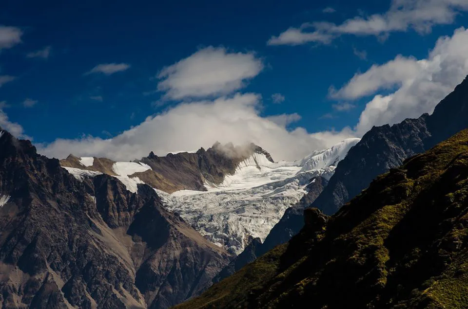
Ralam Dhurra is one of Kumaon's great alpine crossings, linking the historic Johar and Darma valleys across an isolated section of the Greater Himalaya. The expedition traverses the extensive Ralam and Yangchari glacier systems before crossing the 18,471 ft pass beneath the Panchachuli massif.
Beyond the last seasonal settlements, the route enters an environment where navigation, glacier assessment, and expedition logistics become as important as physical endurance. Teams travel across crevassed glaciers, moraine fields, and steep snow slopes while remaining entirely self-supported.
Sustained altitude, difficult access, and prolonged glacier travel make Ralam Dhurra suitable only for experienced mountaineers comfortable with multi-day alpine expeditions.
Quick Facts
Duration
Max Altitude
Difficulty
Best Time
Trek Distance
Trail Atmosphere
Stargazing
Class 1 Dark Sky
Scent Profile
Silence Level
~10 dB
Vertigo Factor
9 / 10
Iconic Spots
Ralam Dhurra Pass (5,645m)
Kalabaland & Ralam Glaciers
Ancient Kumaoni Villages
Rhododendron to Alpine Desert
Exposed Ridge Traverse
Environment
Nature & Culture
Flora & Fauna
Flora
Fauna
An ancient, perilous trade route used by the Bhotiya tribes to access Tibet.
— Local folklore
Spiritual & Cultural Significance
Deeply tied to the animistic beliefs of the local Johari and Darmiya tribes.
Temple Protocols
Technical Details
Challenge & Preparation
Primarily a cardio demand and joint & muscle impact challenge
A demanding expedition with extreme cardio demand and joint & muscle impact.
Personal Readiness
Am I ready?
Planning
Logistics & Trail Intel
Getting There
Route to Base
Train to Kathgodam, then a 12-hour drive to Munsiyari
Base Village
Munsiyari
7,200 ft
Nearest Railhead
Kathgodam
Nearest Airport
Pantnagar / Jolly Grant
Last ATM
Munsiyari
Nearest Medical Facility
Primary Health Center in Munsiyari
Mobile Signal
None
Water Sources
Melted ice.
Charging
None. Solar only.
For Drivers
Road Condition
Roads in Kumaon are highly susceptible to monsoon landslides.
Munsiyari
Trail Culinary & Diet
Don't miss the Tsampa and High-calorie Dal.
Buy specialized diet items at Kathgodam
The Content & Remote Hub
UPI Reliability
1/10
Permits and Regulations
Due to the proximity of the Tibetan border in the Johar and Darma valleys, military checks by the ITBP are frequent and strict.
Learn more about how we vet operators and ensure transparency on our why MountRoutes page.
Packing List
Technical Hardware
- 12-point Mountaineering Crampons
- Ice Axe
- Climbing Harness
- Ascender and Descender
- Locking Carabiners
- Climbing Helmet
High-Altitude Clothing
- Heavy down jacket (-25°C rating)
- Gore-Tex Hardshell jacket and pants
- Merino wool baselayers
- Fleece mid-layers
- Waterproof alpine gloves
- Balaclava
- Expedition woolen socks
Footwear
- Double Mountaineering Boots
- Heavy-duty waterproof gaiters
- Camp booties
- Trekking poles with snow baskets
Survival & Medical
- Category 4 Glacier Glasses
- High-lumen headlamp
- Personal medical kit (Diamox, Dexamethasone)
- High SPF Sunscreen (50+)
- Insulated Nalgene bottles
Deep Dives
Explore Further
Editor's Notes
Explore In Detail
Day by Day Itinerary
12-day route reaching 18,471ft. Covers 54.0km of varied terrain.
→ See full itinerary with altitude profileDifficulty & Fitness
Rated challenging. You transition from lush Kumaon forests to pure, brutal glacial ice for 4 days.
→ See difficulty breakdown and fitness guideCost & Pricing
Packages range from ₹90,000 – ₹1,60,000+. Inclusions and hidden costs vary by operator tier.
→ See full cost breakdownFrequently Asked Questions
Is Ralam Dhurra the same as the Ralam Glacier trek?
No. The Ralam Glacier trek stops near the glacier snout. The Ralam Dhurra expedition goes entirely over the technical icefalls to cross the 18,471 ft pass into the Darma valley.
Do I need ice climbing experience?
Yes. You must know how to use crampons on steep blue ice and how to jumar up fixed static lines.
Can this be done in summer (July/August)?
Absolutely not. The monsoon makes the approach routes wash away and turns the glacier into a death trap of collapsing seracs.
Why is double footwear necessary?
Temperatures at 18,000+ ft during an alpine 1:00 AM start will plunge to -20°C. Single boots will result in frostbite.
Is there a trail on the glacier?
No. The route is entirely unmapped and changes every season based on crevasse formations. Expert guide navigation is mandatory.
How do you descend into the Darma Valley?
The eastern face of Ralam Dhurra is terrifyingly steep. It typically requires rappelling down fixed lines into the heavily broken Darma glacier system.
What happens if someone gets AMS?
They must be immediately evacuated down. If caught on the pass day, it requires a highly complex stretcher lowering by the Sherpa team.
Are permits easy to get?
No. The Johar and Darma valleys border Tibet. Inner Line Permits and IMF expedition clearances are strictly enforced and take weeks to process.
Still deciding?
Compare routes side-by-side to find the perfect match for your fitness, dates, and budget.
Everything you need to know, in one place. Someone else in your group needs to see this.
Planning Ralam Dhurra Pass Expedition?
Get route conditions, operator updates, and season windows before booking.
Don't miss out! Follow us for route updates@mountroutes|LinkedIn
No spam. Only useful trek updates.
Ready to walk this route?
You’ve read the guide, now find the perfect local team to take you there. Compare our verified list of operators.
Compare verified operators