Detailed Route
Dzo Jongo East Peak Expedition Itinerary — Day by Day Route & Camps
A high-fidelity 12-day program from Leh, trekking through Skiu, Markha, Nimaling to the Dzo Jongo East BC, with a reserve day before returning via Kongmaru La.
Standard RouteThis is the standard mountain pacing for this trek. Specific operators may add an acclimatization day or alter the starting point. Check individual operator schedules for their exact logistics.
Duration
12 Days
Total Distance
85 KM
Max Altitude
20,299 FT
Trek Type
Standard
Permits Required Before You Go
Foreigner Process
Requires PAP/ILP and IMF clearances.
Nearest Embassy Hub
New Delhi
Day by Day Breakdown
Arrive in Leh & Acclimatize
No exertion. Altitude 3,500m. Complete rest mandatory to prevent AMS.
Key Landmarks
Leh Acclimatization Walk
Short walk to Namgyal Tsemo monastery or Leh Market. Keep hydrated and check SpO2 levels.
Key Landmarks
Drive to Chilling & Trek to Skiu
Drive ~2hrs along the Indus river to Chilling, then cross the Zanskar river and trek into Markha Valley canyon.
Key Landmarks
Reach Markha Village
Trek along the Markha river. Cross multiple wooden bridges and pass ancient stupas and remote hamlets.
Key Landmarks
Reach Thachungtse
The canyon widens into beautiful alpine pastures. Enjoy the first clear views of Kang Yatse massif.
Key Landmarks
Reach Nimaling
Short but steep climb to the stunning high-altitude pasture plateau of Nimaling at 4,700m.
Key Landmarks
Reach Dzo Jongo East Base Camp
Approach the Dzo Jongo East base camp near the lateral moraine. Establish camp at 5,050m.
Key Landmarks
Technical Training & Acclimatization
Crampon and ice-axe practice on nearby snow slopes. Rest and load up on calories and fluids.
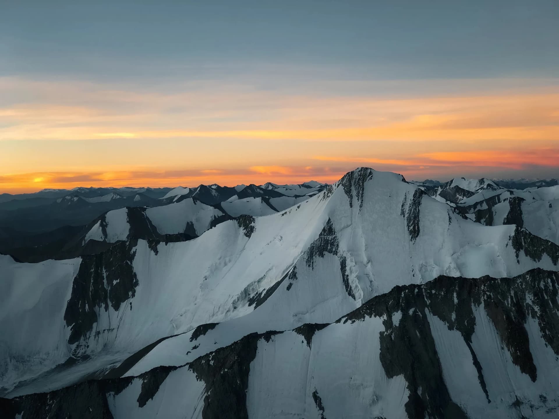
Summit Push & Return to Base Camp
Alpine start at 2 AM. Gradual snow ascent via the East Ridge. Summit at 20,305ft. Return to Base Camp.
Key Landmarks
Weather Buffer Day
Reserve day in case of high winds or bad weather on Day 9. Otherwise full recovery day.
Trek to Chilling & Drive to Leh
Trek via the high pass of Kongmaru La (5,236m) and descend down the narrow gorge to Chokdo, then drive to Leh.
Key Landmarks
Departure
Transfer to Leh airport for departure flight. End of expedition.
Also on this trek
Ready to book? Compare verified operators for Dzo Jongo East Peak Expedition — transparent pricing, no paid rankings.
Still deciding?
Compare routes side-by-side to find the perfect match for your fitness, dates, and budget.
Day by day, camp by camp. Send this to your group so everyone's on the same page.
Love this itinerary?
Find operators who follow this exact route with verified acclimatization days.
Find matching operators