Detailed Route
Bara Shigri Glacier Traverse Expedition Itinerary — Day by Day Route & Camps
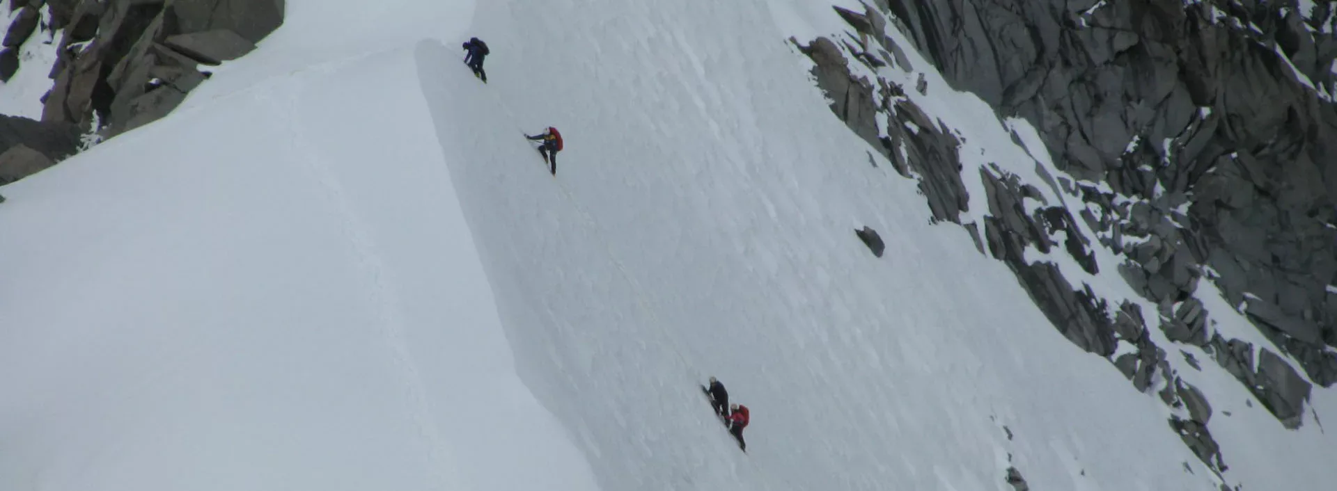
A deep glacier penetration starting from Batal, often crossing high passes like Gunther's Col.
Standard RouteThis is the standard mountain pacing for this trek. Specific operators may add an acclimatization day or alter the starting point. Check individual operator schedules for their exact logistics.
Duration
8 Days
Total Distance
40 KM
Max Altitude
16,503 FT
Trek Type
circuit
Permits Required Before You Go
Permit Cost
Foreigner Process
Inner Line Permit (ILP) required beyond Kaza; PAP for specific higher zones.
Nearest Embassy Hub
Delhi
Day by Day Breakdown
Drive Manali to Batal
Drive via Atal Tunnel and Gramphoo into the stark Spiti-Lahaul transition zone. Batal is the last basic shelter point before the glacier region.
Key Landmarks
Staying At
Trek Batal to Snout Camp
Enter the glacial world. Traverse unstable moraine, loose scree, and glacial outwash zones toward the massive snout of Bara Shigri Glacier.
Key Landmarks
Staying At
Trek Snout Camp to Upper Glacier Camp
Progress deeper into the glacier basin. Terrain becomes increasingly unstable with ice, moraine ridges, and hidden meltwater channels.
Key Landmarks
Staying At
Glacier Exploration & Icefall Traverse
Exploration day across the glacier system. Navigate moraine ridges, crevasse-prone sections, and icefall viewpoints beneath towering Himalayan walls.
Key Landmarks
Staying At
Trek Upper Glacier Camp to Snout Camp
Retrace the moraine route back down-glacier. Descending is physically demanding because of unstable boulder terrain.
Key Landmarks
Staying At
Trek Snout Camp to Batal
Exit the glacier basin and descend toward the Chandra river valley and Batal roadhead.
Key Landmarks
Staying At
Drive Batal to Manali
Drive back via Chhatru and Atal Tunnel into the greener Kullu valley.
Key Landmarks
Staying At
Reserve Day / Weather Buffer
Buffer day at the highest camp.
Staying At
Trek Extensions & Add-ons
Gunther Peak Climb
+3 DaysCombine the glacier exploration with an approach to the Gunther Peak base for high-altitude technical training.
Also on this trek
Ready to book? Compare verified operators for Bara Shigri Glacier Traverse Expedition — transparent pricing, no paid rankings.
Still deciding?
Compare routes side-by-side to find the perfect match for your fitness, dates, and budget.
Day by day, camp by camp. Send this to your group so everyone's on the same page.
Love this itinerary?
Find operators who follow this exact route with verified acclimatization days.
Find matching operators