
Explore
Intelligence
Detailed Route
Zalung Karpo La Trek Itinerary — Day by Day Route & Camps
A 7-day trekking traverse. Start on the popular Markha valley trail, deviate into absolute wilderness at Hankar, cross the massive Zalung Karpo La pass, and finish in the nomadic plains of Dat.
Standard RouteThis is the standard mountain pacing for this trek. Specific operators may add an acclimatization day or alter the starting point. Check individual operator schedules for their exact logistics.
Duration
7 Days
Total Distance
75.0 KM
Max Altitude
17,480 FT
Trek Type
circuit
Permits Required Before You Go
Permit Cost
Where to Get
Leh DC Office / Online
Documents
Original Aadhar Card / Passport, Medical Fitness Certificate
Foreign Nationals
Foreigners MUST travel in a group of at least 2 with a registered travel agency to get the PAP.
Foreigner Process
Protected Area Permit (PAP) mandatory. Must be processed by a registered travel agent in Leh.
Nearest Embassy Hub
New Delhi
Day by Day Breakdown
Camp Alt
12,300 ft
Day Gain
+800 ft
Drive to Skiu & Trek to Markha
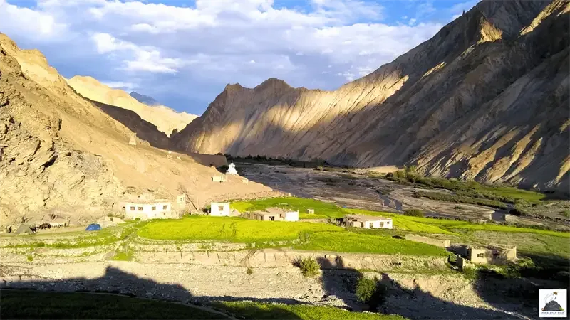
After your mandatory acclimatization days in Leh, drive to the roadhead at Skiu (or Thinlespa). From here, you begin the trek, following the Markha river upstream through a stunning, barren gorge dotted with ancient chortens. You will cross the river a few times before arriving at Markha, the largest village in the valley.
Key Landmarks
Staying At
Tree line disappears as the valley broadens into a spectacular high-altitude alpine meadow basin, replacing the dense forests with expansive grazing pastures.
Field Notes
KEY ACTIONRiver Crossings
Plan to cross early in the day before snowmelt swells the water levels. Unclip backpack waist belts before crossing.
Use Trekking Poles
Trekking poles are highly recommended to save your knees on the descent.
INFOSlower Progress
Progress will be significantly slower and more taxing on your ankles than trail distance suggests.
Camp Alt
13,100 ft
Day Gain
+800 ft
Reach Hankar
The trail continues up the valley. You will pass the Umlung monastery, perched high on a cliff. As you approach Hankar, the massive, snow-capped peak of Kang Yatse (6,400m) suddenly dominates the horizon. Hankar is the highest permanently inhabited village in the valley and marks the end of the 'standard' commercial trail.
Key Landmarks
Staying At
Tree line disappears as the valley broadens into a spectacular high-altitude alpine meadow basin, replacing the dense forests with expansive grazing pastures.
Field Notes
Use Trekking Poles
Trekking poles are highly recommended to save your knees on the descent.
INFOSlower Progress
Progress will be significantly slower and more taxing on your ankles than trail distance suggests.
Camp Alt
14,700 ft
Day Gain
+1,600 ft
Reach Langthang Chen
The true expedition begins today. While most trekkers turn left towards Nimaling, you will continue straight/right into the Langthang gorge. The trail disappears, replaced by a rocky riverbed. You are now entirely in the wilderness. The camp at Langthang Chen is a desolate, rocky expanse.
Key Landmarks
Staying At
Crossing the high-altitude pass bridges two distinct watershed systems, shifting the expedition over the glaciated divide and down into a new river basin.
Field Notes
KEY ACTIONRiver Crossings
Plan to cross early in the day before snowmelt swells the water levels. Unclip backpack waist belts before crossing.
Use Trekking Poles
Trekking poles are highly recommended to save your knees on the descent.
INFOSlower Progress
Progress will be significantly slower and more taxing on your ankles than trail distance suggests.
Camp Alt
15,400 ft
Day Gain
+700 ft
Reach Zalung Karpo La Base
A shorter but strenuous day to position yourself for the pass crossing. The vegetation completely disappears, leaving only barren rocks and glacial streams. You climb steadily to the base camp of Zalung Karpo La. The night here will be freezing, even in August.
Key Landmarks
Staying At
The route follows the river valley. The path breaches the mountain barrier crossing the watershed.
Field Notes
KEY ACTIONRiver Crossings
Plan to cross early in the day before snowmelt swells the water levels. Unclip backpack waist belts before crossing.
Use Trekking Poles
Trekking poles are highly recommended to save your knees on the descent.
INFOSlower Progress
Progress will be significantly slower and more taxing on your ankles than trail distance suggests.
Camp Alt
14,800 ft
Day Gain
-600 ft
Today's Objective
🏔 Cross Zalung Karpo La Pass
The climax of the expedition. You start early, grinding up the steep, loose scree to crest Zalung Karpo La (17,050 ft). From the pass, you have a staggering view of the Zanskar range and the vast Changthang plateau. The descent on the other side into the Kharnak region is incredibly steep and dusty. You finally reach the grassy campsite of Sorra, surrounded by towering red rock cliffs.
Key Landmarks
Staying At
Crossing the high-altitude pass bridges two distinct watershed systems, shifting the expedition over the glaciated divide and down into a new river basin.
Field Notes
Use Trekking Poles
Trekking poles are highly recommended to save your knees on the descent.
INFOSlower Progress
Progress will be significantly slower and more taxing on your ankles than trail distance suggests.
Camp Alt
14,100 ft
Day Gain
-700 ft
Reach Dat
You trek through a dramatic, narrow gorge carved by the Kharnak river, requiring several deep river crossings. The gorge eventually opens up into the wide, sweeping plains of Dat. This is a major summer settlement for the Changpa nomads. You will see their yak-hair tents and massive herds of pashmina goats.
Key Landmarks
Staying At
Vegetation gives way to barren glacial debris as the route enters the expansive moraine basin and ablation zone of the glaciated upper watershed.
Field Notes
KEY ACTIONRiver Crossings
Plan to cross early in the day before snowmelt swells the water levels. Unclip backpack waist belts before crossing.
Use Trekking Poles
Trekking poles are highly recommended to save your knees on the descent.
INFOSlower Progress
Progress will be significantly slower and more taxing on your ankles than trail distance suggests.
Camp Alt
11,500 ft
Day Gain
-2,600 ft
Drive to Leh
The trekking ends at Dat. Board your 4x4 vehicles and drive through the high desert to connect with the Manali-Leh highway. The drive takes you over Taglang La (one of the highest motorable passes in the world) before dropping dramatically down into the Indus valley, returning you to Leh.
Key Landmarks
The motorable road navigates deeper into the mountain river corridor, where the landscape transitions from lower foothills into the steep, dense forested valleys.
Trek Extensions & Add-ons
Kang Yatse Peak Climb
+4 DaysElite mountaineers often combine this trek with an ascent of Kang Yatse II (6,200m) from Nimaling before crossing Zalung Karpo La.
Plan Your Trek:
Ready to book? Compare verified operators for Zalung Karpo La Trek — transparent pricing, no paid rankings.
Still deciding?
Compare routes side-by-side to find the perfect match for your fitness, dates, and budget.
Day by day, camp by camp. Send this to your group so everyone's on the same page.
Step 4: Cost & Logistics
You understand the route.
Now see what services, permits, and logistics actually cost.
View Cost Breakdown