
Explore
Intelligence
Essential Planning Guide
Zalung Karpo La Trek — Complete Guide (2026)
Vibe & Scenery
The Experience
Introduction
Branching away from the classic Markha Valley route, this expedition heads into one of the least-visited regions of Hemis National Park. From Hankar, the trail climbs steadily towards Zalung Karpo La (approximately 17,050 ft) before descending into the remote grazing grounds of Kharnak.
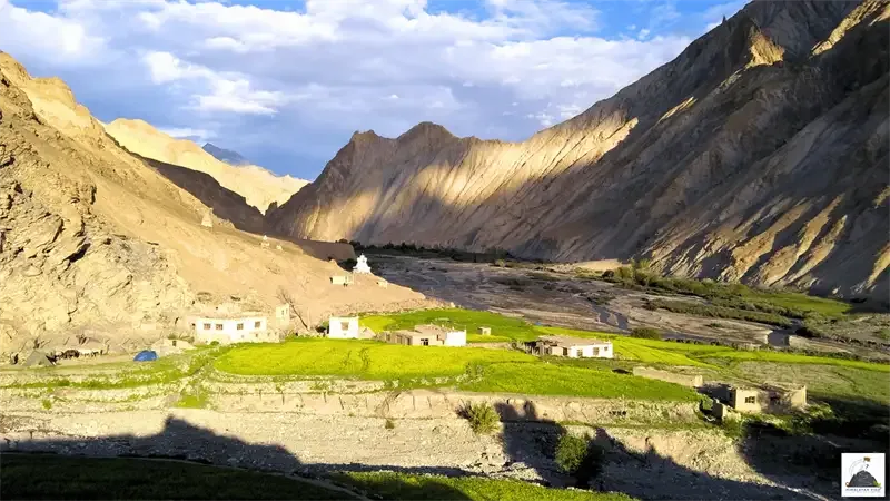
The journey passes through narrow gorges, expansive valleys, and high-altitude plateaus where Changpa nomads continue their traditional pastoral lifestyle. With very limited infrastructure and long distances between settlements, the trek offers a genuine wilderness experience.
Sustained altitude, remote logistics, and demanding terrain make Zalung Karpo La suitable for experienced trekkers comfortable with multi-day high-altitude expeditions.
Quick Facts
Duration
Max Altitude
Difficulty
Best Time
Trek Distance
Trail Atmosphere
Stargazing
Class 1 Dark Sky
Scent Profile
Silence Level
~15 dB
Vertigo Factor
3 / 10
Iconic Spots
Zalung Karpo La Pass
Kharnak Gorge
Dat Nomadic Settlement
Environment
Nature & Culture
Flora & Fauna
Flora
Fauna
The Kharnak region is one of the last strongholds of the nomadic Changpa lifestyle, entirely dependent on the harsh cycles of the high-altitude desert.
— Local folklore
Spiritual & Cultural Significance
The trail passes several ancient Buddhist chortens and mani walls, highlighting the deep integration of Tibetan Buddhism in this harsh landscape.
Temple Protocols
- •Always walk around stupas and mani walls in a clockwise direction.
Technical Details
Challenge & Preparation
Primarily a cardio demand and altitude exposure challenge
A demanding expedition dominated by extreme cardio demand.
Personal Readiness
Am I ready?
Planning
Logistics & Trail Intel
Getting There
Route to Base
Fly to Leh
Acclimatize for 3-4 days
Drive 2.5 hours to Skiu
The trek ends at Dat, from where a 4x4 picks you up for the 6-hour drive back to Leh
Base Village
Skiu (Start) / Dat (End)
11,000 ft
Last ATM
Leh
Nearest Medical Facility
SNM Hospital, Leh.
Mobile Signal
Total blackout.
Water Sources
Glacial streams near camps. Must be heavily purified. Rivers are silty in the afternoon.
Charging
Total blackout.
For Drivers
Road Condition
The drive to Skiu is a mix of paved and dirt roads. The return from Dat connects directly to the smooth, fast Manali-Leh highway.
Leh
Trail Culinary & Diet
Don't miss the Thukpa (Noodle soup) at high camps for warmth and hydration
Buy specialized diet items at Leh
The Content & Remote Hub
Top Vlog Spots
Video Calls
none
Est. 0 Mbps
UPI Reliability
1/10
Permits and Regulations
Inner Line Permits (ILP) are mandatory for Indian nationals, and Protected Area Permits (PAP) are required for foreigners. The trek also requires Hemis National Park entry fees.
Learn more about how we vet operators and ensure transparency on our why MountRoutes page.
Packing List
High-Altitude Clothing
- Heavyweight expedition down jacket (-10°C rating)
- Gore-Tex windproof and waterproof outer shell
- Merino wool heavy thermal base layers (2 sets)
- Fleece mid-layers
- Windproof trekking trousers
Footwear & Protection
- High-ankle, stiff-soled trekking boots
- River crossing shoes (Crocs or sturdy sandals - Mandatory)
- Merino wool trekking socks (x4 pairs)
- Microspikes (for early season pass crossings)
Expedition Gear
- 4-season expedition sleeping bag (-10°C comfort)
- Category 4 UV sunglasses (Essential for snow blindness prevention)
- Trekking poles with rock baskets
- 50-60L expedition backpack with heavy-duty rain cover
Health & Essentials
- Diamox (Acetazolamide) and comprehensive high-altitude medical kit
- High SPF 50+ sunscreen and zinc lip balm (Sun radiation is extreme)
- 2L insulated water thermos
- Original Passport / Inner Line Permits
Deep Dives
Explore Further
Editor's Notes
Explore In Detail
Day by Day Itinerary
7-day route reaching 17,480ft. Covers 75.0km of varied terrain.
→ See full itinerary with altitude profileDifficulty & Fitness
Rated challenging. A harsh, high-altitude cold desert. You will walk on river boulders, dry dusty trails, and steep, loose scree. There are no forests or shade.
→ See difficulty breakdown and fitness guideCost & Pricing
Packages range from 25,000 - 35,000 INR (Leh to Leh). Inclusions and hidden costs vary by operator tier.
→ See full cost breakdownFrequently Asked Questions
How is this different from the Markha Valley Trek?
You share the first two days with the Markha Valley trail. At Hankar village, instead of turning left towards Nimaling (the commercial route), you turn right into the completely isolated Langthang valley to cross Zalung Karpo La.
Do I need to acclimatize in Leh?
Absolutely mandatory. You must spend a minimum of 3 days in Leh (11,500 ft) before starting the trek. Altitude sickness is the number one reason expeditions fail here.
Are there river crossings?
Yes, multiple. The Markha river and the streams in the Kharnak gorge must be crossed on foot. The water is freezing glacial melt. Dedicated river crossing shoes are mandatory.
Will I stay in homestays?
Only for the first two nights (Markha and Hankar). Once you deviate towards Zalung Karpo La, there are no villages. You will be wild camping in tents for the rest of the expedition.
How difficult is the pass?
Zalung Karpo La is 17,050 ft. The climb is a steep, relentless slog up loose scree and gravel. It requires excellent cardiovascular fitness and mental endurance.
What happens in a medical emergency?
Evacuation is very slow. Once you cross the pass, you are days away from any road. A satellite phone with the expedition leader is highly recommended to call for military/helicopter rescue in extreme cases.
Will my phone work?
BSNL/Jio works in Leh and you may get a faint signal at Skiu on Day 1. The rest of the trek is a total communication blackout.
Is there snow on the trek?
In July and August, the pass is generally free of deep snow, consisting mostly of dry rocks. In June and September, you may encounter significant snow patches requiring microspikes.
Still deciding?
Compare routes side-by-side to find the perfect match for your fitness, dates, and budget.
Everything you need to know, in one place. Someone else in your group needs to see this.
Planning Zalung Karpo La Trek?
Get route conditions, operator updates, and season windows before booking.
Don't miss out! Follow us for route updates@mountroutes|LinkedIn
No spam. Only useful trek updates.
Ready to walk this route?
You’ve read the guide, now find the perfect local team to take you there. Compare our verified list of operators.
Compare verified operators