
Explore
Intelligence
Detailed Route
Vasuki Tal Trek - Kedarnath Itinerary — Day by Day Route & Camps
A 5-day immersive expedition traversing diverse Himalayan landscapes and alpine altitudes.
Standard RouteThis is the standard mountain pacing for this trek. Specific operators may add an acclimatization day or alter the starting point. Check individual operator schedules for their exact logistics.
Duration
5 Days
Total Distance
48 KM
Max Altitude
11,750 FT
Trek Type
linear
Permits Required Before You Go
Permit Cost
Where to Get
Online (Uttarakhand Tourism) or Haridwar/Sonprayag counters
Documents
Aadhar Card
Foreign Nationals
No restrictions beyond standard Yatra registration.
Foreigner Process
Standard registration.
Nearest Embassy Hub
New Delhi
Day by Day Breakdown
Camp Alt
6,500 ft
Day Gain
+5,500 ft
Drive Haridwar to Sonprayag and take short ride to Gaurikund
A massive, exhausting drive following the Mandakini river upstream along the primary pilgrimage highway. Prepare for heavy traffic delays during peak Yatra months.
Key Landmarks
Staying At
The mountain road climbs from the plains into a deep, heavily trafficked river gorge.
Camp Alt
11,750 ft
Day Gain
+5,250 ft
Reach Kedarnath
The primary pilgrim ascent. A brutally steep 18km climb fighting crowds, mules, and helicopters. The 5,000 ft altitude gain in one day is massive. Attend the evening Aarti at the temple upon arrival.
Key Landmarks
Staying At
Tree line disappears as the valley broadens into a spectacular high-altitude alpine meadow basin, replacing the dense forests with expansive grazing pastures.
Camp Alt
11,750 ft
Day Gain
0 ft
Today's Objective
💧 Reach Vasuki Tal Kedarnath
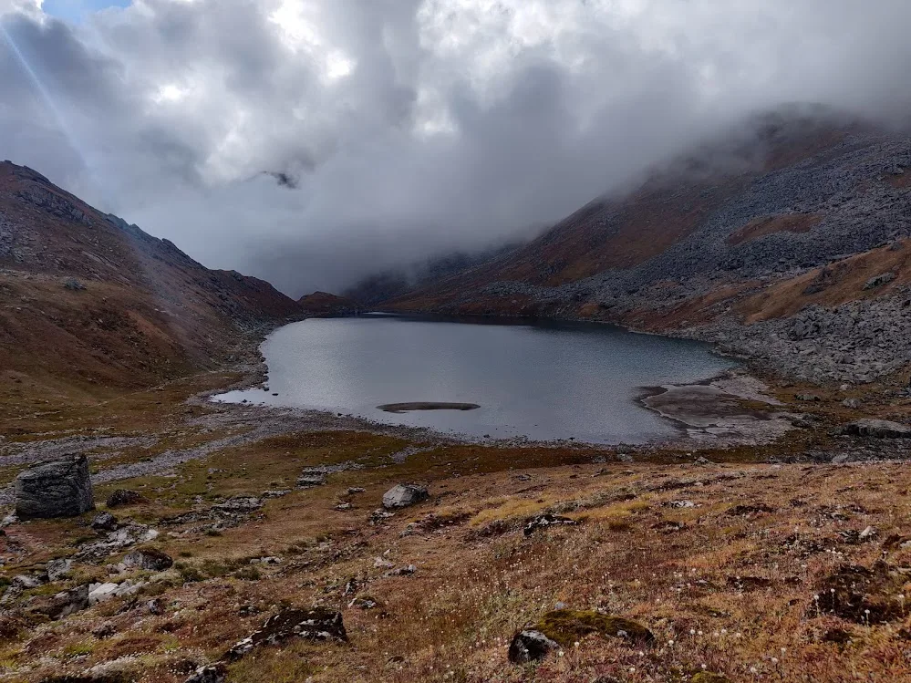
Leave at 5 AM. Ascend to the left of the Kedarnath temple, crossing the ridge. See amazing view of Kedarnath Peak and surrounding. The climb is breathless and continuous. Hit 14,200ft to view the pristine lake, then rapidly descend back to Kedarnath before the afternoon clouds trap you.
Key Landmarks
Staying At
Crossing the high-altitude pass bridges two distinct watershed systems, shifting the expedition over the glaciated divide and down into a new river basin.
Field Notes
Use Trekking Poles
Trekking poles are highly recommended to save your knees on the descent.
INFOSlower Progress
Progress will be significantly slower and more taxing on your ankles than trail distance suggests.
Camp Alt
3,000 ft
Day Gain
-8,750 ft
Trek to Gaurikund & Drive to Rudraprayag
A fast, steep descent from 11,700 ft back to the 6,500 ft roadhead at Gaurikund. Immediately board a local transport vehicle to descend to Rudraprayag to avoid the pilgrim bottleneck.
Key Landmarks
Staying At
The rugged alpine terrain opens up to reveal a spectacular high-altitude glacial tarn, serving as a critical hydrological node in the upper watershed.
Camp Alt
1,000 ft
Day Gain
-2,000 ft
Drive Rudraprayag to Haridwar
The final highway drive back down into the plains.
Key Landmarks
The motorable road navigates deeper into the mountain river corridor, where the landscape transitions from lower foothills into the steep, dense forested valleys.
Trek Extensions & Add-ons
Khatling Glacier Expedition
+10 DaysFor elite mountaineers, Vasuki Tal is Day 1 of the brutal Mayali Pass crossing into the Bhilangna valley.
Plan Your Trek:
Ready to book? Compare verified operators for Vasuki Tal Trek - Kedarnath — transparent pricing, no paid rankings.
Still deciding?
Compare routes side-by-side to find the perfect match for your fitness, dates, and budget.
Day by day, camp by camp. Send this to your group so everyone's on the same page.
Step 4: Cost & Logistics
You understand the route.
Now see what services, permits, and logistics actually cost.
View Cost Breakdown