
Explore
Intelligence
Difficulty & Readiness Guide
Is Saptrishi Kund Trek Difficult? — Fitness & Altitude Guide
A deceptive expedition that shifts from a paved pilgrim trail into an extreme, pathless glacial ascent demanding technical footwork.
The Question
Can I do this trek?
Preparation Required
Intermediate
Prior Experience
Recommended: 1-2 easy Himalayan treks or regular hiking experience.
Expert Verdict
Highly technical trek requiring physical and mental preparation.
Saptrishi Kund Trek
Himalayan Placement · Index 46Route Knowledge
Why is it difficult?
Exertion Index
Primary Challenge
Route Identity
Fast-paced or high-mileage route demanding excellent cardiovascular fitness across a glaciated route featuring loose moraine.
Primary Drivers
- Maximum sleeping altitude of 10,800 ft
- Grueling summit push with 3,700 ft of elevation gain
- 2 consecutive high-output trekking days
- Peak daily distance of 14 km
View Full Route Analysis
Physiological Demand
Expect long, exhausting days of sustained climbing at high intensity. Your cardiovascular system will be pushed to its absolute limit.
Notable elevation gains and losses requiring good leg strength and joint resilience.
Well-defined, stable trails with no technical maneuvers required.
Below the major effects of altitude sickness. Air remains relatively dense.
Comfortable pacing with good recovery options.
Terrain Breakdown
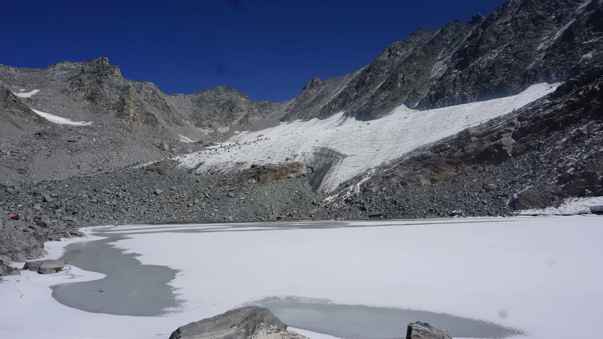
The terrain transitions from a paved concrete path on Day 2 to an unmarked, highly technical, and completely raw alpine basin on Day 3. You will encounter loose rocks, scree slopes, and hard blue ice patches near the Champasar Glacier.
Summit Day Notes
14,500ft. Day 3 to the Kund is exhausting. A 3,700 ft ascent in just 7 km through pathless mountain sides requires exceptional cardiovascular endurance.
The Descent
The descent from the Kund to Yamunotri is perilous for the knees due to loose scree and extreme gradients.
Altitude Profile
The massive jump from 10,800 ft to 14,500 ft in a single day carries a high risk of AMS if not sufficiently hydrated and paced.
Run AMS Risk Audit →Trail Performance Data
Max Gradient
45%
Hydration
0.8L per km recommended
Loose Surface Sections
- •The final 3km ascent over Champasar moraine to the Kund
- •The scree descent below the glacier
Personal Readiness
Am I ready?
What this route demands
People who feel comfortable on this route can usually:
Who Can Do This Trek?
Min Age
15+
Max Age
55
Western Toilets at Base
Yes
Solo Female Travelers
Safe up to Yamunotri due to heavy pilgrim footfall. Beyond Yamunotri, trekking solo is highly unsafe for any gender due to isolation and terrain hazards.
Hazard Profile
What goes wrong?
Common Mistakes on Saptrishi Kund Trek
Most injuries and failures on this trail can be avoided by making smarter decisions early on.
Underestimating the Day 3 climb based on the easy Yamunotri pilgrim trail
Starting too late on the summit day, leading to whiteouts at the lake
Inadequate footwear for glacial moraine
Lack of acclimatization, leading to severe AMS
Attempting the route without a specialized local guide
Safety & Medical Risks
Key Risks
Acute Mountain Sickness (AMS)
Rockfall on the moraine
Slips on hard ice near the lake
Hypothermia near the glacier
AMS (Altitude Sickness)
The rapid ascent of 3,700 ft in one day puts trekkers at significant risk. Immediate descent to Yamunotri is required if symptoms appear.
Evacuation Route
Manual stretcher descent to Yamunotri, followed by pony/dandi to Janki Chatti, then road evac.
Solo Trekking
Strictly prohibited due to the lack of an established trail, highly technical sections, and zero mobile connectivity.
Common Trail Ailments
🏥 Nearest ICU: AIIMS Rishikesh / Max Super Speciality Hospital, Dehradun
Tactical Emergency Hub
> Evacuation above Yamunotri is extremely complex due to steep, rocky terrain. Helirescue is the only viable rapid option if weather permits.
Auditability
How is this calculated?
Understand This Route Further
Before attempting this route:
Still deciding?
Compare routes side-by-side to find the perfect match for your fitness, dates, and budget.
Still think it's doable? Share this with your trek mate and see if they agree.
Step 2: Seasonal Safety
You know how demanding this route is.
Now find the safest and most reliable season to attempt it.
Check Best Time to Go