
Explore
Intelligence
Detailed Route
Rishikund Trek Itinerary — Day by Day Route & Camps
An 8-day expedition starting from Joshimath, ascending through forests and meadows to the pristine Rishikund lake at over 14,000 ft.
Standard RouteThis is the standard mountain pacing for this trek. Specific operators may add an acclimatization day or alter the starting point. Check individual operator schedules for their exact logistics.
Duration
8 Days
Total Distance
47.0 KM
Max Altitude
14,337 FT
Trek Type
circuit
Permits Required Before You Go
Permit Cost
Where to Get
Forest Department Office, Joshimath
Documents
Aadhar Card / Passport, Passport Size Photos, Medical Fitness Certificate
Foreign Nationals
Foreigners require Inner Line Permits (ILP) or special clearances due to the proximity to the border and Biosphere reserve.
Foreigner Process
Requires Inner Line Permits/special clearance from Joshimath SDM/Forest office due to Nanda Devi Biosphere rules.
Nearest Embassy Hub
New Delhi
Day by Day Breakdown
Camp Alt
6,150 ft
Day Gain
+5,120 ft
Drive from Haridwar/Rishikesh to Joshimath
A long, scenic drive along the Alaknanda River, passing the famous Panch Prayags (river confluences). Joshimath serves as the basecamp for the expedition.
Key Landmarks
Staying At
The mountain road navigates upward from the foothills into the Alaknanda river basin.
Camp Alt
9,500 ft
Day Gain
+3,350 ft
Drive to Bhallagaon and Trek to Kurala Camp
Drive along the Dhauliganga river to Suraithota. From the roadhead, the trek begins with a steep ascent through traditional Garhwali villages (Bhallagaon) into dense oak and pine forests, camping at Kurala.
Key Landmarks
Staying At
Crossing the high-altitude pass bridges two distinct watershed systems, shifting the expedition over the glaciated divide and down into a new river basin.
Field Notes
KEY ACTIONRiver Crossings
Plan to cross early in the day before snowmelt swells the water levels. Unclip backpack waist belts before crossing.
Camp Alt
11,800 ft
Day Gain
+2,300 ft
Trek from Kurala Camp to Kantala Camp
The trail breaks out of the tree line into sprawling alpine meadows (bugyals). The ascent is steady, offering the first grand views of the surrounding Himalayan giants.
Key Landmarks
Staying At
Crossing the high-altitude pass bridges two distinct watershed systems, shifting the expedition over the glaciated divide and down into a new river basin.
Camp Alt
14,337 ft
Day Gain
+2,537 ft
Today's Objective
🏔 Cross Trek From Kantala Camp To Rishikund Lake Rishikund
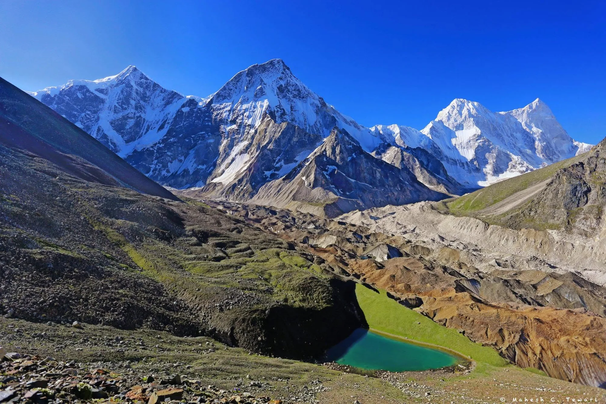
A challenging ascent to the highest point of the trek. The terrain becomes rockier as you approach the pristine glacial lake of Rishikund. The campsite offers magnificent, close-up views of Nanda Devi and Trishul.
Key Landmarks
Staying At
Crossing the high-altitude pass bridges two distinct watershed systems, shifting the expedition over the glaciated divide and down into a new river basin.
Field Notes
Use Trekking Poles
Trekking poles are highly recommended to save your knees on the descent.
INFOSlower Progress
Progress will be significantly slower and more taxing on your ankles than trail distance suggests.
Camp Alt
14,337 ft
Day Gain
0 ft
Rest and Explore Rishikund (or Reserve Day)
A day spent acclimatizing, resting, and exploring the ridges around the lake for panoramic photography. This day also acts as a buffer in case of bad weather.
Key Landmarks
Staying At
The expedition remains stationed within the high-altitude ablation zone, adjusting to the stark environment where exposed scree and ice dominate the glaciated upper watershed.
Camp Alt
9,500 ft
Day Gain
-4,837 ft
Descend to Kurala Camp / Bhallagaon
A long descent retracing your steps back through the bugyals and into the forest line. The steep downhill can be tough on the knees.
Key Landmarks
Staying At
The Rishikund basin descends sharply through the pastures and forest back to the Bhallagaon roadhead.
Camp Alt
6,150 ft
Day Gain
-3,350 ft
Trek to Roadhead and Drive to Joshimath
Complete the final short descent to the roadhead at Suraithota, followed by the drive back to civilization in Joshimath. Celebrate the completion of the trek.
Key Landmarks
Staying At
The high alpine meadows narrow into forested river terraces as tree line vegetation reappears in the lower mountain river corridor.
Camp Alt
1,030 ft
Day Gain
-5,120 ft
Drive Joshimath to Haridwar/Rishikesh
Morning departure from Joshimath for the long drive back to the plains.
The mountain valley topography transitions back into the lower foothill river plains.
Trek Extensions & Add-ons
Kuari Pass Trek
+4 DaysTrekkers can combine this with the Kuari Pass trek, which starts near Joshimath/Auli, for an extended Garhwal experience.
Plan Your Trek:
Ready to book? Compare verified operators for Rishikund Trek — transparent pricing, no paid rankings.
Still deciding?
Compare routes side-by-side to find the perfect match for your fitness, dates, and budget.
Day by day, camp by camp. Send this to your group so everyone's on the same page.
Step 4: Cost & Logistics
You understand the route.
Now see what services, permits, and logistics actually cost.
View Cost Breakdown