Difficulty & Readiness Guide
Is Ranthan Kharak Trek Difficult? — Fitness & Altitude Guide
Preparation Required
Intermediate
Prior Experience
Recommended: 1-2 easy Himalayan treks or regular hiking experience.
Score Engine v3
Why This Score?
Stamina
54/100
Based on average nightly altitude gain, highest campsite, and daily distance. Reflects how hard the average day feels.
Spike Day
22/100
Based on max altitude reached, summit day elevation gain, and summit day distance. Reflects the hardest single day.
Why Ranthan Kharak Trek Feels Difficult
A capable trekker's route that balances cumulative fatigue and altitude exposure.
Physiological Demand
Multi-day camping requiring mental toughness to handle weather and fatigue debt.
Significant time spent above 12,000ft. Expect shortness of breath and slower pacing.
Challenging daily distances and steady climbs. Good cardiovascular fitness is required.
Rough, uneven trails with occasional scrambling or minor exposure.
Rolling or gradual terrain with minimal harsh impact on joints.
Crux Section
Day 5 — Oxygen Peak
Highest exposure point at 12,800ft.
Ranthan Kharak Trek/ 42
Knee & Muscle Advisory
Caution
The vertical descent down to Gogina Village can be tough on the knees. Trekking poles are highly recommended to absorb impact.
Key point
Cardio preparation like running 5km in under 35 minutes makes this journey significantly more enjoyable.
Terrain Breakdown
Offbeat and rugged trail through thick forests, opening up to a high ridge (Kharak).
Summit Day Notes
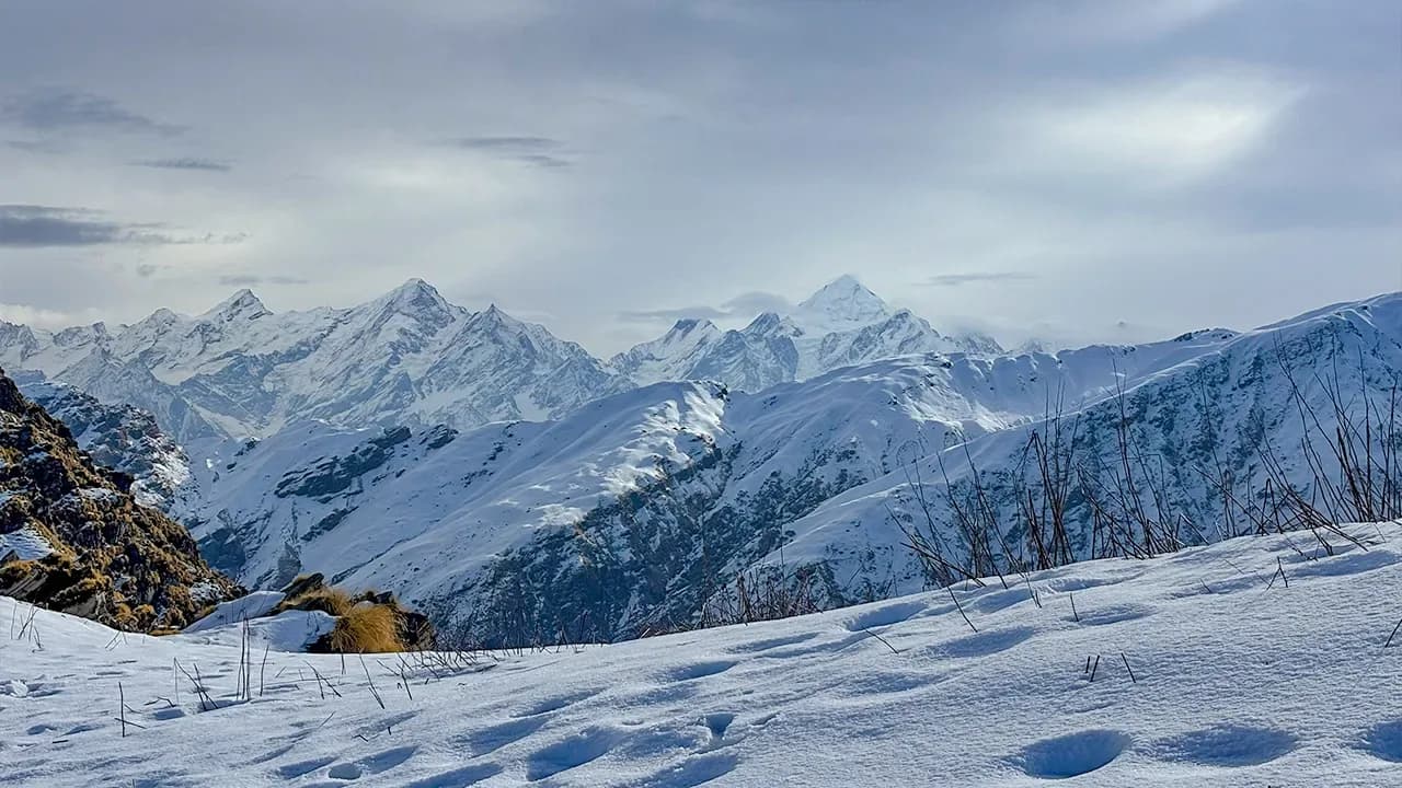
The climb to the Kharak is steep and demanding, offering sweeping views of the Nanda Devi and Panchachuli ranges.
The Descent
Steep and often slippery through the forest sections.
Preparation
Requires good cardiovascular health and strong leg muscles.
Altitude Profile
Significant altitude gain in a short distance; proper pacing is required.
Run AMS Risk Audit →Route Stress Forecast
Highest exposure point at 12,800ft.
Day 4 requires the highest sustained output.
*Forecast derived from route geometry and altitude profile. External variables (weather/group) remain the final authority.
Trail Performance Data
Max Gradient
30%
Hydration
0.4L per km recommended
Loose Surface Sections
- •Rocky pass scree zones
- •Forest slippery switchbacks
Common Mistakes on Ranthan Kharak Trek
Most injuries and failures on this trail can be avoided by making smarter decisions early on.
Getting lost in the dense, confusing ringal bamboo forests.
Underestimating the steep, continuous ascent starting directly from Namik village.
Safety & Medical Risks
Key Risks
Acute Mountain Sickness (AMS) risk due to elevation gain to 11800 ft.
Sudden weather shifts, whiteouts, and trail drops.
Physical fatigue and cold winds on steep rocky ridges.
AMS (Altitude Sickness)
Acclimatize progressively. Hydrate daily with 4-5 liters of water. Pacing should be slow, rhythmic, and continuous. Carry Diamox if prescribed by medical experts.
Evacuation Route
Emergency extraction via local porter or mule team down to the road head at Gogina Village.
Solo Trekking
Allowed, but strongly advised to hire a local guide or team due to deep wilderness isolation and lack of trail signals.
Common Trail Ailments
🏥 Nearest ICU: Ujala Cygnus Central Hospital, Haldwani
Tactical Emergency Hub
> Quick evacuation possible by foot back to Munsiyari.
Who Can Do This Trek?
Min Age
8+
Max Age
65
Western Toilets at Base
No
Solo Female Travelers
Highly safe trail. Locals are friendly and accommodating. Carry basic personal protection.
Expert Verdict
Highly technical trek requiring physical and mental preparation.
Ready to book? Compare verified operators for Ranthan Kharak Trek — transparent pricing, no paid rankings.
Want to know which operators carry certified guides and medical support? See operator safety ratings for Ranthan Kharak Trek
Also on this trek
Still deciding?
Compare routes side-by-side to find the perfect match for your fitness, dates, and budget.
Still think it's doable? Share this with your trek mate and see if they agree.
Fit for the challenge?
For challenging treks, safety is paramount. Find operators prioritizing medical support and guide expertise.
Compare operator safety scores